2020s Maps of Union City, Oklahoma
Explore 6 historic maps of Union City from the 2020s. These maps offer a rare glimpse into what life looked like during the 2020s — showing old roads, neighborhoods, homes, and landmarks that have changed or disappeared over time.
Whether you're researching your family's past, planning a metal detecting trip, or studying how Union City's landscape evolved across the 2020s, these high-resolution maps are a powerful tool for exploring the history of this region.
- Focus on a specific era: All maps on this page are from the 2020s, giving you a focused view of this time period.
- See what’s changed: Compare century-old streets, trails, and buildings to today's modern landscape using overlays and satellite layers.
- Research with precision: Use these maps for genealogy, historical research, land use analysis, or educational projects.
- View, download, or print: Maps are fully viewable online in high resolution, and can be downloaded or printed for your own records.
Start exploring Union City's history through authentic maps from the 2020s. This is your window into the past.
Union City, OK maps
(6)- 2022 Map of Cogar SE, 2022 Print
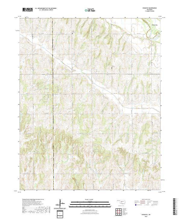 2022 Cogar SE2022 Print · USGSGrady County's agricultural heartland is documented here in the early twenty-first century, showing a landscape defined by rolling creek drainages and section-line roads. Researchers can locate family landmarks like Hazel Dell Cemetery and Center View Cemetery or trace the winding path of Buggy Creek.
 - 2022 Map of Minco, 2022 Print
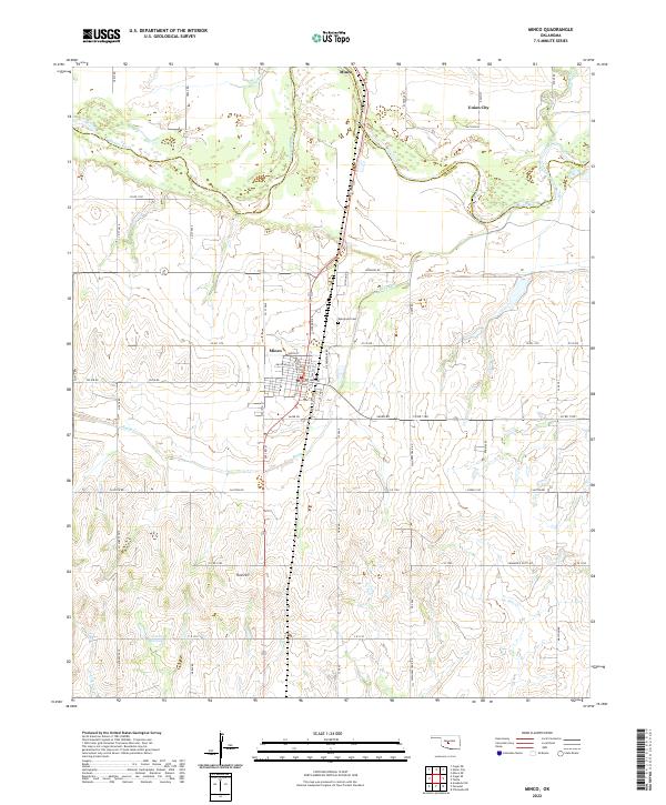 2022 Minco2022 Print · USGSThe borderlands of Grady and Canadian Counties come into focus in the early twenty-first century as the Canadian River cuts through the plains. Genealogists and historians can locate Evergreen Cem, the streets of Minco, and the path of the Chisholm Trail Rd.
 - 2022 Map of Union City, 2022 Print
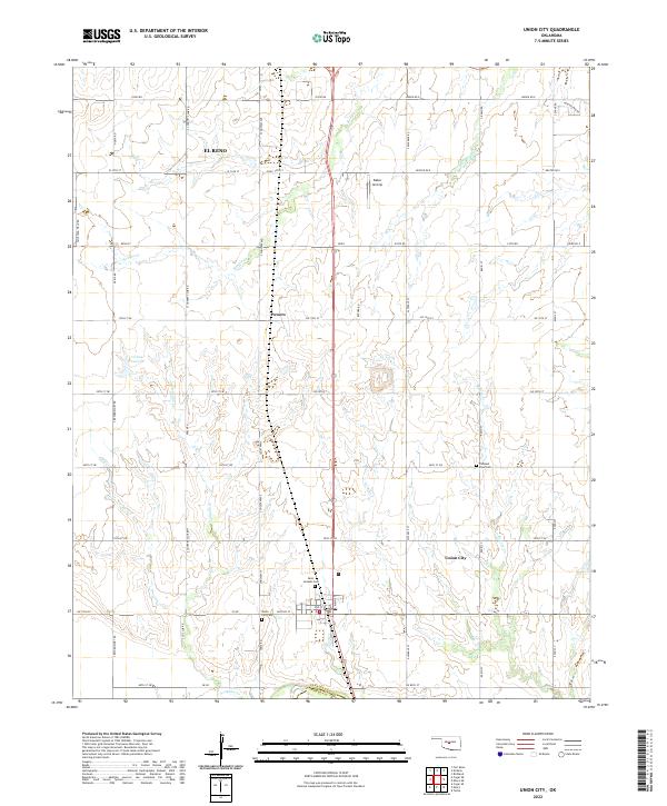 2022 Union City2022 Print · USGSUnion City and its surrounding Canadian County ranchlands are captured here in the early twenty-twenties. Researchers can trace family history at the Union City Cem, Saint Josephs Cem, and the small settlement of Powers.
 - 2022 Map of Minco NE, 2022 Print
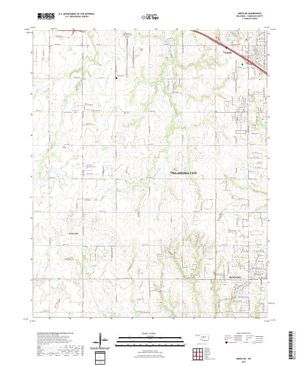 2022 Minco NE2022 Print · USGSThe western Oklahoma City outskirts reveal a landscape of rapid suburban growth in the early 2000s. Genealogists and local historians can locate Forehand Cem or trace the development around Mustang and Union City.
 - 2022 Map of Tuttle, 2022 Print
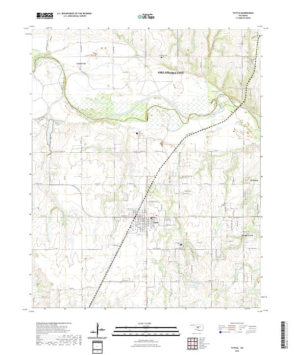 2022 Tuttle2022 Print · USGSThe Canadian River corridor and the growing community of Tuttle are documented here in the early twenty-first century. Researchers can trace local lineage through Silver City Cem and Fairview Cem or locate early homestead sites near Snake Creek.
 - 2022 Map of Cogar NE, 2022 Print
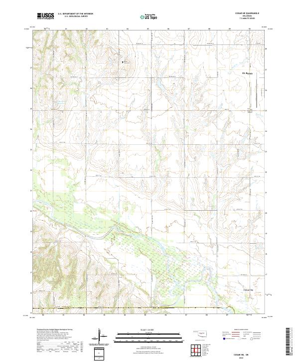 2022 Cogar NE2022 Print · USGSCanadian County at the start of the 2020s shows a landscape of deep river bottoms and prairie section lines. Genealogists and local historians can trace family roots near Buena Vista Cem or follow the banks of the Canadian River toward Union City.
End of results
Showing maps 1-6 of 6
Top cities near Union City
- Oklahoma City historical maps
- Yukon historical maps
- Mustang historical maps
- El Reno historical maps
- Blanchard historical maps
- Piedmont historical maps
See more
Top neighborhoods of Union City
Frequently asked questions
- What are the different types of historical maps available for Union City?
- What is the oldest map of Union City?
- Where can I purchase historical maps of Union City for my home or office?
- Where can I download high-res historical maps of Union City?
- Are there historical topographic maps available for Union City?
- Is there historical aerial imagery available for Union City?
- Where are historical maps of Union City sourced from?