Old Maps of Cleveland County, Oklahoma for Academic Research
Study the evolution of Cleveland County with 145 high-resolution historic maps. Whether you're teaching, researching, or modeling changes in land use, these maps provide essential visual documentation of urban, environmental, and geographic change.
- Analyze long-term change: Track patterns in development, transportation, and natural features.
- Ideal for environmental or urban studies: Support academic projects with primary historical map data.
- Use in the classroom or lab: Educators and researchers rely on these maps to bring historical context to life.
These maps are a powerful tool for teaching, research, and visualizing how Cleveland County has changed over the decades.
Cleveland County, OK maps
(145)- 1892 Map of Moore
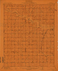
 1892 Moore1892 Print · USGSOklahoma Territory was still in its infancy when this survey was conducted, showing the vital rail line connecting early settlements. Genealogists and historians can trace the foundations of Moore and find long-forgotten locations like Chaddick and Berry along the Atchison Topeka and Santa Fe Rail Road.
 - 1893 Map of Norman
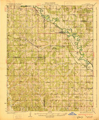
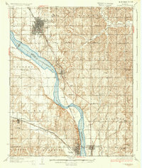
 1893 Norman1893 Print · USGSOklahoma Territory and Indian Territory meet along the river in the late nineteenth century. Trace the early footprints of Norman, Noble, and Purcell along the Atchison Topeka and Santa Fe R. R. and the winding Canadian River.2 unique versions available
 - 1893 Map of Oklahoma City
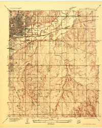
 1893 Oklahoma City1893 Print · USGSOklahoma City and the surrounding territory are captured here in the 1890s, just as the rail lines began transforming the landscape. You can trace early township developments and find the historic border between the Oklahoma territory and the Chickasaw Nation near Walden and Clancy.
 - 1898 Map of Purcell
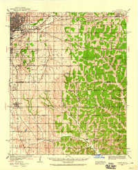
 1898 Purcell1898 Print · USGSOklahoma and Indian Territory are captured at the end of the century during a period of rapid regional expansion. Genealogists and historians can trace the early rail alignment of the G C and S F R R as it passes through Purcell near Walnut Creek.
 - 1898 Map of Pauls Valley, 1954 Print
 1898 Pauls Valley1954 Print · USGSThe Chickasaw Nation is documented at the turn of the century, showing the rail-driven growth of the Washita River valley. Researchers can trace early settlements like Whitebead and Wynnewood along the Gulf Colorado and Santa Fe RR.
 - 1902 Map of Pauls Valley
 1902 Pauls Valley1902 Print · USGSThe Chickasaw Nation at the turn of the century shows a landscape of river-valley agriculture and burgeoning rail towns. Genealogists and historians can trace the early footprints of Pauls Valley, Wynnewood, and Whitebead before statehood.5 unique versions available
 - 1904 Map of Chickasha
 1904 Chickasha1904 Print · USGSIndian Territory and Oklahoma Territory meet in this detailed 1904 survey, showing the region just years before statehood. Genealogists can trace the early rail stops at Minco and Tuttle or locate family homesteads near Womack and Dibble.4 unique versions available
 - 1910 Map of McComb
 1910 McComb1910 Print · USGSPottawatomie County was still transitioning from territorial days when this survey recorded its burgeoning rail towns and rural school districts. Researchers can find early landmarks like Solomons Temple School and Tribbey, or trace the path of the AT&SF RR through the local landscape.2 unique versions available
 - 1925 Map of Norman NO 2
 1925 Norman NO 21925 Print · USGSNorman and the university grounds are pictured in the mid-twenties during a period of steady growth along the river bluffs. Genealogists can locate family-named landmarks and rural schoolhouses like White Mound School and Adair School.
 - 1930 Map of McLoud
 1930 McLoud1930 Print · USGSCentral Oklahoma is captured in the late 1920s as a landscape of rural school districts and river crossings. Researchers can trace early settlements and family landmarks like the Kickapoo Mission, Sweeney Bridge, and the Moore & Nordin Gin.2 unique versions available
 - 1934 Map of Crutcho Creek
 1934 Crutcho Creek1934 Print · USGSOklahoma City and its eastern fringes are captured in the mid-1930s as industrial sites and schools began to dot the landscape. Genealogists can locate family names and sites like Sunny Lane Cemetery, Foster High Sch, and the Oklahoma County Farm.
 - 1934 Map of Moore, 1959 Print
 1934 Moore1959 Print · USGSOklahoma City and its surrounding rural townships are shown in the mid-thirties just as the region’s oil and rail economy was maturing. Genealogists can locate family landmarks like Sunnylane Cemetery or rural community hubs such as Nicoma Park and Hollywood Corners.
 - 1936 Map of Norman
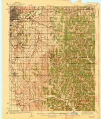
 1936 Norman1936 Print · USGSThe river valley between Norman and Purcell is captured here in the mid-1930s as the railroad and river define local growth. Genealogists can trace family footprints across dozens of rural landmarks, from the University of Oklahoma to local schools like Goldsby Sch and Lone Star Sch.5 unique versions available
 - 1938 Map of Moore
 1938 Moore1938 Print · USGSOklahoma City and its southern neighbors were at a rail and oil crossroads in the 1930s. Genealogists can trace early rural life through a dense network of country schools like Foster High Sch and family-named sites such as Burk Burnett Cem.2 unique versions available
 - 1954 Map of Oklahoma City
 1954 Oklahoma City1954 Print · USGSOklahoma City and its surrounding counties are captured here in the early fifties during a period of significant postwar growth. Researchers can trace the development of the Turner Turnpike and locate aviation hubs like Tinker Field or Will Rogers Field.
 - 1956 Map of Choctaw, 1957 Print
 1956 Choctaw1957 Print · USGSIn the mid-fifties, eastern Oklahoma County was a landscape of expanding aviation interests and established rail towns. Local researchers can trace the footprint of Tinker Air Force Base and find vanished rural landmarks like Barnes Sch (Abandoned) and Schwartz Cem.3 unique versions available
 - 1956 Map of Midwest City, 1957 Print
 1956 Midwest City1957 Print · USGSOklahoma City and its eastern suburbs were rapidly transforming in the mid-fifties as military and industrial growth reshaped the county line. Researchers can trace the development of Tinker Air Force Base and dozens of local schools like Monroney Jr High Sch and Edison Sch.3 unique versions available
 - 1956 Map of Moore, 1957 Print
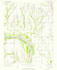
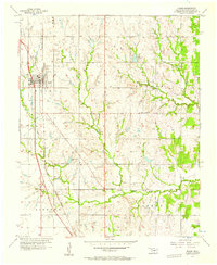 1956 Moore1957 Print · USGSCleveland County emerges in the mid-1950s as a region of rail-connected towns and developing rural industry. Genealogists and local historians can trace family locations near Smith Cem, the old Grotts Sch, and the riverside crossroads at Hollywood Corners.3 unique versions available
 - 1956 Map of Oklahoma City, 1957 Print
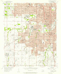 1956 Oklahoma City1957 Print · USGSOklahoma City emerges as a bustling mid-century hub at the intersection of major rail lines and early aviation history. Genealogists and historians can trace the development of urban neighborhoods and local institutions from Fairlawn Cemetery to the Will Rogers Municipal Airport.3 unique versions available
 - 1956 Map of Franklin, 1957 Print
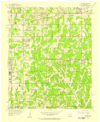
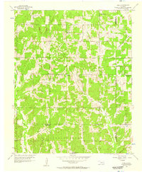
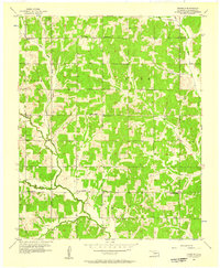 1956 Franklin1957 Print · USGSCleveland County was a landscape of small schoolhouses and country churches in the mid-1950s. Researchers can trace the rural community through locations like Franklin, Blackburn Cem, and several local schools like Robinson Sch.4 unique versions available
 - 1956 Map of Harrah, 1957 Print
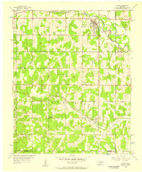 1956 Harrah1957 Print · USGSOklahoma county lines and the winding river bottom highlight this mid-fifties survey of the frontier between central and eastern Oklahoma. Researchers can trace the path of the Indian Meridian and locate landmarks like Newalla, Texas Sch (Abandoned), and the oil wells scattered near the Cleveland County border.4 unique versions available
 - 1956 Map of Oklahoma City, 1957 Print
 1956 Oklahoma City1957 Print · USGSCentral Oklahoma in the mid-fifties shows the transition from a rail-centered capital to a modern aviation and oil hub. Researchers can trace family roots through neighborhood landmarks like St Patricks Sch, Fairlawn Cem, and the old Union Station.2 unique versions available
 - 1956 Map of Oklahoma City SE, 1957 Print
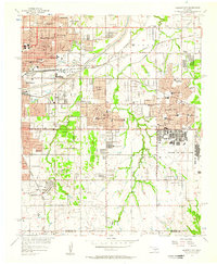
 1956 Oklahoma City SE1957 Print · USGSSouth of Oklahoma City in the mid-fifties, the landscape transitions from busy airfields to the oil-rich river bottoms. Trace family roots at Antioch Ch and Moore Cem, or locate early aviation sites like Country Club Airport.3 unique versions available
 - 1956 Map of Stella, 1957 Print
 1956 Stella1957 Print · USGSCleveland County in the mid-1950s reveals a rural landscape shaped by the Little River and early oil exploration. Researchers can locate family landmarks like Stella Cem and several older sites such as the Red Hill Sch and Keebles Cem.5 unique versions available
 - 1957 Map of Ardmore, 1968 Print
 1957 Ardmore1968 Print · USGSSouth-central Oklahoma in the late fifties was a landscape of rising reservoir waters and expanding rail lines. Genealogists and historians can trace the foundations of Ardmore and Duncan or locate early recreation sites at Platt National Park and Lake Murray State Park.3 unique versions available
Showing maps 1-25 of 145
Top cities of Cleveland County
- Norman historical maps
- Moore historical maps
- Noble historical maps
- Slaughterville historical maps
- Lexington historical maps
- Etowah historical maps
Frequently asked questions
- What are the different types of historical maps available for Cleveland County?
- What is the oldest map of Cleveland County?
- Where can I purchase historical maps of Cleveland County for my home or office?
- Where can I download high-res historical maps of Cleveland County?
- Are there historical topographic maps available for Cleveland County?
- Is there historical aerial imagery available for Cleveland County?
- Where are historical maps of Cleveland County sourced from?