1900s (20th Century) Maps of Craig County, Oklahoma
Explore 29 historic maps of Craig County from the 1900s (20th Century). These maps offer a rare glimpse into what life looked like during the 1900s — showing old roads, neighborhoods, homes, and landmarks that have changed or disappeared over time.
Whether you're researching your family's past, planning a metal detecting trip, or studying how Craig County's landscape evolved across the 1900s, these high-resolution maps are a powerful tool for exploring the history of this region.
- Focus on a specific era: All maps on this page are from the 1900s, giving you a focused view of this time period.
- See what’s changed: Compare century-old streets, trails, and buildings to today's modern landscape using overlays and satellite layers.
- Research with precision: Use these maps for genealogy, historical research, land use analysis, or educational projects.
- View, download, or print: Maps are fully viewable online in high resolution, and can be downloaded or printed for your own records.
Start exploring Craig County's history through authentic maps from the 1900s. This is your window into the past.
Craig County, OK maps
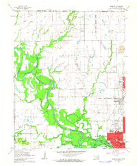
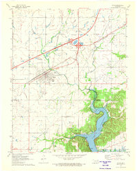
(29)- 1901 Map of Vinita
 1901 Vinita1901 Print · USGSIndian Territory at the turn of the century shows a landscape of burgeoning railroad towns and Cherokee Nation settlements. Genealogists can trace family roots in early townsites like Vinita, Bluejacket, and Chelsea or locate rural homesteads near Cabin Creek.2 unique versions available
 - 1907 Map of Wyandotte, 1954 Print
 1907 Wyandotte1954 Print · USGSThe Tri-State border region at the start of the twentieth century shows a landscape of river ferries and early rail towns. Trace the locations of family landmarks like Hickory Grove Church, Goad Eagle Ferry, and rural schools from Afton to Seneca.2 unique versions available
 - 1909 Map of Wyandotte
 1909 Wyandotte1909 Print · USGSNortheastern Oklahoma’s river valleys and prairies are captured here just after statehood, during a period of rapid rail expansion and tribal land transition. Researchers can trace early river crossings like Rodwhite Ferry and locate historic community centers such as Hickory Grove Church or the Bluejacket School.2 unique versions available
 - 1913 Map of Vinita
 1913 Vinita1913 Print · USGSNortheast Oklahoma at the height of its rail-and-ranch era is meticulously detailed here just as the state was entering its second decade. Genealogists can trace family roots through dozens of local landmarks like W H School, Big Cabin, and the Blue Hawk School.3 unique versions available
 - 1954 Map of Tulsa
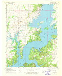
 1954 Tulsa1954 Print · USGSNortheast Oklahoma and the Ozark border are shown here during a period of massive industrial and infrastructure growth. Researchers can trace the legacy of the Tri-State Mining District and the development of major reservoirs like Grand Lake O' The Cherokees.2 unique versions available
 - 1958 Map of Tulsa, 1968 Print
 1958 Tulsa1968 Print · USGSNortheast Oklahoma and the Ozark borderlands are captured here during a massive era of reservoir construction and highway expansion. Researchers can trace the mid-century footprints of Tulsa, the sprawling Lake O' the Cherokees, and historical sites like Pea Ridge National Military Park.3 unique versions available
 - 1961 Map of Miami NW, 1963 Print
 1961 Miami NW1963 Print · USGSNortheastern Oklahoma at the start of the 1960s shows a landscape defined by tribal heritage and the legacy of the Tri-State mining district. Genealogists and historians can trace Old Indian Cem and North Fairview Sch alongside the active tracks of the St Louis-San Francisco RR.2 unique versions available
 - 1961 Map of Miami SW, 1963 Print
 1961 Miami SW1963 Print · USGSSouthwest of Miami in the early sixties, the landscape reflects a shift from rail-side settlements to turnpike travel. Local researchers can trace family landmarks like Lone Star Ch, Coal Creek Cem, and the small community of Narcissa.2 unique versions available
 - 1963 Map of Tulsa
 1963 Tulsa1963 Print · USGSThe Oklahoma and Arkansas borderlands are shown here in the early sixties, a time of massive reservoir construction and heavy mining. Genealogists can trace family roots through settlements like Nowata, Pryor, and Jay, or locate historical zinc and lead mines and coal mines.
 - 1970 Map of Chelsea, 1972 Print
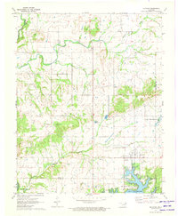
 1970 Chelsea1972 Print · USGSNortheast Oklahoma's extraction landscape is on full display during the early 1970s, as coal and oil operations surround the town of Chelsea. Researchers can trace family history at Shady Grove Cem and Snider Cem or locate industrial sites like the many Strip Mines and the St Louis - San Francisco rail line.3 unique versions available
 - 1970 Map of White Oak, 1972 Print
 1970 White Oak1972 Print · USGSThe Cherokee Nation countryside at the start of the 1970s shows a landscape of rail-driven settlements and emerging turnpike travel. Researchers can locate family landmarks like Shawnee Cem, Condry Ch, and the workings of the Catale Oil Field.2 unique versions available
 - 1971 Map of Pyramid Corners, 1973 Print
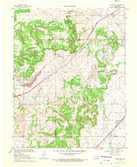
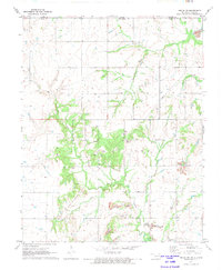
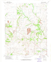
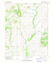 1971 Pyramid Corners1973 Print · USGSThis rural portion of Craig County in the early seventies shows a landscape shaped by both coal extraction and small-town roots. Genealogists and historians can locate the Timber Hill Ch, trace family sites near West Point Cem, and find old Strip Mines.
 - 1971 Map of Big Cabin, 1973 Print
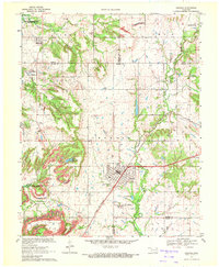
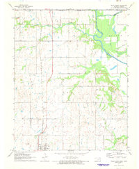
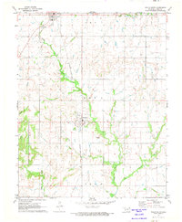
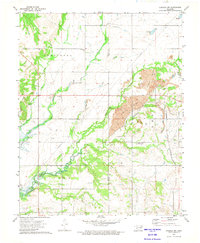
 1971 Big Cabin1973 Print · USGSBig Cabin and the surrounding Craig County countryside appear here in the early seventies during the height of the toll road era. Genealogists and local historians can locate Landrum Cem, Big Cabin Cem, and the site of Ironside Sch.
 - 1971 Map of Welch North, 1973 Print
 1971 Welch North1973 Print · USGSNortheastern Oklahoma and the Kansas borderlands appear in the early 1970s as a landscape of rural rail towns and prairie creek valleys. Trace the Missouri - Kansas - Texas rail line through Welch or locate family history at Russell Creek Cem and Maybelle Ch.
 - 1971 Map of Ketchum, 1973 Print
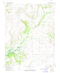
 1971 Ketchum1973 Print · USGSNortheastern Oklahoma at the start of the 1970s shows a landscape shaped by massive water projects and established rural communities. Genealogists can locate family landmarks like Carselowey Cem, the Foursquare Gospel Ch, and the small settlement of Success.
 - 1971 Map of Vinita, 1973 Print
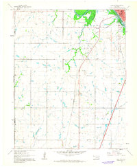
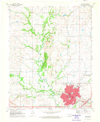 1971 Vinita1973 Print · USGSVinita emerges as a bustling railroad and transit hub in northeastern Oklahoma during the early seventies. Genealogists and historians can trace family roots through several rural burial grounds like Pheasant Hill Cemetery or locate landmarks such as the Eastern Oklahoma State Hospital.
 - 1971 Map of Afton, 1973 Print
 1971 Afton1973 Print · USGSAfton and Bernice sit at the crossroads of Northeastern Oklahoma in the early 1970s, where the turnpike and rail lines meet the Grand Lake shoreline. Genealogists can locate family landmarks like Mt Hope Cem and Sixkiller Cem near the winding Horse Creek.
 - 1971 Map of Bernice, 1973 Print
 1971 Bernice1973 Print · USGSDelaware County shoreline and the Neosho River valley appear in detail during the early 1970s as lakefront life centered around Bernice and Cleora. Researchers can trace rural family sites like Wallen Cem, the Cleora Sch, and the winding Old Railroad Grade.2 unique versions available
 - 1971 Map of Welch South, 1973 Print
 1971 Welch South1973 Print · USGSBluejacket and Welch are shown in the early seventies during a period of established rail-and-river life in Craig County. Trace family roots at Bluejacket Cem and follow the path of the MISSOURI - KANSAS - TEXAS railroad past Timber Hill.
 - 1971 Map of Welch NW, 1973 Print
 1971 Welch NW1973 Print · USGSThe Oklahoma-Kansas borderlands in the early 1970s are defined here by a landscape of energy extraction and quiet rural landmarks. Genealogists can locate family-named sites like Rogers Cem and Walker Cem among the active Strip Mines and Gas Wells.2 unique versions available
 - 1971 Map of Vinita NE, 1973 Print
 1971 Vinita NE1973 Print · USGSNortheast Oklahoma’s prairie landscape is captured here in the early seventies, dominated by the expansive Eastern Oklahoma State Hospital complex. Local historians can trace the paths of the Missouri-Kansas-Texas railroad and find small settlements like Kelso and Cornatzar.
 - 1972 Map of Estella, 1974 Print
 1972 Estella1974 Print · USGSNortheastern Oklahoma's rural landscape is captured here in the early seventies, centered on the community of Estella. Researchers can trace local genealogy through numerous burial grounds like St Augustine Cem and Deal Cem, or find old gathering places like Timpson Chapel.2 unique versions available
 - 1972 Map of Sanders, 1974 Print
 1972 Sanders1974 Print · USGSNortheastern Oklahoma's creek valleys and the rising waters of the Verdigris River basin define this landscape in the early seventies. Genealogists and local historians can locate Martin Cem, the Halsell Ranch, and the Twin Bridges Community Center along the banks of Big Creek.
 - 1972 Map of Chelsea NW, 1974 Print
 1972 Chelsea NW1974 Print · USGSNortheastern Oklahoma in the early seventies shows a landscape where industrial extraction meets rural life along the Nowata and Craig County line. Researchers can trace family history at Mc Mains Cem or locate the old Lightning Creek Ch near extensive Oil Field sites.2 unique versions available
 - 1972 Map of Centralia, 1974 Print
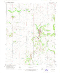 1972 Centralia1974 Print · USGSIn the early seventies, the rural landscape of Craig County was a mix of small-town life and active resource extraction. Researchers can locate the Centralia Cem, trace the winding Big Cabin Creek, or study industrial markers like the Strip Mine and Notch Mound.
Showing maps 1-25 of 29
Top cities of Craig County
- Vinita historical maps
- Welch historical maps
- Big Cabin historical maps
- Ketchum historical maps
- Bluejacket historical maps
Frequently asked questions
- What are the different types of historical maps available for Craig County?
- What is the oldest map of Craig County?
- Where can I purchase historical maps of Craig County for my home or office?
- Where can I download high-res historical maps of Craig County?
- Are there historical topographic maps available for Craig County?
- Is there historical aerial imagery available for Craig County?
- Where are historical maps of Craig County sourced from?