1960s Maps of Fair Oaks, Oklahoma
Explore 3 historic maps of Fair Oaks from the 1960s. These maps offer a rare glimpse into what life looked like during the 1960s — showing old roads, neighborhoods, homes, and landmarks that have changed or disappeared over time.
Whether you're researching your family's past, planning a metal detecting trip, or studying how Fair Oaks's landscape evolved across the 1960s, these high-resolution maps are a powerful tool for exploring the history of this region.
- Focus on a specific era: All maps on this page are from the 1960s, giving you a focused view of this time period.
- See what’s changed: Compare century-old streets, trails, and buildings to today's modern landscape using overlays and satellite layers.
- Research with precision: Use these maps for genealogy, historical research, land use analysis, or educational projects.
- View, download, or print: Maps are fully viewable online in high resolution, and can be downloaded or printed for your own records.
Start exploring Fair Oaks's history through authentic maps from the 1960s. This is your window into the past.
Fair Oaks, OK maps
(3)- 1963 Map of Tulsa
 1963 Tulsa1963 Print · USGSThe Oklahoma and Arkansas borderlands are shown here in the early sixties, a time of massive reservoir construction and heavy mining. Genealogists can trace family roots through settlements like Nowata, Pryor, and Jay, or locate historical zinc and lead mines and coal mines.
 - 1963 Map of Oneta, 1964 Print
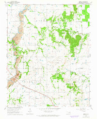 1963 Oneta1964 Print · USGSWagoner County during the early sixties shows a landscape of rail-fed settlements and active extraction. Researchers can locate family landmarks like Springtown Church and Bailey Cemetery alongside the Strip Mines and the Missouri-Kansas-Texas railroad.3 unique versions available
 - 1963 Map of Catoosa, 1964 Print
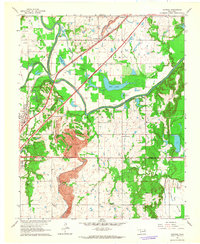 1963 Catoosa1964 Print · USGSThe Verdigris River valley in the early sixties shows a landscape of growing infrastructure and heavy industry. Genealogists and researchers can trace rural life through the Keeton Sch, Timber Ridge Cem, and the massive Strip Mine south of Catoosa.4 unique versions available
End of results
Showing maps 1-3 of 3
Top cities near Fair Oaks
- Tulsa historical maps
- Broken Arrow historical maps
- Owasso historical maps
- Bixby historical maps
- Claremore historical maps
- Coweta historical maps
See more
Frequently asked questions
- What are the different types of historical maps available for Fair Oaks?
- What is the oldest map of Fair Oaks?
- Where can I purchase historical maps of Fair Oaks for my home or office?
- Where can I download high-res historical maps of Fair Oaks?
- Are there historical topographic maps available for Fair Oaks?
- Is there historical aerial imagery available for Fair Oaks?
- Where are historical maps of Fair Oaks sourced from?