1970s Maps of Haskell County, Oklahoma
Explore 9 historic maps of Haskell County from the 1970s. These maps offer a rare glimpse into what life looked like during the 1970s — showing old roads, neighborhoods, homes, and landmarks that have changed or disappeared over time.
Whether you're researching your family's past, planning a metal detecting trip, or studying how Haskell County's landscape evolved across the 1970s, these high-resolution maps are a powerful tool for exploring the history of this region.
- Focus on a specific era: All maps on this page are from the 1970s, giving you a focused view of this time period.
- See what’s changed: Compare century-old streets, trails, and buildings to today's modern landscape using overlays and satellite layers.
- Research with precision: Use these maps for genealogy, historical research, land use analysis, or educational projects.
- View, download, or print: Maps are fully viewable online in high resolution, and can be downloaded or printed for your own records.
Start exploring Haskell County's history through authentic maps from the 1970s. This is your window into the past.
Haskell County, OK maps
(9)- 1977 Map of Mc Curtain SW
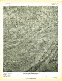 1977 Mc Curtain SW1977 Print · USGSLe Flore County land use and mountain terrain are captured in this 1970s aerial survey. Local researchers can trace old homesteads and timberlines near small communities like Brazil, Walls, and Cedar along the slopes of the Sans Bois Mountains.
 - 1977 Map of Quinton South
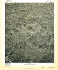 1977 Quinton South1977 Print · USGSThe eastern Oklahoma landscape comes into focus in the late seventies as the timbered ridges meet the valley floor. Genealogists and historians can trace rural homesteads and roads near Quinton, Lewisville, and the prominent Tucker Knob.
 - 1977 Map of Mc Curtain
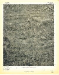
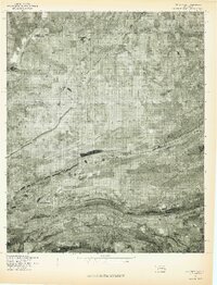 1977 Mc Curtain1977 Print · USGSHaskell County's ridged terrain and late-seventies settlement patterns are documented in this orthophotoquad. Researchers can trace the literal footprint of Mc Curtain or locate the shoreline where the Robert S. Kerr Reservoir meets Ironbridge.
 - 1977 Map of Kinta
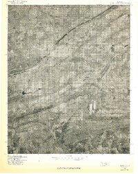
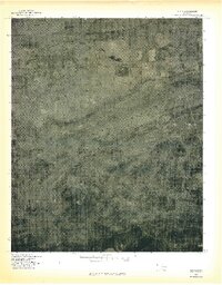 1977 Kinta1977 Print · USGSHaskell County at the end of the seventies is shown here through detailed aerial imagery of the Sans Bois Mountains. Local researchers can trace the footprint of Kinta and the topographical landmarks of Hulsey Mountain and Sans Bois Creek.
 - 1977 Map of Lequire
 1977 Lequire1977 Print · USGSThe Haskell County hills appear in sharp detail during the late 1970s, showcasing a landscape shaped by the timbered ridges of the Sans Bois Mountains. Researchers can trace the rural roads connecting Lequire and Lodi while locating family-named landmarks like Ryan Peak.
 - 1977 Map of Bokoshe
 1977 Bokoshe1977 Print · USGSBokoshe and the industrial landscapes of Le Flore County are seen here in the late seventies through detailed aerial photography. Researchers can trace the exact layout of settlements like Cartersville and Milton or locate Campground Spring Mountain.
 - 1978 Map of Eufaula, 1979 Print
 1978 Eufaula1979 Print · USGSEastern Oklahoma in the late seventies is defined by the sprawling waters of Eufaula Lake and the dense timber of the Sans Bois Mountains. Genealogists and historians can trace the development of towns like Checotah and Stigler or locate legacy sites like the Old R R Grade and Robbers Cave State Park.
 - 1978 Map of Fort Smith, 1979 Print
 1978 Fort Smith1979 Print · USGSThe Arkansas-Oklahoma borderlands in the late seventies show a landscape shaped by massive river reservoirs and sprawling military reservations. Trace the historic rail lines of the Missouri Pacific RR and locate regional landmarks like Fort Gibson, Tenkiller Ferry Lake, and Barling.2 unique versions available
 - 1978 Map of Fort Smith, 1979 Print
 1978 Fort Smith1979 Print · USGSThe Arkansas-Oklahoma borderlands in the late seventies show a region defined by river navigation, coal mining, and military expansion. You can trace industrial footprints like the Strip Mines and the vast Fort Chaffee Military Reservation.2 unique versions available
End of results
Showing maps 1-9 of 9
Top cities of Haskell County
- Stigler historical maps
- Keota historical maps
- McCurtain historical maps
- Kinta historical maps
- Whitefield historical maps
- Tamaha historical maps
Frequently asked questions
- What are the different types of historical maps available for Haskell County?
- What is the oldest map of Haskell County?
- Where can I purchase historical maps of Haskell County for my home or office?
- Where can I download high-res historical maps of Haskell County?
- Are there historical topographic maps available for Haskell County?
- Is there historical aerial imagery available for Haskell County?
- Where are historical maps of Haskell County sourced from?