Old Maps of Ryan, Oklahoma for Academic Research
Study the evolution of Ryan with 11 high-resolution historic maps. Whether you're teaching, researching, or modeling changes in land use, these maps provide essential visual documentation of urban, environmental, and geographic change.
- Analyze long-term change: Track patterns in development, transportation, and natural features.
- Ideal for environmental or urban studies: Support academic projects with primary historical map data.
- Use in the classroom or lab: Educators and researchers rely on these maps to bring historical context to life.
These maps are a powerful tool for teaching, research, and visualizing how Ryan has changed over the decades.
Ryan, OK maps
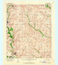
(11)- 1901 Map of Addington
 1901 Addington1901 Print · USGSThe Chickasaw Nation at the turn of the century shows a landscape transitioning from cattle trails to rail commerce. Local historians can trace the Chisholm Trail and the Chicago Rock Island and Pacific rail line through Duncan, Comanche, and Addington.6 unique versions available
 - 1957 Map of Ardmore, 1968 Print
 1957 Ardmore1968 Print · USGSSouth-central Oklahoma in the late fifties was a landscape of rising reservoir waters and expanding rail lines. Genealogists and historians can trace the foundations of Ardmore and Duncan or locate early recreation sites at Platt National Park and Lake Murray State Park.3 unique versions available
 - 1962 Map of Ryan, 1964 Print
 1962 Ryan1964 Print · USGSJefferson County in the early 1960s was a landscape shaped by the rail-and-creek economy of southern Oklahoma. Researchers can trace family history at the Addington Cem or locate industrial sites like the Tank Farm and several Gravel Pits along the Chicago Rock Island and Pacific line.2 unique versions available
 - 1963 Map of Ardmore
 1963 Ardmore1963 Print · USGSSouthern Oklahoma during the early sixties shows a landscape defined by the Arbuckle Mountains and a booming energy economy. Genealogists and historians can trace family-named sites across the Ardmore Oil Field, find old schools like Southeastern State College, or locate historic markers such as Boggy Depot State Park.2 unique versions available
 - 1986 Map of Ardmore
 1986 Ardmore1986 Print · USGSSouthern Oklahoma in the mid-eighties was a landscape of rugged geology and deep petroleum roots. Genealogists and historians can trace the development of Ardmore and Healdon alongside the vast Sholem Alechem Oil Field and the rails of the AT & SF RR.2 unique versions available
 - 1987 Map of Ryan, 1988 Print
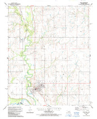 1987 Ryan1988 Print · USGSJefferson County sits on the Oklahoma-Texas border in the late eighties, dominated by the railroad corridor and river bottomlands. Researchers can trace the grid of Ryan, locate family sites at Ryan Cem, and follow the Beaver Creek drainage.
 - 2011 Map of Ryan, 2011 Print
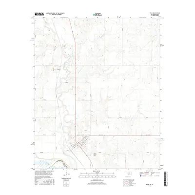
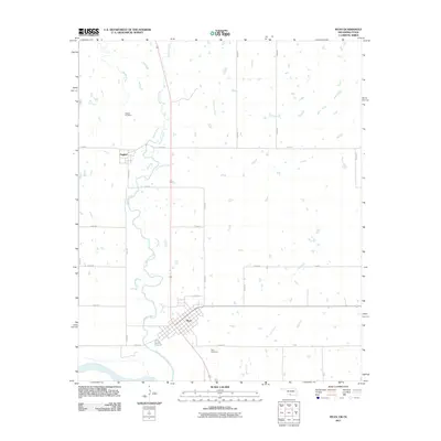 2011 Ryan2011 Print · USGSCovers Ryan, including Sugden, Jefferson County, and other nearby areas
 - 2012 Map of Ryan, 2012 Print
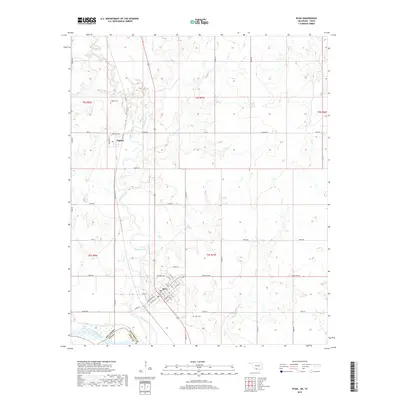
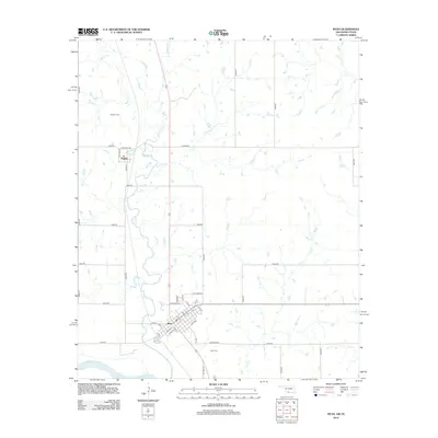 2012 Ryan2012 Print · USGSCovers Ryan, including Sugden, Jefferson County, and other nearby areas
 - 2016 Map of Ryan, 2016 Print
 2016 Ryan2016 Print · USGSCovers Ryan, including Sugden, Jefferson County, and other nearby areas
 - 2019 Map of Ryan, 2019 Print
 2019 Ryan2019 Print · USGSCovers Ryan, including Sugden, Jefferson County, and other nearby areas
 - 2022 Map of Ryan, 2022 Print
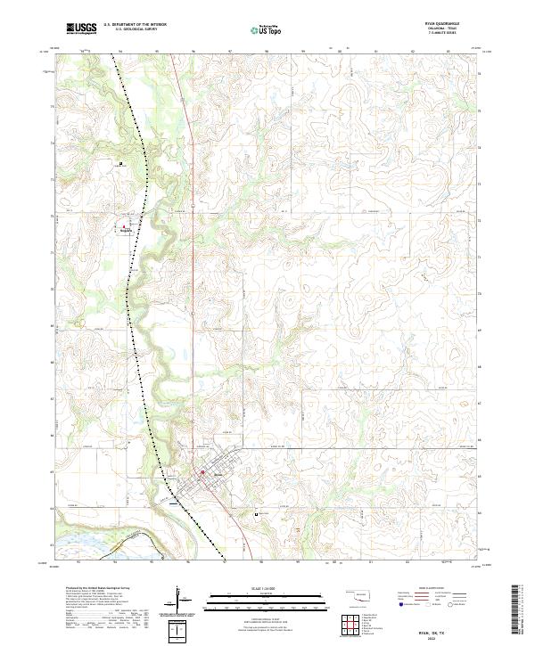 2022 Ryan2022 Print · USGSJefferson County, Oklahoma, at the Texas border is defined by its prairie creeks and the established towns of the early twenty-first century. Genealogists and local historians can trace family roots at the Ryan Cemetery or explore the smaller community of Sugden near Beaver Creek.
End of results
Showing maps 1-11 of 11
Top cities near Ryan
- Nocona historical maps
- Henrietta historical maps
- Waurika historical maps
- Terral historical maps
- Hastings historical maps
- Addington historical maps
See more
Frequently asked questions
- What are the different types of historical maps available for Ryan?
- What is the oldest map of Ryan?
- Where can I purchase historical maps of Ryan for my home or office?
- Where can I download high-res historical maps of Ryan?
- Are there historical topographic maps available for Ryan?
- Is there historical aerial imagery available for Ryan?
- Where are historical maps of Ryan sourced from?