
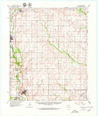
1962 Map of Ryan
USGS Topo · Published 1964About this map
The Chicago Rock Island and Pacific railroad corridor serves as the primary spine for this 1960s landscape, connecting the agricultural and industrial hubs of Addington, Waurika, Sugden, and Ryan. To the north, a prominent Tank Farm and the high elevation of Monument Hill overlook the winding course of Addington Creek, while an active Oil Field in the southeastern portion of the map indicates the region's energy production.
Find a feature on this map
30 named features on this map. Tap any name to fly to it.
Don’t see what you’re looking for? This feature index may not catch every label — zoom into the map to look around manually.
Map Details
Editions of this 1962 Ryan Map
2 editions found
Other maps of this area

1901 · Addington
USGS Topo · 1:125,000

1905 · Montague
USGS Topo · 1:125,000

1954 · Sherman
USGS Topo · 1:250,000

1954 · Wichita Falls
USGS Topo · 1:250,000

1955 · Lawton
USGS Topo · 1:250,000

1956 · Henrietta
USGS Topo · 1:62,500

1957 · Hastings
USGS Topo · 1:62,500

1957 · Ardmore
USGS Topo · 1:250,000

1958 · Wichita Falls
USGS Topo · 1:250,000

1958 · Sherman
USGS Topo · 1:250,000