2020s Maps of Dibble, Oklahoma
Explore 4 historic maps of Dibble from the 2020s. These maps offer a rare glimpse into what life looked like during the 2020s — showing old roads, neighborhoods, homes, and landmarks that have changed or disappeared over time.
Whether you're researching your family's past, planning a metal detecting trip, or studying how Dibble's landscape evolved across the 2020s, these high-resolution maps are a powerful tool for exploring the history of this region.
- Focus on a specific era: All maps on this page are from the 2020s, giving you a focused view of this time period.
- See what’s changed: Compare century-old streets, trails, and buildings to today's modern landscape using overlays and satellite layers.
- Research with precision: Use these maps for genealogy, historical research, land use analysis, or educational projects.
- View, download, or print: Maps are fully viewable online in high resolution, and can be downloaded or printed for your own records.
Start exploring Dibble's history through authentic maps from the 2020s. This is your window into the past.
Dibble, OK maps
(4)- 2022 Map of Bradley, 2022 Print
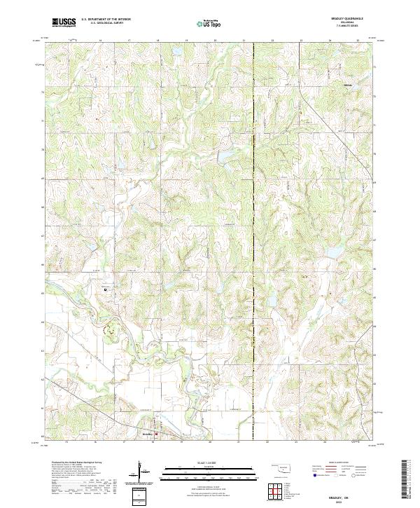 2022 Bradley2022 Print · USGSCentral Oklahoma's rural landscape at the Grady and McClain county line is documented here in the early twenty-first century. Genealogists and local historians can trace the course of the Washita River and locate Laflin Cem near the communities of Bradley and Dibble.
 - 2022 Map of Criner, 2022 Print
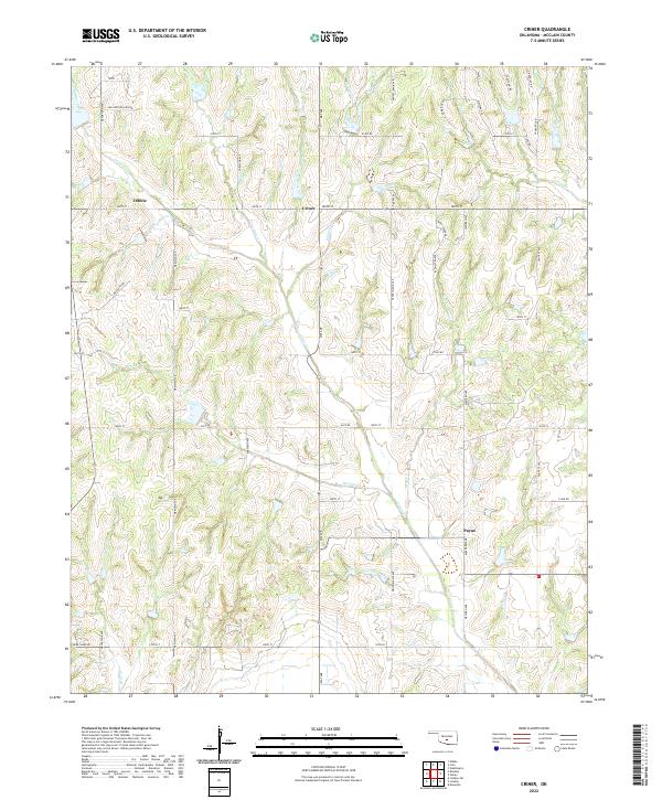 2022 Criner2022 Print · USGSMcClain County’s rolling prairie and creek bottoms are documented here in the early twenty-first century. Researchers can trace family lands and rural crossroads between the settlements of Dibble and Payne, following landmarks like Criner Creek and Finn Ridge Road.
 - 2022 Map of Dibble, 2022 Print
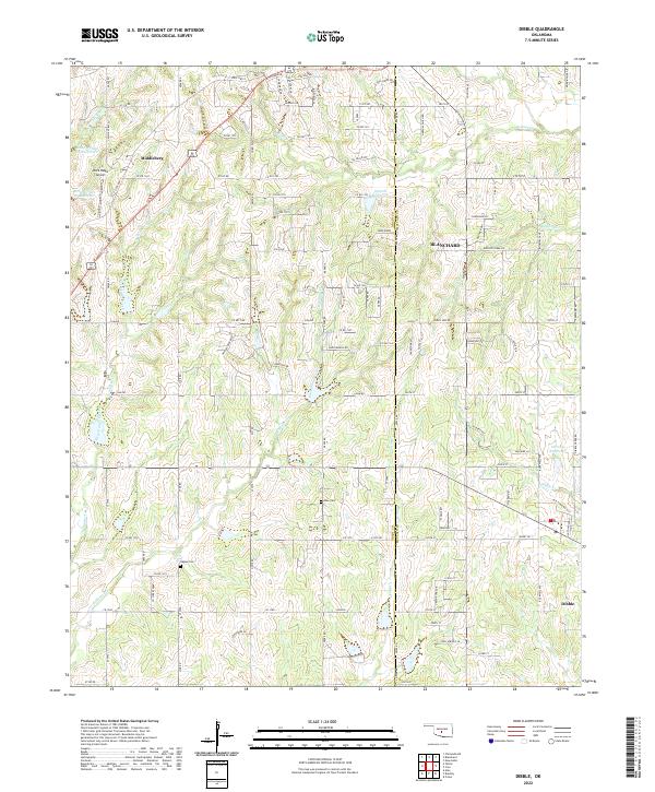 2022 Dibble2022 Print · USGSBlanchard and Middleberg are shown here at the Grady and McClain county line during a period of steady rural growth. Genealogists can locate Hale Cem and Naples Cem or trace the many branches of Winter Cr.
 - 2022 Map of Cole, 2022 Print
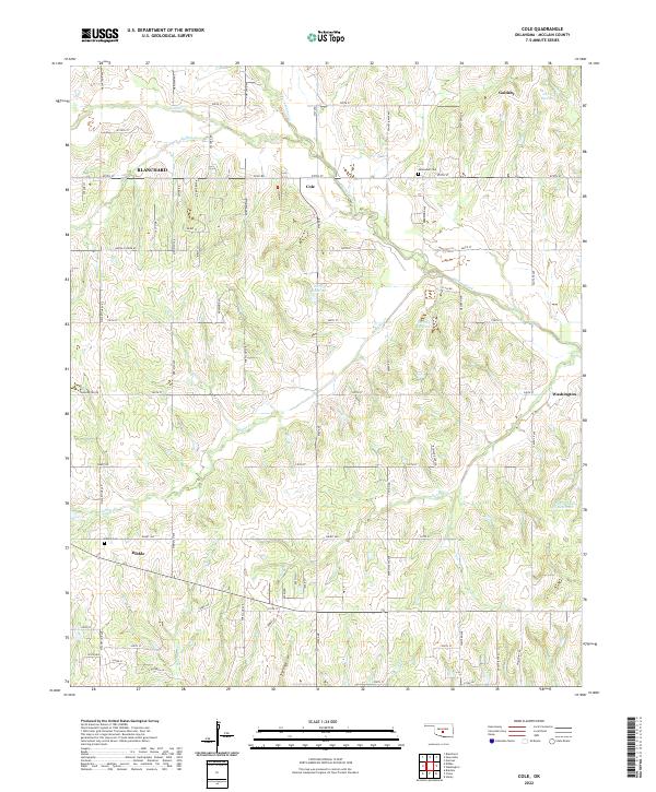 2022 Cole2022 Print · USGSMcClain County remains a landscape of quiet rural crossroads and winding creek valleys in this contemporary survey of central Oklahoma. Researchers can trace the local geography of Cole and Dibble, finding historic sites like Jerusalem Cem and Dibble Cem.
End of results
Showing maps 1-4 of 4
Top cities near Dibble
- Norman historical maps
- Newcastle historical maps
- Blanchard historical maps
- Noble historical maps
- Purcell historical maps
- Lindsay historical maps
See more
Frequently asked questions
- What are the different types of historical maps available for Dibble?
- What is the oldest map of Dibble?
- Where can I purchase historical maps of Dibble for my home or office?
- Where can I download high-res historical maps of Dibble?
- Are there historical topographic maps available for Dibble?
- Is there historical aerial imagery available for Dibble?
- Where are historical maps of Dibble sourced from?