Old Maps of Indian Village, Oklahoma for Metal Detecting
Plan your next treasure hunt with 12 historic maps of Indian Village. Find old homesites, ghost towns, trails, and gathering spots that may be lost to time — perfect for identifying promising metal detecting locations.
- Locate forgotten sites: Uncover places like long-lost settlements, abandoned rail lines, or gathering spots.
- Plan better hunts: Use map overlays combined with LiDAR or satellite views to narrow in on historically rich areas.
- Made for detectorists: Thousands of hobbyists use these maps to discover relics, coins, and hidden history.
Use these historic maps to boost your research and find new opportunities beneath the surface of Indian Village.
Indian Village, OK maps
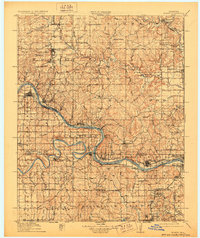
(12)- 1912 Map of Hominy, 1960 Print
 1912 Hominy1960 Print · USGSNortheastern Oklahoma comes alive in this pre-reservoir survey, documenting the river-valley settlements and tribal lands of the early statehood era. Genealogists can locate dozens of country schools and sites like Black Dog (Indian Village) or the early Oil City Barnsdall P O.
 - 1915 Map of Hominy
 1915 Hominy1915 Print · USGSOsage and Creek counties come to life in the years before the Great War, showing a landscape defined by river confluences and the expansion of the rail industry. Genealogists can locate early settlements like Black Dog and schools like Dripping Spring School or Sunset School.2 unique versions available
 - 1915 Map of Hominy, 1928 Print
 1915 Hominy1928 Print · USGSNortheast Oklahoma during the early oil and rail boom is captured here as the Osage and Creek county lines meet the great river bends. Genealogists can trace early homesteads near Black Dog, Oil City, and Union Chapel.2 unique versions available
 - 1955 Map of Enid, 1966 Print
 1955 Enid1966 Print · USGSNorth-central Oklahoma's transition from open plains to the blackjack hills of the Osage Indian Reservation is captured in the mid-1950s. Researchers can trace the development of the Naval Reserve Oil Field, the grounds of Vance AFB, and the early footprints of Tulsa and Stillwater.4 unique versions available
 - 1958 Map of Enid
 1958 Enid1958 Print · USGSNorthern Oklahoma is mapped here in the late fifties, showcasing a dense network of petroleum production and historic tribal lands. Researchers can trace the legacy of the Osage Indian Reservation, early energy hubs like the Cushing Oil Field, and the Chilocco Indian Agricultural School.2 unique versions available
 - 1966 Map of Hominy, 1967 Print
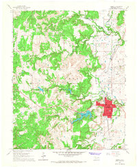 1966 Hominy1967 Print · USGSIn mid-century Osage County, the town of Hominy and the nearby Indian Village sit at the intersection of a rail-driven economy and burgeoning oil production. Genealogists and historians can trace the locations of the Hominy Cemetery, Mound Valley Sch, and the extensive Hominy Oil Field.2 unique versions available
 - 1990 Map of Keystone Lake
 1990 Keystone Lake1990 Print · USGSNorth-central Oklahoma's landscape is captured here in the 1990s as the vast waters of Keystone Lake meet the Osage Indian Reservation. Researchers can trace old rail corridors like the St Louis-San Francisco Railway and find local landmarks such as Pawnee Bill State Park or the Oil Field at Oilton.
 - 2009 Map of Hominy, 2009 Print
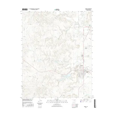
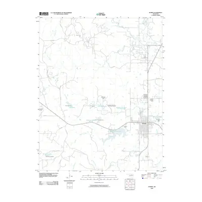 2009 Hominy2009 Print · USGSCovers Indian Village, including Hominy, Osage County, and other nearby areas
 - 2012 Map of Hominy, 2012 Print
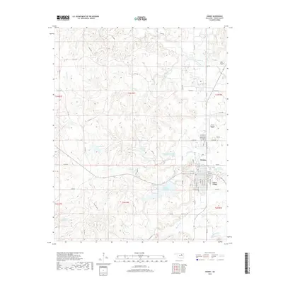
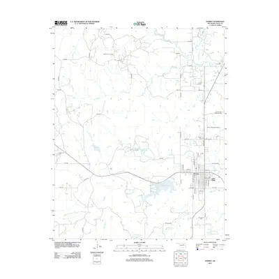 2012 Hominy2012 Print · USGSCovers Indian Village, including Hominy, Osage County, and other nearby areas
 - 2016 Map of Hominy, 2016 Print
 2016 Hominy2016 Print · USGSCovers Indian Village, including Hominy, Osage County, and other nearby areas
 - 2018 Map of Hominy, 2018 Print
 2018 Hominy2018 Print · USGSCovers Indian Village, including Hominy, Osage County, and other nearby areas
 - 2022 Map of Hominy, 2022 Print
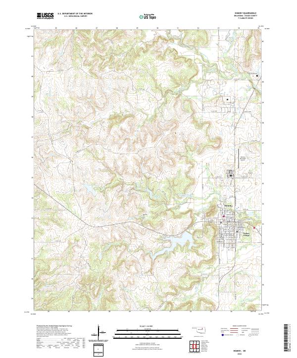 2022 Hominy2022 Print · USGSHominy and the neighboring Osage settlement of Indian Village are shown in detail during the early 2020s. Researchers can trace local heritage through landmarks like the Hominy-Indian Village Cem, Hominy Municipal Airport, and the winding course of Hominy Creek.
End of results
Showing maps 1-12 of 12
Top cities near Indian Village
- Sand Springs historical maps
- Skiatook historical maps
- Hominy historical maps
- Cleveland historical maps
- Barnsdall historical maps
- Wynona historical maps
See more
Frequently asked questions
- What are the different types of historical maps available for Indian Village?
- What is the oldest map of Indian Village?
- Where can I purchase historical maps of Indian Village for my home or office?
- Where can I download high-res historical maps of Indian Village?
- Are there historical topographic maps available for Indian Village?
- Is there historical aerial imagery available for Indian Village?
- Where are historical maps of Indian Village sourced from?