1940s Maps of Ottawa County, Oklahoma
Explore 2 historic maps of Ottawa County from the 1940s. These maps offer a rare glimpse into what life looked like during the 1940s — showing old roads, neighborhoods, homes, and landmarks that have changed or disappeared over time.
Whether you're researching your family's past, planning a metal detecting trip, or studying how Ottawa County's landscape evolved across the 1940s, these high-resolution maps are a powerful tool for exploring the history of this region.
- Focus on a specific era: All maps on this page are from the 1940s, giving you a focused view of this time period.
- See what’s changed: Compare century-old streets, trails, and buildings to today's modern landscape using overlays and satellite layers.
- Research with precision: Use these maps for genealogy, historical research, land use analysis, or educational projects.
- View, download, or print: Maps are fully viewable online in high resolution, and can be downloaded or printed for your own records.
Start exploring Ottawa County's history through authentic maps from the 1940s. This is your window into the past.
Ottawa County, OK maps
(2)- 1949 Map of Seneca, 1970 Print
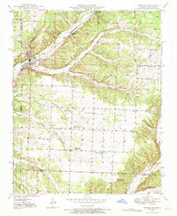 1949 Seneca1970 Print · USGSNewton County life in the late 1940s is centered on the town of Seneca and its proximity to the Oklahoma border. Genealogists can trace family footprints across several rural landmarks, including Gallemore Sch, Graves Cem, and Swars Prairie Baptist Ch.2 unique versions available
 - 1949 Map of Racine, 1973 Print
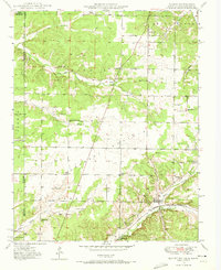 1949 Racine1973 Print · USGSNewton County was a crossroad of mining and agriculture in the late 1940s, situated at the junction of three states. Researchers can trace family history through dozens of landmarks like Tripoli Mines, Burkhart Ch, and the Gibson Cem.2 unique versions available
End of results
Showing maps 1-2 of 2
Top cities of Ottawa County
- Miami historical maps
- Commerce historical maps
- Afton historical maps
- Fairland historical maps
- Quapaw historical maps
- North Miami historical maps
See more
Frequently asked questions
- What are the different types of historical maps available for Ottawa County?
- What is the oldest map of Ottawa County?
- Where can I purchase historical maps of Ottawa County for my home or office?
- Where can I download high-res historical maps of Ottawa County?
- Are there historical topographic maps available for Ottawa County?
- Is there historical aerial imagery available for Ottawa County?
- Where are historical maps of Ottawa County sourced from?