2020s Maps of Watchorn, Oklahoma
Explore 1 historic maps of Watchorn from the 2020s. These maps offer a rare glimpse into what life looked like during the 2020s — showing old roads, neighborhoods, homes, and landmarks that have changed or disappeared over time.
Whether you're researching your family's past, planning a metal detecting trip, or studying how Watchorn's landscape evolved across the 2020s, these high-resolution maps are a powerful tool for exploring the history of this region.
- Focus on a specific era: All maps on this page are from the 2020s, giving you a focused view of this time period.
- See what’s changed: Compare century-old streets, trails, and buildings to today's modern landscape using overlays and satellite layers.
- Research with precision: Use these maps for genealogy, historical research, land use analysis, or educational projects.
- View, download, or print: Maps are fully viewable online in high resolution, and can be downloaded or printed for your own records.
Start exploring Watchorn's history through authentic maps from the 2020s. This is your window into the past.
Watchorn, OK maps
(1)- 2022 Map of Watchorn, 2022 Print
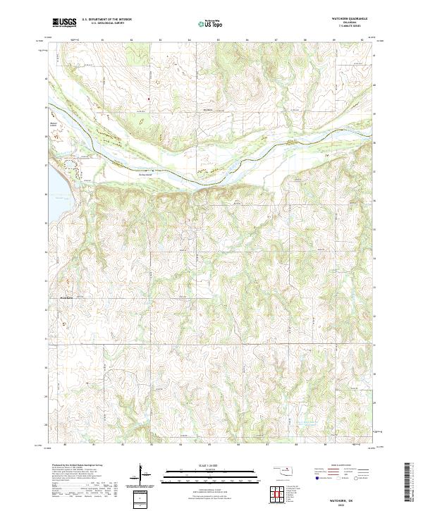 2022 Watchorn2022 Print · USGSThe Arkansas River valley in Northern Oklahoma is captured here in modern detail, where the Osage and Pawnee county lines meet. Researchers can trace rural life and water features like Watchorn, Beaver Island, and the Lower Black Bear Cr Site 7 Reservoir.
End of results
Showing maps 1-1 of 1
Top cities near Watchorn
- Stillwater historical maps
- Pawnee historical maps
- Morrison historical maps
- Glencoe historical maps
- Red Rock historical maps
- Marland historical maps
Frequently asked questions
- What are the different types of historical maps available for Watchorn?
- What is the oldest map of Watchorn?
- Where can I purchase historical maps of Watchorn for my home or office?
- Where can I download high-res historical maps of Watchorn?
- Are there historical topographic maps available for Watchorn?
- Is there historical aerial imagery available for Watchorn?
- Where are historical maps of Watchorn sourced from?