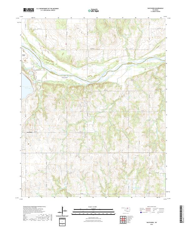
2022 Map of Watchorn
USGS Topo · Published 2022About this map
The Arkansas River winds through the northern reach of this quadrangle, forming a natural boundary between Osage Co and Pawnee Co. Within these river bends lie Beaver Island and Turkey Island, surrounded by a landscape defined by its creek systems and rural road grid. The settlement of Watchorn stands in the western portion of the map, while Big Bend is situated to the north along the river's path. Water management is a central theme of the geography here, evidenced by the expansive Sooner Lake and the Lower Black Bear Cr Site 7 Reservoir. This 2022 survey details the modern configuration of the land, showing how local routes like e0410 RD and n3380 RD connect these rural Oklahoma communities. For those studying the hydrology of the region, the intricate drainage patterns of Red Rock Creek, Greasy Cr, and Walker Cr are meticulously charted.
Find a feature on this map
42 named features on this map. Tap any name to fly to it.
Don’t see what you’re looking for? This feature index may not catch every label — zoom into the map to look around manually.
Map Details
Editions of this 2022 Watchorn Map
This is the sole edition of this map. No revisions or reprints were ever made.
Other maps of this area

1930 · Pawnee
USGS Topo · 1:62,500

1936 · Belford
USGS Topo · 1:62,500

1936 · Pawnee
USGS Topo · 1:62,500

1955 · Enid
USGS Topo · 1:250,000

1958 · Enid
USGS Topo · 1:250,000

1968 · Ponca City SE
USGS Topo · 1:24,000

1972 · Morrison NE
USGS Topo · 1:24,000

1972 · Morrison
USGS Topo · 1:24,000
1978 · Prettyhair Creek
USGS Topo · 1:24,000
1978 · Pawnee
USGS Topo · 1:24,000