2020s Maps of Payne County, Oklahoma
Explore 21 historic maps of Payne County from the 2020s. These maps offer a rare glimpse into what life looked like during the 2020s — showing old roads, neighborhoods, homes, and landmarks that have changed or disappeared over time.
Whether you're researching your family's past, planning a metal detecting trip, or studying how Payne County's landscape evolved across the 2020s, these high-resolution maps are a powerful tool for exploring the history of this region.
- Focus on a specific era: All maps on this page are from the 2020s, giving you a focused view of this time period.
- See what’s changed: Compare century-old streets, trails, and buildings to today's modern landscape using overlays and satellite layers.
- Research with precision: Use these maps for genealogy, historical research, land use analysis, or educational projects.
- View, download, or print: Maps are fully viewable online in high resolution, and can be downloaded or printed for your own records.
Start exploring Payne County's history through authentic maps from the 2020s. This is your window into the past.
Payne County, OK maps
(21)- 2022 Map of Stillwater South, 2022 Print
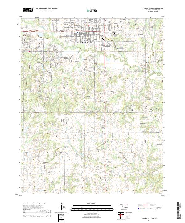 2022 Stillwater South2022 Print · USGSStillwater and its southern rural reaches are captured here in the early twenty-first century as the city grows around the university. Genealogists and historians can locate burials at Fairlawn Cem and Elm Grove Cem or trace the geography of Pickles Gap.
 - 2022 Map of Clear Creek, 2022 Print
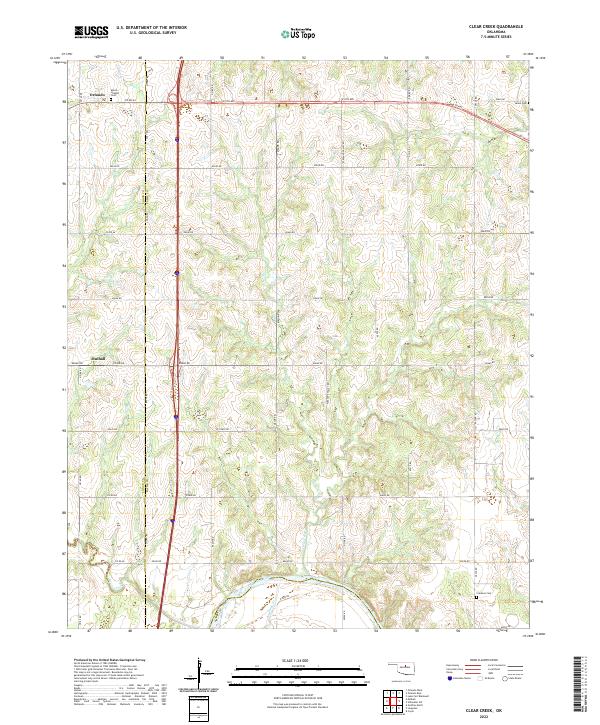 2022 Clear Creek2022 Print · USGSThe Logan and Payne county borderlands are captured here in the early twenty-first century, showing the rural structure of the Oklahoma prairie. Trace family history and land use through the location of Morris Heights Cem, Orlando, and the banks of the Cimarron River.
 - 2022 Map of Orlando East, 2022 Print
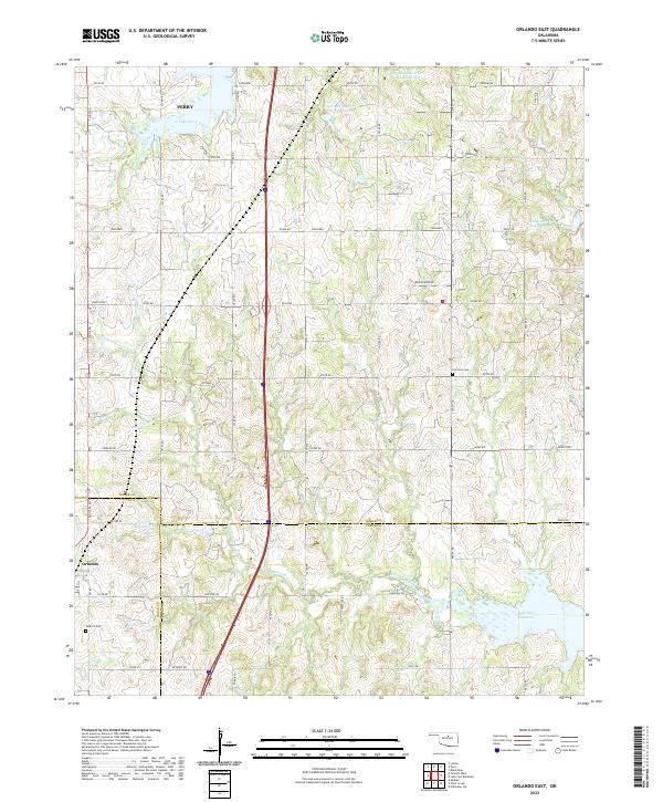 2022 Orlando East2022 Print · USGSThe borderlands of Noble, Logan, and Payne counties are captured here in the early 2020s, showing a landscape defined by cattle country and water management. Researchers can locate the Tedford Cem, the quiet settlement of Orlando, and the expansive waters of Lake Carl Blackwell.
 - 2022 Map of Oilton, 2022 Print
 2022 Oilton2022 Print · USGSThe Creek County oil region comes into focus in this recent survey of the corridor between Oilton and Drumright. Researchers can trace the legacy of local settlements like Pemeta and Markham or locate family plots at Highland Cem and Brooks Cem.
 - 2022 Map of Langston, 2022 Print
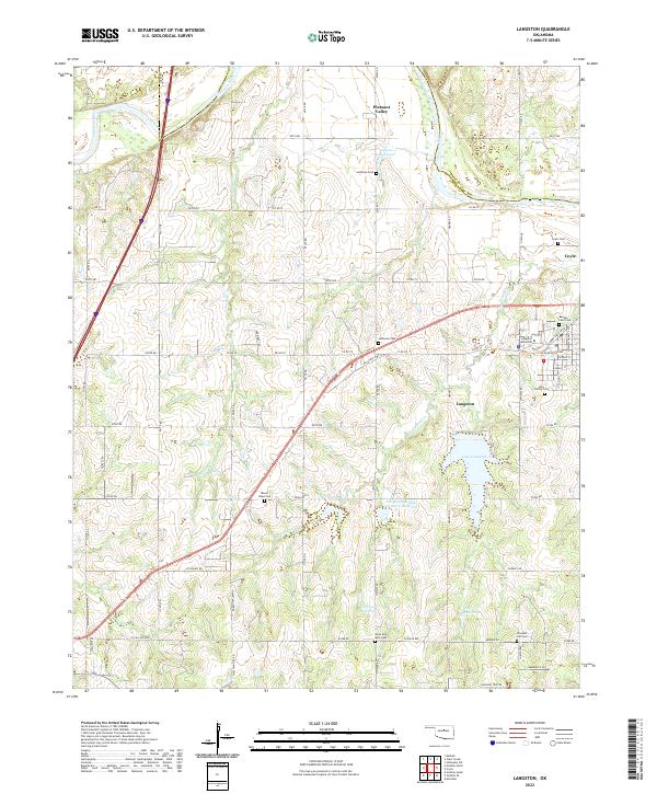 2022 Langston2022 Print · USGSThe Oklahoma prairie surrounding Langston is shown here in the early twenty-first century, centered on its historic university and river valleys. Researchers can trace local family lineages through numerous sites like Beulah Land Cem, Mount Hope Cem, and Pleasant Hill Cem.
 - 2022 Map of Coyle, 2022 Print
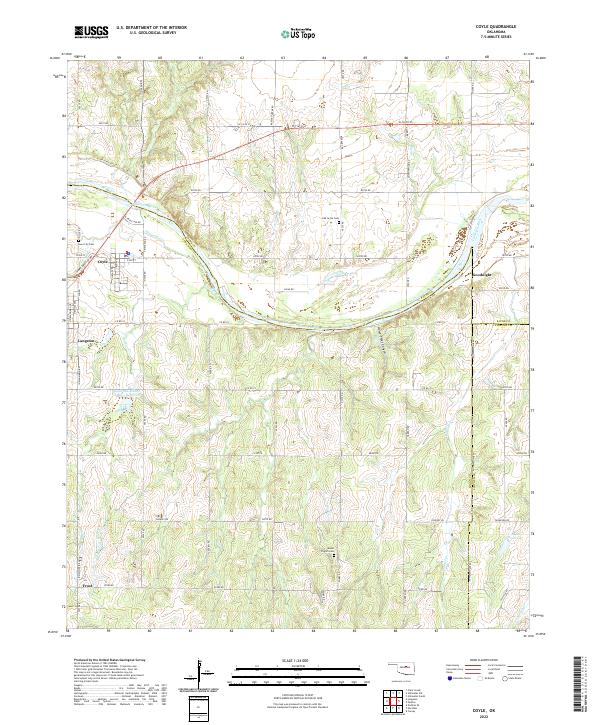 2022 Coyle2022 Print · USGSLogan County in the early twenty-first century reveals a landscape where the Cimarron River still dictates the rhythm of rural life. Family historians and researchers can trace local roots at Iowa City Cem or explore the geography around Goodnight and Horse-Thief Canyon.
 - 2022 Map of Perkins, 2022 Print
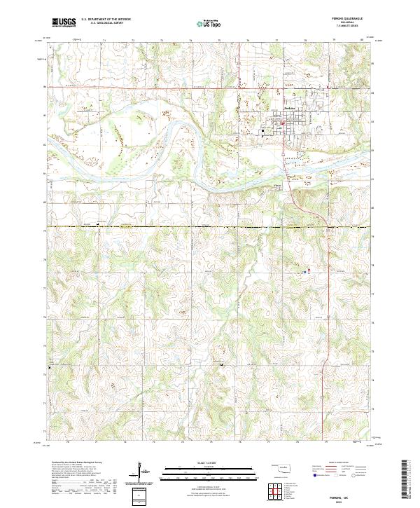 2022 Perkins2022 Print · USGSThe Cimarron River valley south of Stillwater is captured here in the early twenty-first century, showing the enduring grid of Payne and Lincoln Counties. Genealogists can locate several burial grounds including Knipe Cem, Olivet Cem, and Iowa Chapel Cem.
 - 2022 Map of Yale, 2022 Print
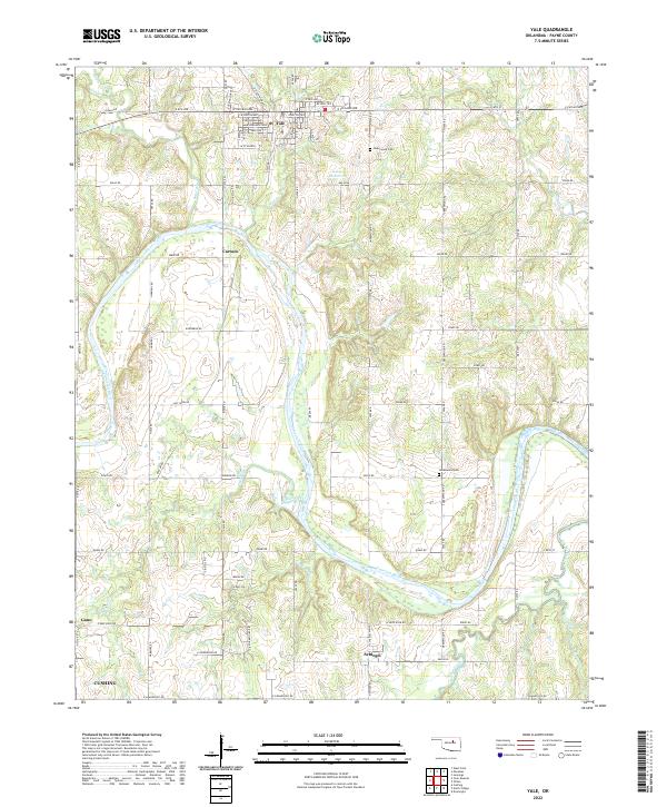 2022 Yale2022 Print · USGSThe Cimarron River valley in Payne County is revealed in high detail during the early 2020s, showing the rural landscape around Yale. Researchers can trace old family sites near Underwood Cem and the small communities of Schlegel and Cartoco.
 - 2022 Map of West Point, 2022 Print
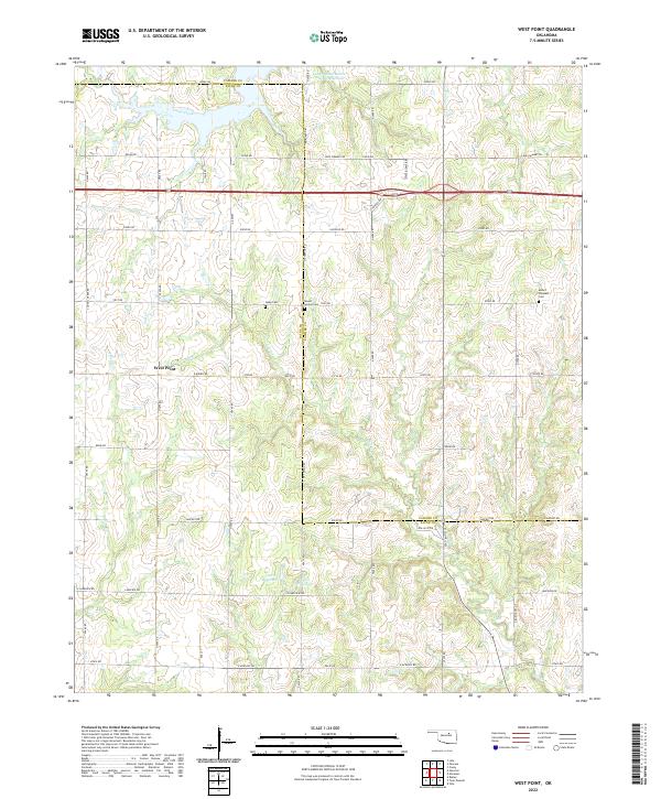 2022 West Point2022 Print · USGSCentral Oklahoma's rural landscapes are captured here in the early twenty-first century, spanning the border of Payne and Pawnee counties. Genealogists can trace family heritage at Mount Vernon Cem, Hopp Cem, and the high ground of Twin Mounds.
 - 2022 Map of Stillwater North, 2022 Print
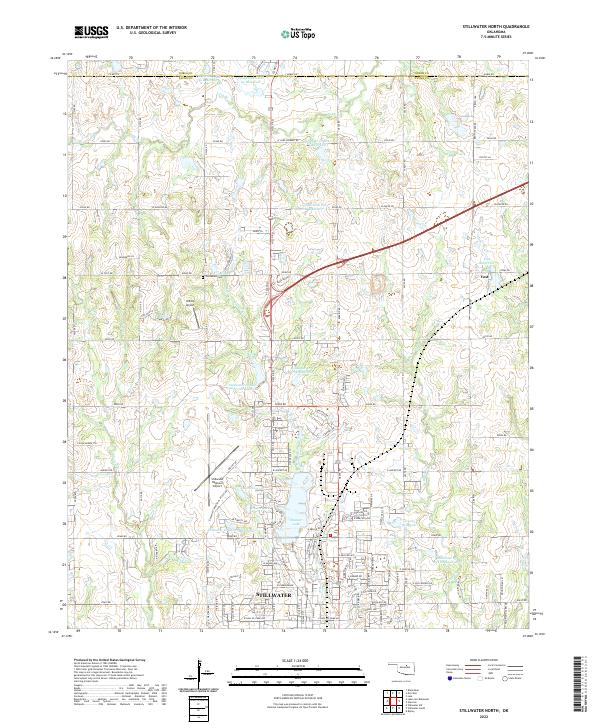 2022 Stillwater North2022 Print · USGSThe northern reaches of Stillwater and the surrounding Oklahoma plains are documented here in the early 2020s. Researchers can trace family sites near Old Moore Cem, explore the growth of Stillwater, and locate rural landmarks like Yost and Roka Ridge.
 - 2022 Map of Stillwater SW, 2022 Print
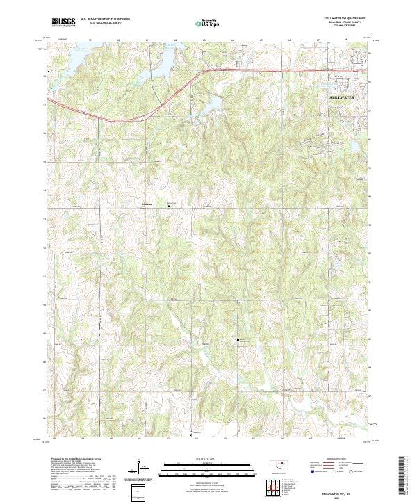 2022 Stillwater SW2022 Print · USGSThe outskirts of Stillwater and the rural reaches of Payne County are captured here during a period of modern growth. Genealogists and local historians can trace the locations of Marena Cem, Mount Vernon Cem, and the community of Marena.
 - 2022 Map of Lake Carl Blackwell, 2022 Print
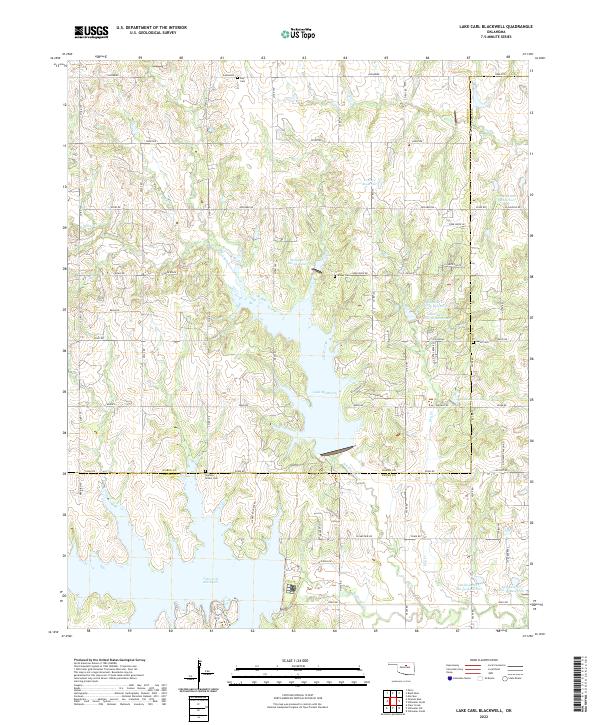 2022 Lake Carl Blackwell2022 Print · USGSThe Noble and Payne County line area in north-central Oklahoma is defined by a massive network of reservoirs and creeks. Local historians can locate ancestral sites like Shelton-Bethel Cemetery or trace the early paths of North Stillwater Creek and Dry Creek.
 - 2022 Map of Drumright, 2022 Print
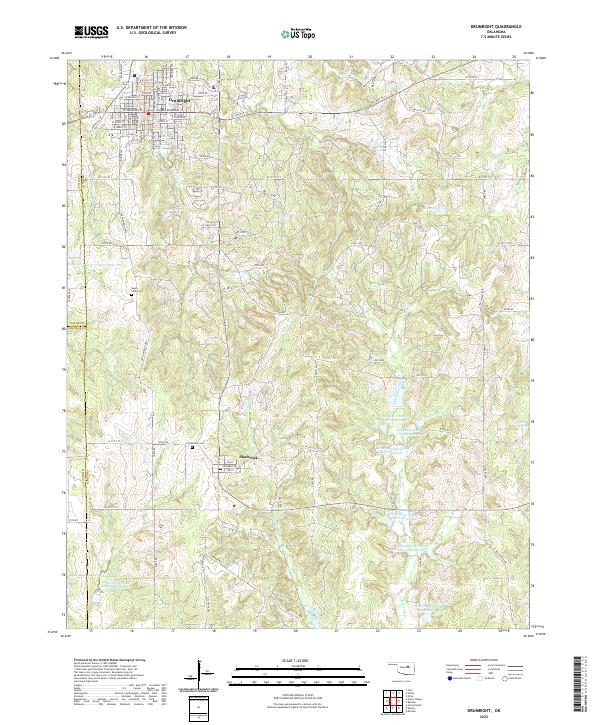 2022 Drumright2022 Print · USGSOklahoma's oil-country history is preserved here in the early twenty-first century, centered on the historic streets of Drumright and the nearby village of Shamrock. Genealogists and local historians can trace family plots at South Side Cem or explore the numerous reservoirs of the Little Deep Fork Creek system.
 - 2022 Map of Cushing, 2022 Print
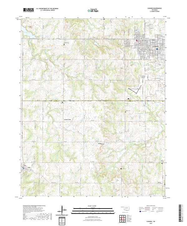 2022 Cushing2022 Print · USGSCushing and its surrounding rural townships are documented in the early twenty-first century as the landscape straddles the Payne and Lincoln County lines. Genealogists can locate several remote burial grounds, including Flynn Cem, Smith Cem, and the Avery Memorial Cem.
 - 2022 Map of North Village, 2022 Print
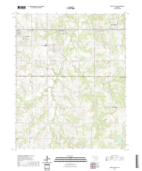 2022 North Village2022 Print · USGSOklahoma's borderlands between Payne and Lincoln counties are captured here in the early twenty-first century. Researchers can trace local heritage through numerous burial grounds like Euchee Valley Memorial Park and settlements such as North Village and Avery.
 - 2022 Map of Tryon North, 2022 Print
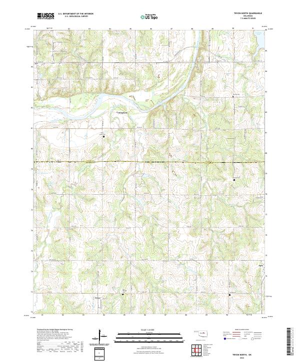 2022 Tryon North2022 Print · USGSCentral Oklahoma's rural landscape at the Payne and Lincoln County line comes into focus during this modern survey. Researchers can trace ancestral locations and local landmarks including the Iowa Indian Cem, the settlement of Tryon, and the high ground of Cimarron Bluff.
 - 2022 Map of Twin Mounds, 2022 Print
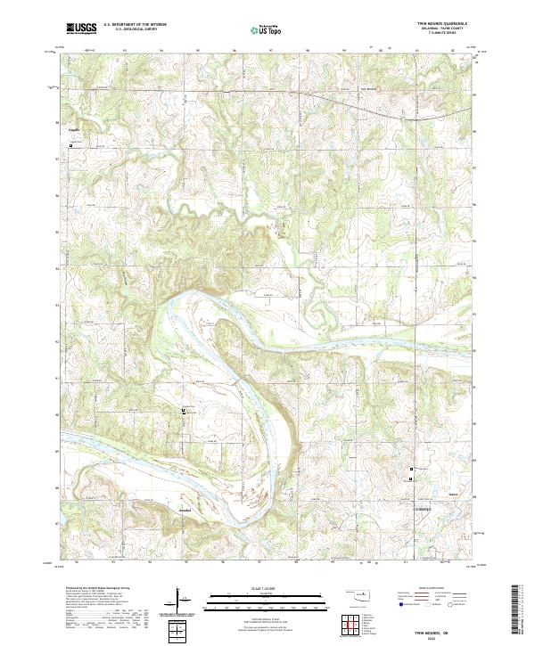 2022 Twin Mounds2022 Print · USGSThe Cimarron River valley in Payne County is captured here in the early 2020s, showing a landscape defined by its rural heritage and small settlements. Researchers can trace family history through numerous burial sites like Union Cem, Dunkin Cem, and the historic area of Ingalls.
 - 2022 Map of Ripley, 2022 Print
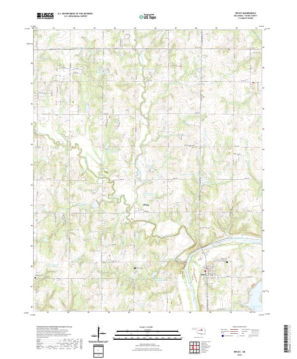 2022 Ripley2022 Print · USGSRipley and the Cimarron River valley are captured here in the early twenty-first century, showcasing a landscape defined by flood control and river geography. Genealogists can trace family sites at Ripley Oak Park Cem or Glenwood Cem and locate the small community of Mehan.
 - 2022 Map of Jennings, 2022 Print
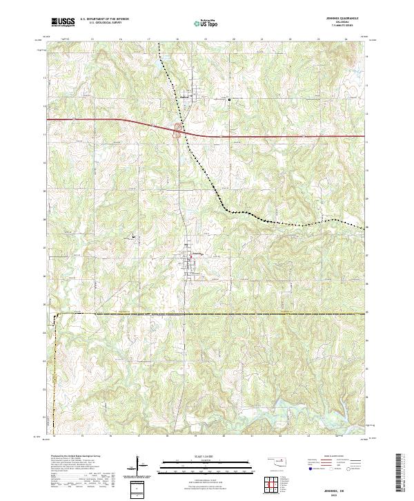 2022 Jennings2022 Print · USGSJennings and the surrounding Pawnee County landscape are captured here in the early twenty-first century, showing the rural grid and watercourse networks. Researchers can locate family landmarks like Bethany Cem or trace the paths of Lagoon Creek and House Cr.
 - 2022 Map of Maramec, 2022 Print
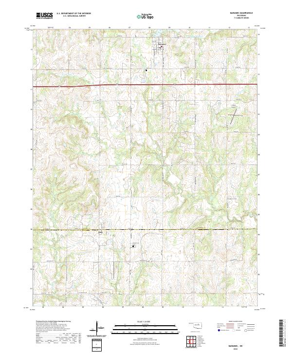 2022 Maramec2022 Print · USGSThe rural border of Pawnee and Payne counties is documented here in the early 2020s, centered on the community of Maramec. Researchers can trace local burial sites at I.O.O.F. Cem and Lawson Cem or locate the settlement of Quay.
 - 2022 Map of Glencoe, 2022 Print
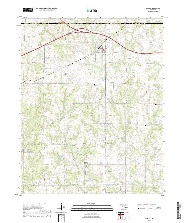 2022 Glencoe2022 Print · USGSGlencoe and its surrounding rural sections in northern Oklahoma are documented here during a period of modern water management and established transport. Researchers can trace family history at Glencoe Cem or Eberle Cem and locate local landmarks like Mulberry Hill Airport.
End of results
Showing maps 1-21 of 21
Top cities of Payne County
- Stillwater historical maps
- Cushing historical maps
- Perkins historical maps
- Yale historical maps
- Glencoe historical maps
- Ripley historical maps
Frequently asked questions
- What are the different types of historical maps available for Payne County?
- What is the oldest map of Payne County?
- Where can I purchase historical maps of Payne County for my home or office?
- Where can I download high-res historical maps of Payne County?
- Are there historical topographic maps available for Payne County?
- Is there historical aerial imagery available for Payne County?
- Where are historical maps of Payne County sourced from?