1900s (20th Century) Maps of Cherryville, Oregon
Explore 10 historic maps of Cherryville from the 1900s (20th Century). These maps offer a rare glimpse into what life looked like during the 1900s — showing old roads, neighborhoods, homes, and landmarks that have changed or disappeared over time.
Whether you're researching your family's past, planning a metal detecting trip, or studying how Cherryville's landscape evolved across the 1900s, these high-resolution maps are a powerful tool for exploring the history of this region.
- Focus on a specific era: All maps on this page are from the 1900s, giving you a focused view of this time period.
- See what’s changed: Compare century-old streets, trails, and buildings to today's modern landscape using overlays and satellite layers.
- Research with precision: Use these maps for genealogy, historical research, land use analysis, or educational projects.
- View, download, or print: Maps are fully viewable online in high resolution, and can be downloaded or printed for your own records.
Start exploring Cherryville's history through authentic maps from the 1900s. This is your window into the past.
Cherryville, OR maps
(10)- 1916 Map of Estacada
 1916 Estacada1916 Print · USGSClackamas County is captured here during a period of rapid hydroelectric and rail development just before the First World War. Researchers can trace early family homesteads near Fishers Mill, the old Feldbimer Ferry crossing, and the rail line serving Boring and Estacada.5 unique versions available
 - 1948 Map of Vancouver, 1957 Print
 1948 Vancouver1957 Print · USGSPost-war growth transforms the river valleys of the Pacific Northwest as the timber and rail economy thrives. Trace family roots in Tillamook or Oregon City, and locate vanished landmarks like the spit at Bayocean or the Skamania Mine.
 - 1950 Map of Vancouver
 1950 Vancouver1950 Print · USGSCoastal Oregon and the lower Columbia River valley are captured in detail just after the war. Researchers can trace historic rail routes like the Southern Pacific or locate early settlements such as Vernonia, Gaston, and the Grand Ronde Indian Reservation.
 - 1950 Map of Vancouver, 1951 Print
 1950 Vancouver1951 Print · USGSThe Pacific Northwest urban corridor meets the rugged coast in the years following the war, showing the expansion of Portland and Vancouver. Genealogists and historians can trace the reach of the Southern Pacific RR and locate coastal communities like Tillamook, Seaside, and Tolovana Park.
 - 1955 Map of Cherryville, 1957 Print
 1955 Cherryville1957 Print · USGSClackamas County in the mid-fifties is defined by its transition from the agricultural valleys near Cherryville to the timbered heights of the Mount Hood National Forest. Genealogists can locate family landmarks like Porter School and Camp Namanu or trace the early path of Highway 26 through Brightwood.3 unique versions available
 - 1958 Map of Vancouver, 1968 Print
 1958 Vancouver1968 Print · USGSThe Lower Columbia and Willamette valleys thrive in the late sixties as major rail and river hubs. Genealogists and historians can trace the development of Portland, identify the grounds of Camp Withycombe, and locate coastal landmarks from Tillamook Head to Garibaldi.3 unique versions available
 - 1964 Map of Vancouver
 1964 Vancouver1964 Print · USGSThe Pacific Northwest interior and coast are shown here in the 1960s, from the Portland metropolitan hub to the rugged Pacific shoreline. Researchers can trace the legacy of the Grand Ronde Indian Reservation, the early layout of McMinnville, and the maritime approaches near Tillamook Head.
 - 1982 Map of Oregon City, 1983 Print
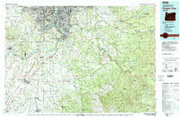 1982 Oregon City1983 Print · USGSGreater Portland and the Willamette Valley are shown in the early eighties as the region's urban and rural landscapes converged. Genealogists and historians can trace family-named sites across French Prairie, visit St Paul Ch, or locate the grounds of Dammasch State Hospital.
 - 1985 Map of Cherryville, 1986 Print
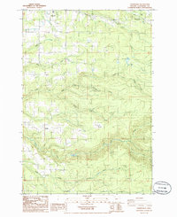 1985 Cherryville1986 Print · USGSClackamas County settlement and timber country are captured here in the mid-1980s as rural communities continued to grow along the creek drainages. Genealogists and local historians can locate rural markers like the Cem near George and the settlements of Firwood and Bissell.
 - 1997 Map of Cherryville, 1999 Print
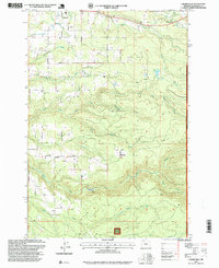 1997 Cherryville1999 Print · USGSClackamas County in the late nineties shows a landscape of small foothill settlements and forest service lands. Genealogists and local historians can trace family-named locations such as Bissell, George, and Cherryville alongside landmarks like the Fish Hatchery.
End of results
Showing maps 1-10 of 10
Frequently asked questions
- What are the different types of historical maps available for Cherryville?
- What is the oldest map of Cherryville?
- Where can I purchase historical maps of Cherryville for my home or office?
- Where can I download high-res historical maps of Cherryville?
- Are there historical topographic maps available for Cherryville?
- Is there historical aerial imagery available for Cherryville?
- Where are historical maps of Cherryville sourced from?