Old Maps of Wilhoit, Oregon for Genealogy
Trace your family roots with 14 historic maps of Wilhoit. These high-res maps reveal old neighborhoods, homesites, landmarks, and streets — helping you uncover where your ancestors lived and how the area evolved over time.
- Explore historic neighborhoods: Identify where your relatives may have lived in the 1800s or 1900s.
- Compare maps over time: Trace the changes in streets, buildings, and landmarks for multi-generational research.
- Perfect for genealogy & ancestry research: Used by family historians and researchers to map out lineage and migration.
These maps are an incredible resource for exploring your personal connection to Wilhoit's past.
Wilhoit, OR maps
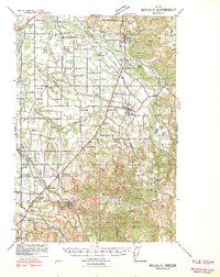
(14)- 1939 Map of Molalla, 1958 Print
 1939 Molalla1958 Print · USGSBefore the modernization of the Willamette Valley's rural roads, this region centered on Molalla was a patchwork of family timberlands and prairie farms. Genealogists can trace family names and small-scale industry through landmarks like Union Mills, Maplewood Grange, and Jacks Bridge.2 unique versions available
 - 1940 Map of Molalla
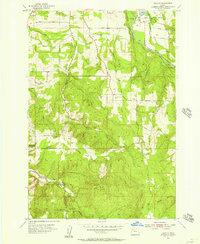
 1940 Molalla1940 Print · USGSClackamas and Marion counties are captured here just before the war, showing the fertile prairies and rising timbered foothills of the Willamette Valley. Researchers can trace ancestral property near Lone Elder, visit the Trinity Lutheran Church, or locate vanished logging landmarks like the Old Saw Mill.2 unique versions available
 - 1948 Map of Vancouver, 1957 Print
 1948 Vancouver1957 Print · USGSPost-war growth transforms the river valleys of the Pacific Northwest as the timber and rail economy thrives. Trace family roots in Tillamook or Oregon City, and locate vanished landmarks like the spit at Bayocean or the Skamania Mine.
 - 1950 Map of Vancouver
 1950 Vancouver1950 Print · USGSCoastal Oregon and the lower Columbia River valley are captured in detail just after the war. Researchers can trace historic rail routes like the Southern Pacific or locate early settlements such as Vernonia, Gaston, and the Grand Ronde Indian Reservation.
 - 1950 Map of Vancouver, 1951 Print
 1950 Vancouver1951 Print · USGSThe Pacific Northwest urban corridor meets the rugged coast in the years following the war, showing the expansion of Portland and Vancouver. Genealogists and historians can trace the reach of the Southern Pacific RR and locate coastal communities like Tillamook, Seaside, and Tolovana Park.
 - 1955 Map of Wilhoit, 1957 Print
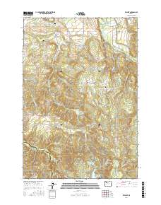
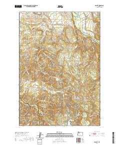
 1955 Wilhoit1957 Print · USGSClackamas and Marion counties are captured here in the mid-fifties, showing a landscape of timber ponds and rural schoolhouses. Genealogists can locate family landmarks like Dart Cemetery and historical school sites including Beaver Lake School and Koke Corner.4 unique versions available
 - 1958 Map of Vancouver, 1968 Print
 1958 Vancouver1968 Print · USGSThe Lower Columbia and Willamette valleys thrive in the late sixties as major rail and river hubs. Genealogists and historians can trace the development of Portland, identify the grounds of Camp Withycombe, and locate coastal landmarks from Tillamook Head to Garibaldi.3 unique versions available
 - 1964 Map of Vancouver
 1964 Vancouver1964 Print · USGSThe Pacific Northwest interior and coast are shown here in the 1960s, from the Portland metropolitan hub to the rugged Pacific shoreline. Researchers can trace the legacy of the Grand Ronde Indian Reservation, the early layout of McMinnville, and the maritime approaches near Tillamook Head.
 - 1982 Map of Oregon City, 1983 Print
 1982 Oregon City1983 Print · USGSGreater Portland and the Willamette Valley are shown in the early eighties as the region's urban and rural landscapes converged. Genealogists and historians can trace family-named sites across French Prairie, visit St Paul Ch, or locate the grounds of Dammasch State Hospital.
 - 2011 Map of Wilhoit, 2011 Print
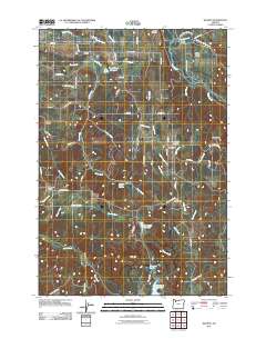 2011 Wilhoit2011 Print · USGSCovers Wilhoit, including Clackamas County, Marion County, and other nearby areas
 - 2014 Map of Wilhoit, 2014 Print
 2014 Wilhoit2014 Print · USGSCovers Wilhoit, including Clackamas County, Marion County, and other nearby areas
 - 2017 Map of Wilhoit, 2017 Print
 2017 Wilhoit2017 Print · USGSCovers Wilhoit, including Clackamas County, Marion County, and other nearby areas
 - 2020 Map of Wilhoit, 2020 Print
 2020 Wilhoit2020 Print · USGSCovers Wilhoit, including Clackamas County, Marion County, and other nearby areas
 - 2023 Map of Wilhoit, 2023 Print
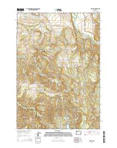
 2023 Wilhoit2023 Print · USGSThe Clackamas and Marion County borderlands appear here in the modern era as a landscape of timbered ridges and family homesteads. Genealogists can trace deep local roots at the Mrs Eliza Jane Gray Grave, Dickey-Family Cem, and the settlement of Wilhoit.
End of results
Showing maps 1-14 of 14
Top cities near Wilhoit
- Canby historical maps
- Silverton historical maps
- Molalla historical maps
- Mount Angel historical maps
- Sublimity historical maps
- Aurora historical maps
See more
Frequently asked questions
- What are the different types of historical maps available for Wilhoit?
- What is the oldest map of Wilhoit?
- Where can I purchase historical maps of Wilhoit for my home or office?
- Where can I download high-res historical maps of Wilhoit?
- Are there historical topographic maps available for Wilhoit?
- Is there historical aerial imagery available for Wilhoit?
- Where are historical maps of Wilhoit sourced from?