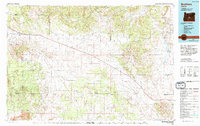
Old Maps of Brothers, Oregon for Academic Research
Study the evolution of Brothers with 10 high-resolution historic maps. Whether you're teaching, researching, or modeling changes in land use, these maps provide essential visual documentation of urban, environmental, and geographic change.
- Analyze long-term change: Track patterns in development, transportation, and natural features.
- Ideal for environmental or urban studies: Support academic projects with primary historical map data.
- Use in the classroom or lab: Educators and researchers rely on these maps to bring historical context to life.
These maps are a powerful tool for teaching, research, and visualizing how Brothers has changed over the decades.
Brothers, OR maps
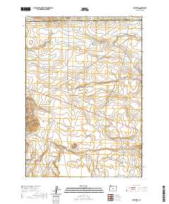
(10)- 1955 Map of Crescent, 1963 Print
 1955 Crescent1963 Print · USGSCentral Oregon in the mid-1950s was a landscape of dense national forests and high desert expanses. Researchers can trace timber-era settlements like Gilchrist and Crescent or locate remote outposts such as Stauffer and Millican near the Wagontire Mountains.3 unique versions available
 - 1957 Map of Crescent
 1957 Crescent1957 Print · USGSCentral Oregon’s high desert and volcanic rim are captured here in the late fifties, showing the region before the modernization of its wilderness corridors. Genealogists and local historians can trace rail-line outposts like Chemult and the early boundaries of the Klamath Indian Reservation.
 - 1958 Map of Crescent
 1958 Crescent1958 Print · USGSCentral Oregon’s volcanic high desert and timber country are captured here in the mid-fifties, from the peaks of the Cascades to the arid basins. Researchers can trace the lines of the Southern Pacific RR, the northern reaches of the Klamath Indian Reservation, and remote outposts like Fort Rock.
 - 1967 Map of Brothers, 1968 Print
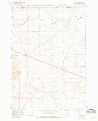 1967 Brothers1968 Print · USGSCentral Oregon ranching and aviation infrastructure are documented here during the late sixties. Trace the historical footprint of Brothers and locate specific local landmarks like Fehrenbacker Reservoir, Varco Well, and the local Landing Strip.
 - 1970 Map of Crescent, 1973 Print
 1970 Crescent1973 Print · USGSCentral Oregon in the early seventies reveals a landscape of volcanic peaks and timber outposts connected by the Southern Pacific rail line. Researchers can trace the layout of Christmas Valley, locate Cabin Lake Ranger Station, and explore the geological footprint of Newberry Crater.
 - 1983 Map of Brothers, 1994 Print
 1983 Brothers1994 Print · USGSThe high desert of central Oregon appears here during the early eighties, showing the remote ranching outposts and volcanic formations of the region. Trace local landmarks like the Millican settlement, the extensive Lava flows, and the elevations of Glass Buttes.2 unique versions available
 - 2011 Map of Brothers, 2011 Print
 2011 Brothers2011 Print · USGSCovers Brothers, including Deschutes County, Crook County, and other nearby areas
 - 2017 Map of Brothers, 2017 Print
 2017 Brothers2017 Print · USGSCovers Brothers, including Deschutes County, Crook County, and other nearby areas
 - 2020 Map of Brothers, 2020 Print
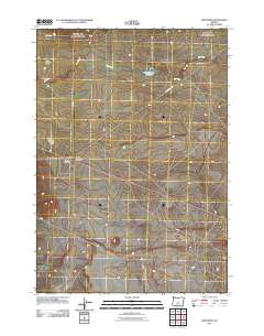
 2020 Brothers2020 Print · USGSCovers Brothers, including Deschutes County, Crook County, and other nearby areas
 - 2023 Map of Brothers, 2023 Print
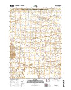
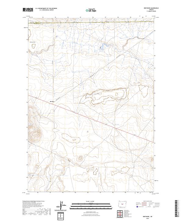 2023 Brothers2023 Print · USGSCentral Oregon ranching and high-desert transit come into focus in the early 2020s near the remote outpost of Brothers. Researchers can trace old water rights and range infrastructure through features like Fehrenbacker Reservoir, Varco Well, and the Dry River.
End of results
Showing maps 1-10 of 10
Frequently asked questions
- What are the different types of historical maps available for Brothers?
- What is the oldest map of Brothers?
- Where can I purchase historical maps of Brothers for my home or office?
- Where can I download high-res historical maps of Brothers?
- Are there historical topographic maps available for Brothers?
- Is there historical aerial imagery available for Brothers?
- Where are historical maps of Brothers sourced from?