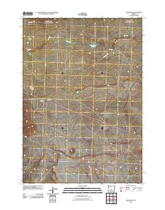
2011 Map of Brothers
USGS Topo · Published 2011About this map
Brothers serves as the central hub of this high desert landscape in central Oregon, centered around the Brothers Post Office and the intersection of local routes. The area is defined by the ephemeral path of the Dry River, which cuts across the northern reaches of the quadrangle near the Harney Holes and Fehrenbacker Reservoir. Transport and infrastructure are critical to this remote settlement, evidenced by the Brothers Landing Strip and the Brothers Oasis Safety Rest Area located along the primary east-west corridor.
Find a feature on this map
10 named features on this map. Tap any name to fly to it.
Don’t see what you’re looking for? This feature index may not catch every label — zoom into the map to look around manually.
Map Details
Editions of this 2011 Brothers Map
This is the sole edition of this map. No revisions or reprints were ever made.
Other maps of this area

1955 · Crescent
USGS Topo · 1:250,000

1957 · Crescent
USGS Topo · 1:250,000

1958 · Crescent
USGS Topo · 1:250,000

1967 · Brothers NW
USGS Topo · 1:24,000
1967 · Sugarloaf Butte
USGS Topo · 1:24,000
1967 · Brothers SW
USGS Topo · 1:24,000
1967 · Brothers
USGS Topo · 1:24,000

1970 · Crescent
USGS Topo · 1:250,000
1983 · Soldiers Cap
USGS Topo · 1:24,000
1983 · Pringle Flat
USGS Topo · 1:24,000