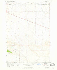
1967 Map of Brothers SW
USGS Topo · Published 1968About this map
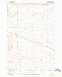
Government Well and several other isolated water sources anchor this arid landscape on the high desert border between Crook County and Deschutes County. Mapping in the late 1960s reveals a terrain defined by sparse survival resources in an otherwise desiccated environment, where the winding bed of the Dry River cuts through the northern sections. This topography is dominated by distinct elevations such as Pine Ridge, Skull, and Twin Pines, which served as critical navigational landmarks for those traversing the sagebrush and juniper country. The infrastructure of the period is limited to scattered wells like Israel Well and King Well, illustrating the high value of groundwater for the region's livestock and ranching operations. The survey provides a clear view of the section lines and survey markers that organized this portion of Central Oregon before significant modern development.
Find a feature on this map
8 named features on this map. Tap any name to fly to it.
Don’t see what you’re looking for? This feature index may not catch every label — zoom into the map to look around manually.
Map Details
Editions of this 1967 Brothers SW Map
2 editions found
Other maps of this area

1955 · Crescent
USGS Topo · 1:250,000

1957 · Crescent
USGS Topo · 1:250,000

1958 · Crescent
USGS Topo · 1:250,000

1966 · Millican SE
USGS Topo · 1:24,000

1967 · Brothers NW
USGS Topo · 1:24,000
1967 · Sugarloaf Butte
USGS Topo · 1:24,000
1967 · West Butte
USGS Topo · 1:24,000
1967 · Brothers
USGS Topo · 1:24,000

1970 · Crescent
USGS Topo · 1:250,000
1981 · Plot Butte
USGS Topo · 1:24,000