1967 Map of Brothers
USGS Topo · Published 1968About this map
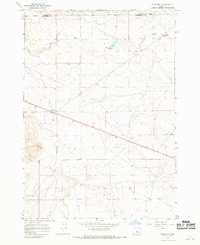
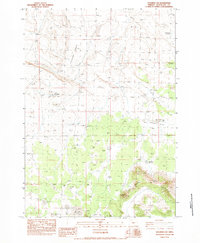
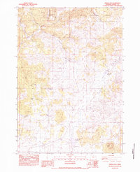
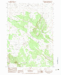
Brothers sits at the center of this high desert landscape, serving as a primary point of human activity along the main transit corridor through the region. This 1967 survey captures a period when the area's infrastructure supported ranching and aviation, notably featuring a Landing Strip and several water resources such as the Fehrenbacker Reservoir and Varco Well. The terrain is defined by the course of the Dry River and the undulating topography typical of the central Oregon interior. The boundary between Crook County and Deschutes County runs across the northern portion of the sheet, where Borrow Pits and numerous benchmarks like BM 4655 track the elevation across this arid expanse. The map illustrates a network of roads and a Jeep Trail that connect isolated wells and landmarks, providing a clear record of the rural land use and surveying history of the late 1960s.
Find a feature on this map
21 named features on this map. Tap any name to fly to it.
Don’t see what you’re looking for? This feature index may not catch every label — zoom into the map to look around manually.
Map Details
Editions of this 1967 Brothers Map
This is the sole edition of this map. No revisions or reprints were ever made.
Other maps of this area

1955 · Crescent
USGS Topo · 1:250,000

1957 · Crescent
USGS Topo · 1:250,000

1958 · Crescent
USGS Topo · 1:250,000
1967 · Brothers NW
USGS Topo · 1:24,000
1967 · Sugarloaf Butte
USGS Topo · 1:24,000
1967 · Brothers SW
USGS Topo · 1:24,000

1970 · Crescent
USGS Topo · 1:250,000
1983 · Soldiers Cap
USGS Topo · 1:24,000
1983 · Pringle Flat
USGS Topo · 1:24,000
1983 · Imperial Valley South
USGS Topo · 1:24,000