Old Maps of Leona, Oregon for Metal Detecting
Plan your next treasure hunt with 10 historic maps of Leona. Find old homesites, ghost towns, trails, and gathering spots that may be lost to time — perfect for identifying promising metal detecting locations.
- Locate forgotten sites: Uncover places like long-lost settlements, abandoned rail lines, or gathering spots.
- Plan better hunts: Use map overlays combined with LiDAR or satellite views to narrow in on historically rich areas.
- Made for detectorists: Thousands of hobbyists use these maps to discover relics, coins, and hidden history.
Use these historic maps to boost your research and find new opportunities beneath the surface of Leona.
Leona, OR maps
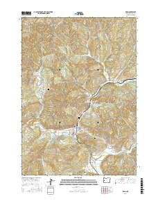
(10)- 1954 Map of Drain, 1956 Print
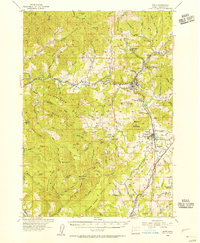 1954 Drain1956 Print · USGSDouglas County’s timber and rail corridors come alive in this mid-fifties study of the northern Umpqua basin. Genealogists can trace several vanished rural hubs like the Cold Spring Sch or locate family plots at the Applegate Cemetery.2 unique versions available
 - 1958 Map of Roseburg, 1960 Print
 1958 Roseburg1960 Print · USGSThe timber valleys and high volcanic peaks of Southern Oregon are captured here in the late fifties. Researchers can trace the Southern Pacific rail line through historic settlements like Cottage Grove, Yoncalla, and Oakridge near the Cascade Range crest.4 unique versions available
 - 1959 Map of Roseburg
 1959 Roseburg1959 Print · USGSThe Umpqua and Willamette valleys meet the high Cascades in this late-fifties study of Southern Oregon's timber and rail corridors. Genealogists and researchers can trace the Southern Pacific RR through historic towns like Roseburg, Yoncalla, and Cottage Grove.
 - 1979 Map of Cottage Grove
 1979 Cottage Grove1979 Print · USGSThe Oregon timber and rail corridors of the late seventies are documented here, centered on the Coast Fork Willamette River and the growing hub of Cottage Grove. Researchers can trace the path of the Southern Pacific railroad as it connects small stations like Divide, Saginaw, and Yoncalla.2 unique versions available
 - 1987 Map of Drain
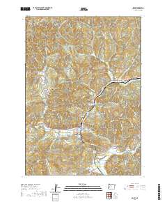
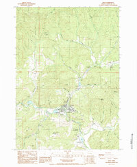 1987 Drain1987 Print · USGSIn the late 1980s, the Douglas County town of Drain sat as a vital junction of creek valleys and mountain passes. Genealogists and local historians can locate early landmarks such as the Jesse Applegate Historical Marker, the Cem near Leona, and the Boswell Mineral Springs.
 - 2011 Map of Drain, 2011 Print
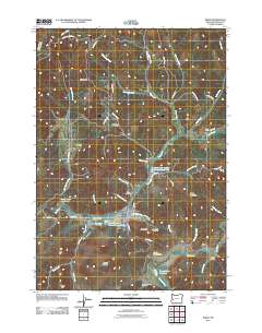 2011 Drain2011 Print · USGSCovers Leona, including Drain, Douglas County, and other nearby areas
 - 2014 Map of Drain, 2014 Print
 2014 Drain2014 Print · USGSCovers Leona, including Drain, Douglas County, and other nearby areas
 - 2017 Map of Drain, 2017 Print
 2017 Drain2017 Print · USGSCovers Leona, including Drain, Douglas County, and other nearby areas
 - 2020 Map of Drain, 2020 Print
 2020 Drain2020 Print · USGSCovers Leona, including Drain, Douglas County, and other nearby areas
 - 2024 Map of Drain, 2024 Print
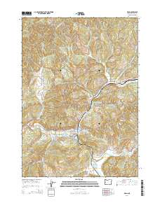
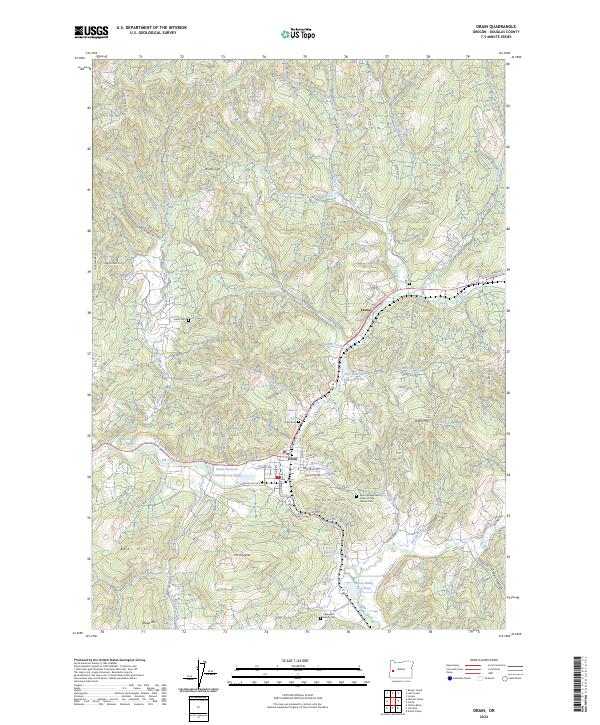 2024 Drain2024 Print · USGSThe timber-driven economy of Douglas County is on display in this contemporary survey of the Drain area. Researchers can trace genealogical roots at the Applegate Family Cem or locate industrial sites like the Drain Plywood Company Log Pond and Boswell Mineral Springs.
End of results
Showing maps 1-10 of 10
Top cities near Leona
Frequently asked questions
- What are the different types of historical maps available for Leona?
- What is the oldest map of Leona?
- Where can I purchase historical maps of Leona for my home or office?
- Where can I download high-res historical maps of Leona?
- Are there historical topographic maps available for Leona?
- Is there historical aerial imagery available for Leona?
- Where are historical maps of Leona sourced from?