Old Maps of Sunnydale, Oregon for Hiking & Exploration
Hike through history with 8 historic maps of Sunnydale. Explore old trails, ghost towns, and forgotten backroads — perfect for outdoor adventurers and local explorers.
- Rediscover forgotten places: Map out old mining camps, roads, and footpaths that no longer exist on modern maps.
- Layer with modern tools: Combine with LiDAR or satellite views to plan hikes through historical terrain.
- Made for exploration: Popular among hikers, overlanders, and local history lovers.
Use these maps to find adventure and explore the hidden past of Sunnydale.
Sunnydale, OR maps
(8)- 1954 Map of Drain, 1956 Print
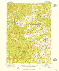 1954 Drain1956 Print · USGSDouglas County’s timber and rail corridors come alive in this mid-fifties study of the northern Umpqua basin. Genealogists can trace several vanished rural hubs like the Cold Spring Sch or locate family plots at the Applegate Cemetery.2 unique versions available
 - 1958 Map of Roseburg, 1960 Print
 1958 Roseburg1960 Print · USGSThe timber valleys and high volcanic peaks of Southern Oregon are captured here in the late fifties. Researchers can trace the Southern Pacific rail line through historic settlements like Cottage Grove, Yoncalla, and Oakridge near the Cascade Range crest.4 unique versions available
 - 1959 Map of Roseburg
 1959 Roseburg1959 Print · USGSThe Umpqua and Willamette valleys meet the high Cascades in this late-fifties study of Southern Oregon's timber and rail corridors. Genealogists and researchers can trace the Southern Pacific RR through historic towns like Roseburg, Yoncalla, and Cottage Grove.
 - 1979 Map of Cottage Grove
 1979 Cottage Grove1979 Print · USGSThe Oregon timber and rail corridors of the late seventies are documented here, centered on the Coast Fork Willamette River and the growing hub of Cottage Grove. Researchers can trace the path of the Southern Pacific railroad as it connects small stations like Divide, Saginaw, and Yoncalla.2 unique versions available
 - 1987 Map of Putnam Valley
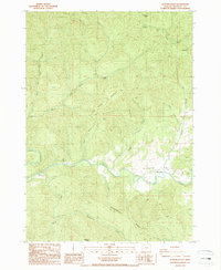 1987 Putnam Valley1987 Print · USGSDouglas County in the 1980s was characterized by its timbered creek valleys and remote homesteads centered on Putnam Valley. You can trace rural life and land use through the settlement of Sunnydale, local Cem sites, and the Quarry near Parker Creek.
 - 2011 Map of Putnam Valley, 2011 Print
 2011 Putnam Valley2011 Print · USGSCovers Sunnydale, including Douglas County, United States, and other nearby areas
 - 2017 Map of Putnam Valley, 2017 Print
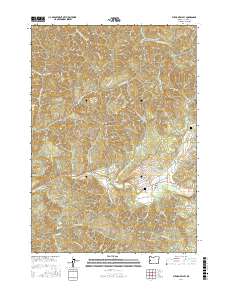 2017 Putnam Valley2017 Print · USGSCovers Sunnydale, including Douglas County, United States, and other nearby areas
 - 2023 Map of Putnam Valley, 2023 Print
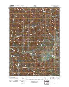
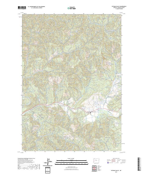 2023 Putnam Valley2023 Print · USGSDouglas County's timberlands and early settlements are documented in this contemporary survey of the Oregon Coast Range. Genealogists can locate Putnam Cem and Ensley Cem, or trace family landmarks like Tom Folley Mtn and Peterson Point.
End of results
Showing maps 1-8 of 8
Top cities near Sunnydale
Frequently asked questions
- What are the different types of historical maps available for Sunnydale?
- What is the oldest map of Sunnydale?
- Where can I purchase historical maps of Sunnydale for my home or office?
- Where can I download high-res historical maps of Sunnydale?
- Are there historical topographic maps available for Sunnydale?
- Is there historical aerial imagery available for Sunnydale?
- Where are historical maps of Sunnydale sourced from?