Old Maps of Winchester Bay, Oregon for Metal Detecting
Plan your next treasure hunt with 13 historic maps of Winchester Bay. Find old homesites, ghost towns, trails, and gathering spots that may be lost to time — perfect for identifying promising metal detecting locations.
- Locate forgotten sites: Uncover places like long-lost settlements, abandoned rail lines, or gathering spots.
- Plan better hunts: Use map overlays combined with LiDAR or satellite views to narrow in on historically rich areas.
- Made for detectorists: Thousands of hobbyists use these maps to discover relics, coins, and hidden history.
Use these historic maps to boost your research and find new opportunities beneath the surface of Winchester Bay.
Winchester Bay, OR maps
(13)- 1923 Map of Reedsport
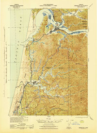
 1923 Reedsport1923 Print · USGSCoastal Oregon thrives in the 1920s as river commerce and rail lines connect the Umpqua estuary to the interior. Trace the old Southern Pacific line past Gardiner Sta or locate rural landmarks like Umpqua LH and Tenmile School.4 unique versions available
 - 1942 Map of Reedsport
 1942 Reedsport1942 Print · USGSThe Oregon coast at the onset of the 1940s reveals a landscape shaped by the Umpqua River and the Southern Pacific railroad. Genealogists and historians can trace old school sites like Scholfield Sch and find early landmarks including the Umpqua River LH and Lakeside.2 unique versions available
 - 1954 Map of Coos Bay
 1954 Coos Bay1954 Print · USGSCoastal Oregon at mid-century shows a landscape of timber and tides, from the river ports to the edge of the Pacific. Researchers can trace family roots through coastal schools like Beachview School or follow the Southern Pacific RR through Reedsport and Coos Bay.
 - 1956 Map of Reedsport
 1956 Reedsport1956 Print · USGSCoastal Douglas and Coos counties appear here in the mid-fifties, centered on the bustling river-and-rail hub of Reedsport. Researchers can trace the waterfront legacy of Gardiner, locate the North Bend Air Force Station, or explore the lakeside landings at Lakeside and Shutter Landing.3 unique versions available
 - 1958 Map of Coos Bay, 1974 Print
 1958 Coos Bay1974 Print · USGSThe Southern Oregon coastline at mid-century reveals a bustling maritime and timber economy centered on Coos Bay and North Bend. Researchers can trace the legacy of coastal settlements from Bandon to Brookings, including rail lines of the Southern Pacific RR and the rugged reaches of the Siuslaw National Forest.
 - 1962 Map of Coos Bay
 1962 Coos Bay1962 Print · USGSThe Oregon coast at the end of the fifties reveals a landscape of timber ports and fishing villages connected by U.S. Highway 101. Researchers can trace the rail infrastructure of the Southern Pacific RR and locate early settlements from Florence down to Brookings.2 unique versions available
 - 1980 Map of Reedsport, 1987 Print
 1980 Reedsport1987 Print · USGSThe Oregon coast at the dawn of the 1980s reveals a landscape defined by timber, tourism, and the shifting sands of the Oregon Dunes. Local historians can trace the rail-and-river economy through Reedsport, the historic timber town of Gardiner, and the lakeside community of Lakeside.
 - 1985 Map of Winchester Bay
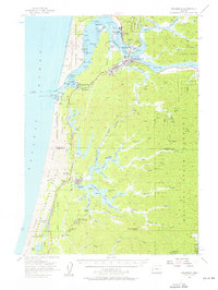
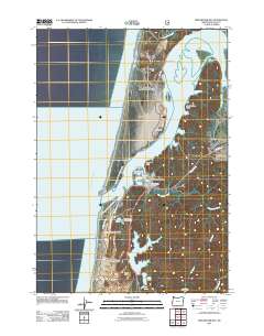
 1985 Winchester Bay1985 Print · USGSThe Oregon coast in the mid-1980s reveals a landscape of shifting sands and busy harbors at the Umpqua River's mouth. Researchers can trace the development of Winchester Bay and its Salmon Harbor alongside landmarks like Barretts Landing and Lake Marie.
 - 2011 Map of Winchester Bay, 2011 Print
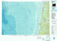
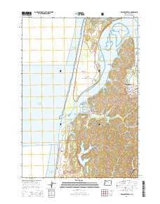
 2011 Winchester Bay2011 Print · USGSCovers Winchester Bay, including Reedsport, Douglas County, and other nearby areas
 - 2014 Map of Winchester Bay, 2014 Print
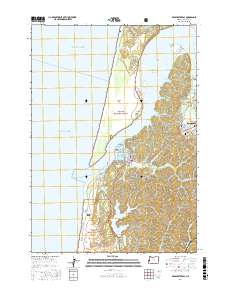
 2014 Winchester Bay2014 Print · USGSCovers Winchester Bay, including Reedsport, Douglas County, and other nearby areas
 - 2017 Map of Winchester Bay, 2017 Print
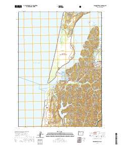
 2017 Winchester Bay2017 Print · USGSCovers Winchester Bay, including Reedsport, Douglas County, and other nearby areas
 - 2020 Map of Winchester Bay, 2020 Print
 2020 Winchester Bay2020 Print · USGSCovers Winchester Bay, including Reedsport, Douglas County, and other nearby areas
 - 2024 Map of Winchester Bay, 2024 Print
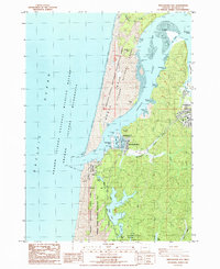
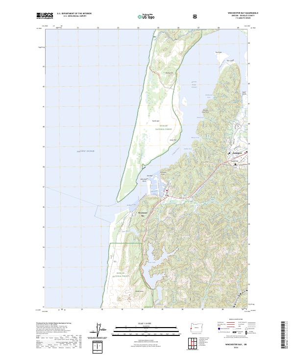 2024 Winchester Bay2024 Print · USGSWinchester Bay and the Umpqua River estuary are documented in this contemporary survey of the Douglas County coast. Genealogists and researchers can trace local landmarks like Masonic Cem, the dunes at Drake Dune, and the residential layout of Reedsport.
End of results
Showing maps 1-13 of 13
Top cities near Winchester Bay
Frequently asked questions
- What are the different types of historical maps available for Winchester Bay?
- What is the oldest map of Winchester Bay?
- Where can I purchase historical maps of Winchester Bay for my home or office?
- Where can I download high-res historical maps of Winchester Bay?
- Are there historical topographic maps available for Winchester Bay?
- Is there historical aerial imagery available for Winchester Bay?
- Where are historical maps of Winchester Bay sourced from?