Old Maps of Condon, Oregon for Academic Research
Study the evolution of Condon with 11 high-resolution historic maps. Whether you're teaching, researching, or modeling changes in land use, these maps provide essential visual documentation of urban, environmental, and geographic change.
- Analyze long-term change: Track patterns in development, transportation, and natural features.
- Ideal for environmental or urban studies: Support academic projects with primary historical map data.
- Use in the classroom or lab: Educators and researchers rely on these maps to bring historical context to life.
These maps are a powerful tool for teaching, research, and visualizing how Condon has changed over the decades.
Condon, OR maps
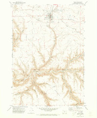
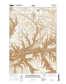
(11)- 1916 Map of Condon
 1916 Condon1916 Print · USGSNorth-central Oregon at the start of the twentieth century was a land of high plateaus and deep canyons centered on the Condon wheat country. Genealogists can trace a vast network of rural schoolhouses like Linville School and Buckhorn School, alongside early rail stops at Mikkalo and Gwendolen.3 unique versions available
 - 1953 Map of The Dalles, 1965 Print
 1953 The Dalles1965 Print · USGSThe Columbia River Gorge at mid-century shows a region being transformed by massive hydroelectric dams and a growing highway network. Researchers can trace the development of The Dalles Dam, locate the Maryhill Museum, and find old rail stops in Rufus, Wishram, and Arlington.3 unique versions available
 - 1956 Map of The Dalles
 1956 The Dalles1956 Print · USGSThe Columbia River Gorge and the high Cascades are captured in the mid-1950s, showing a vital corridor of rail and road. Researchers can trace the original path of The Old Oregon Trail or locate historical landmarks like the Maryhill Museum and Mount Hood.
 - 1957 Map of The Dalles
 1957 The Dalles1957 Print · USGSThe Columbia River Gorge and the high plateaus of the mid-1950s come alive on this detailed survey of northern Oregon and southern Washington. Researchers can trace the path of the Oregon Trail and The Old Barlow Road alongside river towns like The Dalles and Wishram.
 - 1970 Map of Condon, 1973 Print
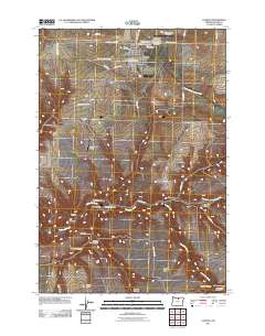
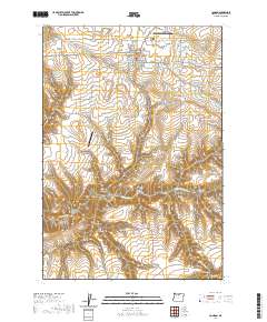
 1970 Condon1973 Print · USGSThe high plateau of Gilliam County comes into focus in the early seventies, centered on the wheat-and-rail hub of Condon. Researchers can trace the Kinzua and Southern Railroad and locate significant local landmarks like Pictographs, the Masonic Cem, and Condon Airfield.2 unique versions available
 - 1981 Map of Condon, 1997 Print
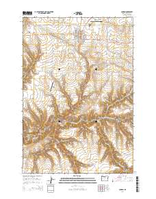
 1981 Condon1997 Print · USGSNorth-central Oregon in the early eighties reveals a vast plateau landscape defined by the deep canyons of the John Day and Deschutes rivers. Researchers can trace the rural legacy of the region through small hubs like Condon, Fossil, and the Old Railroad Grade.2 unique versions available
 - 2011 Map of Condon, 2011 Print
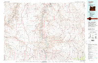
 2011 Condon2011 Print · USGSCovers Condon, including Gilliam County, United States, and other nearby areas
 - 2014 Map of Condon, 2014 Print
 2014 Condon2014 Print · USGSCovers Condon, including Gilliam County, United States, and other nearby areas
 - 2017 Map of Condon, 2017 Print
 2017 Condon2017 Print · USGSCovers Condon, including Gilliam County, United States, and other nearby areas
 - 2020 Map of Condon, 2020 Print
 2020 Condon2020 Print · USGSCovers Condon, including Gilliam County, United States, and other nearby areas
 - 2023 Map of Condon, 2023 Print
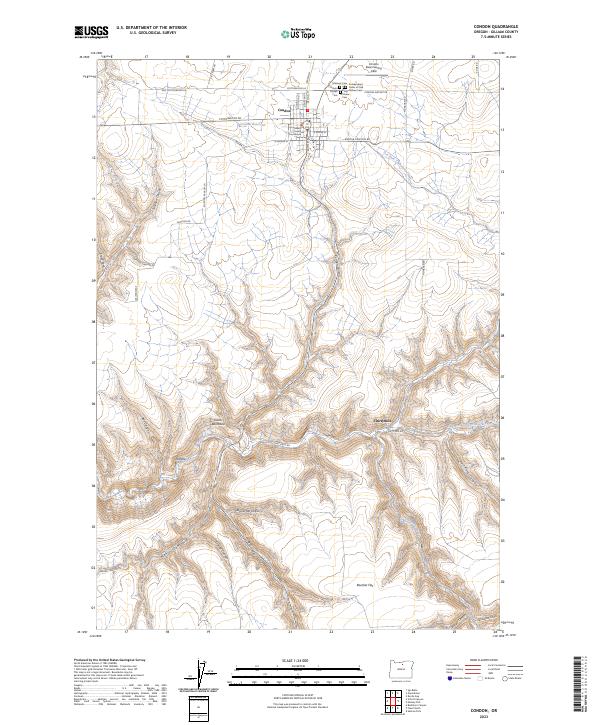 2023 Condon2023 Print · USGSCondon and the surrounding Gilliam County uplands are documented here during the early twenty-first century. Researchers can trace the civic and community layout of Condon, from the Gilliam County Courthouse to the historic Independent Order of Odd Fellows Cem.
End of results
Showing maps 1-11 of 11
Frequently asked questions
- What are the different types of historical maps available for Condon?
- What is the oldest map of Condon?
- Where can I purchase historical maps of Condon for my home or office?
- Where can I download high-res historical maps of Condon?
- Are there historical topographic maps available for Condon?
- Is there historical aerial imagery available for Condon?
- Where are historical maps of Condon sourced from?