Old Maps of Courtrock, Oregon for Genealogy
Trace your family roots with 11 historic maps of Courtrock. These high-res maps reveal old neighborhoods, homesites, landmarks, and streets — helping you uncover where your ancestors lived and how the area evolved over time.
- Explore historic neighborhoods: Identify where your relatives may have lived in the 1800s or 1900s.
- Compare maps over time: Trace the changes in streets, buildings, and landmarks for multi-generational research.
- Perfect for genealogy & ancestry research: Used by family historians and researchers to map out lineage and migration.
These maps are an incredible resource for exploring your personal connection to Courtrock's past.
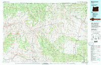
Courtrock, OR maps
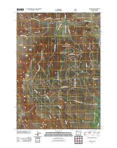
(11)- 1951 Map of Courtrock, 1952 Print
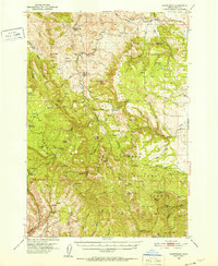 1951 Courtrock1952 Print · USGSSettlement and high-country ranching define this portion of central Oregon in the early fifties. Genealogists and historians can trace the foundations of the Hamilton community, locating the Courtrock school and landmarks like Courthouse Rock.3 unique versions available
 - 1955 Map of Canyon City, 1966 Print
 1955 Canyon City1966 Print · USGSCentral Oregon's high desert and timber country are captured here in the mid-fifties, showing the rugged ranching and logging landscape. Trace the path of the Sumpter Valley Ry or locate remote settlements like Izee, Whitney, and Ritter.4 unique versions available
 - 1959 Map of Canyon City
 1959 Canyon City1959 Print · USGSEastern Oregon in the late fifties was a landscape of high timber and remote river valleys shaped by the cattle and mining trades. Genealogists and historians can trace the paths of the Sumpter Valley RR and find early settlements like Antone, Richmond, and Dayville.2 unique versions available
 - 1980 Map of Monument, 1997 Print
 1980 Monument1997 Print · USGSCentral Oregon’s river-cut high country comes into focus in the early 1980s, documenting a landscape of remote ranching and timber work. Genealogists and researchers can trace local landmarks like Ritter, the Cohoe Mine, and the high reaches of Sourdough Ridge.
 - 1990 Map of Hamilton
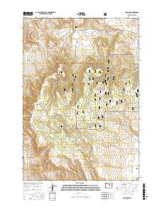
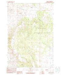 1990 Hamilton1990 Print · USGSGrant County ranching and timber lands are captured here during the late twentieth century as the forest meets the valley. Genealogists and local researchers can locate Hamilton and Courtrock, or trace landmarks like Sunken Mountain and Mud Spring.
 - 1999 Map of Hamilton, 2002 Print
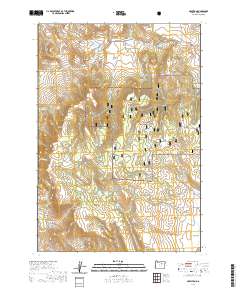
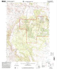 1999 Hamilton2002 Print · USGSGrant County ranchlands and timber forests meet in the late twentieth century near the rural settlements of Hamilton and Courtrock. Researchers can trace old 4WD tracks through the Malheur National Forest and locate specific sites like the Cem and Cinder Pit.
 - 2011 Map of Hamilton, 2011 Print
 2011 Hamilton2011 Print · USGSCovers Courtrock, including Grant County, United States, and other nearby areas
 - 2014 Map of Hamilton, 2014 Print
 2014 Hamilton2014 Print · USGSCovers Courtrock, including Grant County, United States, and other nearby areas
 - 2017 Map of Hamilton, 2017 Print
 2017 Hamilton2017 Print · USGSCovers Courtrock, including Grant County, United States, and other nearby areas
 - 2020 Map of Hamilton, 2020 Print
 2020 Hamilton2020 Print · USGSCovers Courtrock, including Grant County, United States, and other nearby areas
 - 2023 Map of Hamilton, 2023 Print
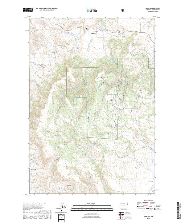 2023 Hamilton2023 Print · USGSHigh desert elevations and remote Oregon settlements define this Grant County landscape in the 2020s. Genealogists and historians can trace the Hamilton Cem near Hamilton or follow the winding Hamilton to Courtrock Rd toward Courtrock.
End of results
Showing maps 1-11 of 11
Top cities near Courtrock
Frequently asked questions
- What are the different types of historical maps available for Courtrock?
- What is the oldest map of Courtrock?
- Where can I purchase historical maps of Courtrock for my home or office?
- Where can I download high-res historical maps of Courtrock?
- Are there historical topographic maps available for Courtrock?
- Is there historical aerial imagery available for Courtrock?
- Where are historical maps of Courtrock sourced from?