Old Maps of Monument, Oregon for Academic Research
Study the evolution of Monument with 10 high-resolution historic maps. Whether you're teaching, researching, or modeling changes in land use, these maps provide essential visual documentation of urban, environmental, and geographic change.
- Analyze long-term change: Track patterns in development, transportation, and natural features.
- Ideal for environmental or urban studies: Support academic projects with primary historical map data.
- Use in the classroom or lab: Educators and researchers rely on these maps to bring historical context to life.
These maps are a powerful tool for teaching, research, and visualizing how Monument has changed over the decades.
Monument, OR maps
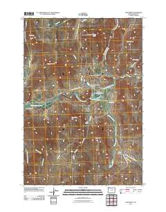
(10)- 1951 Map of Monument, 1953 Print
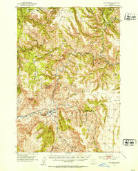 1951 Monument1953 Print · USGSThe Grant and Morrow County borderlands in the early 1950s center on the vital confluence of the John Day River forks. Genealogists and historians can trace old homestead sites near the Top School (Aband) or explore the remote canyon reaches of Monument and Kimberly.3 unique versions available
 - 1955 Map of Canyon City, 1966 Print
 1955 Canyon City1966 Print · USGSCentral Oregon's high desert and timber country are captured here in the mid-fifties, showing the rugged ranching and logging landscape. Trace the path of the Sumpter Valley Ry or locate remote settlements like Izee, Whitney, and Ritter.4 unique versions available
 - 1959 Map of Canyon City
 1959 Canyon City1959 Print · USGSEastern Oregon in the late fifties was a landscape of high timber and remote river valleys shaped by the cattle and mining trades. Genealogists and historians can trace the paths of the Sumpter Valley RR and find early settlements like Antone, Richmond, and Dayville.2 unique versions available
 - 1980 Map of Monument, 1997 Print
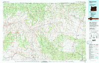 1980 Monument1997 Print · USGSCentral Oregon’s river-cut high country comes into focus in the early 1980s, documenting a landscape of remote ranching and timber work. Genealogists and researchers can trace local landmarks like Ritter, the Cohoe Mine, and the high reaches of Sourdough Ridge.
 - 1990 Map of Monument
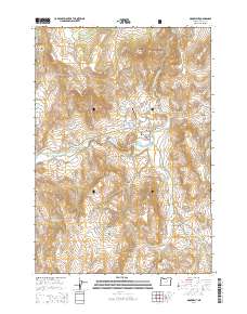
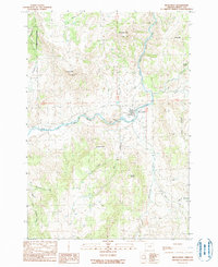 1990 Monument1990 Print · USGSMonument and the surrounding high-desert river valleys are captured here as they appeared in the 1990s. Researchers can trace the rural infrastructure of the North Fork John Day River and find landmarks like Hell Fire Flat and the Lookout Tower.
 - 1995 Map of Monument, 1998 Print
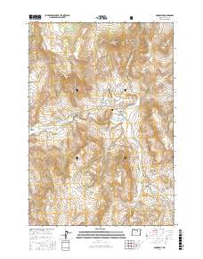
 1995 Monument1998 Print · USGSThe community of Monument serves as the focal point of this mid-nineties survey of the John Day river country. Genealogists and historians can locate the local Cem, the small settlement at Graves, and mountain landmarks like Monument Mountain or Franklin Mountain.
 - 2011 Map of Monument, 2011 Print
 2011 Monument2011 Print · USGSCovers Monument, including Grant County, United States, and other nearby areas
 - 2014 Map of Monument, 2014 Print
 2014 Monument2014 Print · USGSCovers Monument, including Grant County, United States, and other nearby areas
 - 2017 Map of Monument, 2017 Print
 2017 Monument2017 Print · USGSCovers Monument, including Grant County, United States, and other nearby areas
 - 2024 Map of Monument, 2024 Print
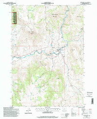
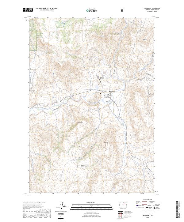 2024 Monument2024 Print · USGSThe small town of Monument and its surrounding Grant County ranchlands are captured here in the contemporary era. Researchers can trace land use near Monument Cem and family-named landmarks like Hell Fire Flat and Dustin Point.
End of results
Showing maps 1-10 of 10
Frequently asked questions
- What are the different types of historical maps available for Monument?
- What is the oldest map of Monument?
- Where can I purchase historical maps of Monument for my home or office?
- Where can I download high-res historical maps of Monument?
- Are there historical topographic maps available for Monument?
- Is there historical aerial imagery available for Monument?
- Where are historical maps of Monument sourced from?