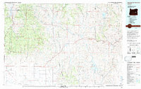
Old Maps of Buchanan, Oregon for Hiking & Exploration
Hike through history with 11 historic maps of Buchanan. Explore old trails, ghost towns, and forgotten backroads — perfect for outdoor adventurers and local explorers.
- Rediscover forgotten places: Map out old mining camps, roads, and footpaths that no longer exist on modern maps.
- Layer with modern tools: Combine with LiDAR or satellite views to plan hikes through historical terrain.
- Made for exploration: Popular among hikers, overlanders, and local history lovers.
Use these maps to find adventure and explore the hidden past of Buchanan.
Buchanan, OR maps
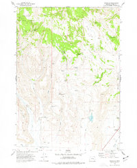
(11)- 1955 Map of Burns, 1964 Print
 1955 Burns1964 Print · USGSHarney County's high desert ranching and timber heartland is captured here in the mid-fifties, centered on the hub of Burns and Hines. Genealogists and researchers can locate remote landmarks like the Suntex School, New Princeton P. O., and the Lumber Mill.3 unique versions available
 - 1958 Map of Burns
 1958 Burns1958 Print · USGSHarney County ranching and timber lands are captured here in the late fifties. Genealogists and local historians can trace family holdings and rural institutions, from the Kimball Flat School to remote outposts like Crow Camp Ranch and the Sutton Ranch.
 - 1959 Map of Burns
 1959 Burns1959 Print · USGSHarney County in the late fifties remains a landscape of high-desert ranching and timber production, centered on the hubs of Burns and Hines. Researchers can locate remote rural institutions like the Suntex School or trace family landholdings such as the Stallard Ranch and O'Keefe Homestead.
 - 1973 Map of Buchanan, 1977 Print
 1973 Buchanan1977 Print · USGSHarney County's high-desert ranching landscape is captured here in the early seventies, featuring the isolated settlement of Buchanan and the Malheur National Forest. Researchers can trace historic land claims like the Mary Oard Homestead or locate old water sources such as Renfroe Springs and Corcoran Res.
 - 1978 Map of Stinkingwater Mountains, 1997 Print
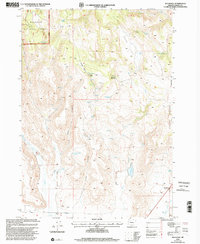
 1978 Stinkingwater Mountains1997 Print · USGSHarney County in the late seventies is a land of high tables and deep basins, where the Stinkingwater Mountains rise over the Malheur River. Researchers can trace the Oregon and Northwestern Railroad and locate historic points like Fort Harney (Site) and Drewsey.2 unique versions available
 - 1999 Map of Buchanan, 2002 Print
 1999 Buchanan2002 Print · USGSHarney County ranching and forest lands are revealed in the late nineties, showcasing the remote homesteads and vital water sources of the high desert. Genealogists can trace family footprints at the Mary Oard Homestead and Poujade Ranch or locate the old Buchanan settlement.
 - 2011 Map of Buchanan, 2011 Print
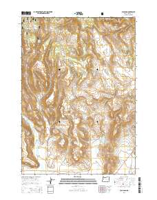
 2011 Buchanan2011 Print · USGSCovers Buchanan, including Harney County, United States, and other nearby areas
 - 2014 Map of Buchanan, 2014 Print
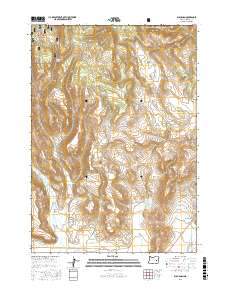
 2014 Buchanan2014 Print · USGSCovers Buchanan, including Harney County, United States, and other nearby areas
 - 2017 Map of Buchanan, 2017 Print
 2017 Buchanan2017 Print · USGSCovers Buchanan, including Harney County, United States, and other nearby areas
 - 2020 Map of Buchanan, 2020 Print
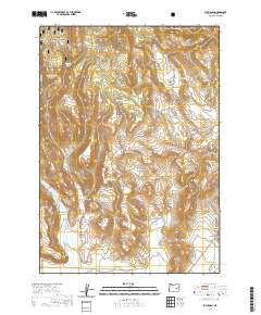 2020 Buchanan2020 Print · USGSCovers Buchanan, including Harney County, United States, and other nearby areas
 - 2023 Map of Buchanan, 2023 Print
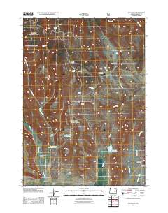
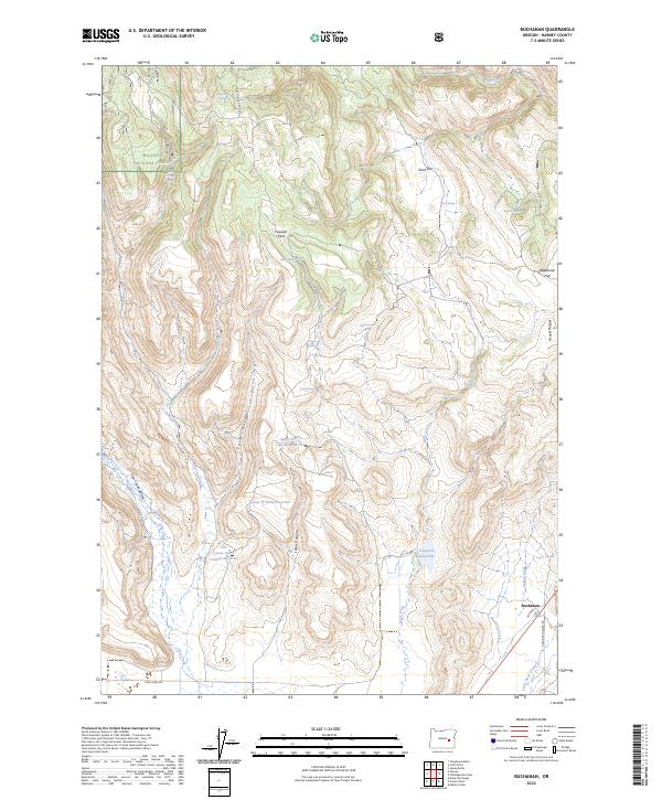 2023 Buchanan2023 Print · USGSHigh desert ranching and water management define this portion of Harney County in the early twenty-first century. Researchers can trace land use through features like Poujade Field, Corcoran Reservoir, and the settlement of Buchanan.
End of results
Showing maps 1-11 of 11
Frequently asked questions
- What are the different types of historical maps available for Buchanan?
- What is the oldest map of Buchanan?
- Where can I purchase historical maps of Buchanan for my home or office?
- Where can I download high-res historical maps of Buchanan?
- Are there historical topographic maps available for Buchanan?
- Is there historical aerial imagery available for Buchanan?
- Where are historical maps of Buchanan sourced from?