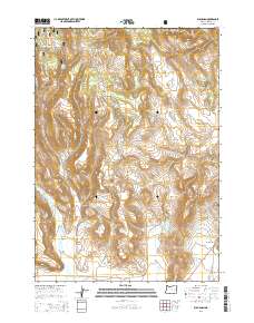
2014 Map of Buchanan
USGS Topo · Published 2014About this map
Malhuer National Forest lands dominate the northwestern portion of this landscape, where the terrain transitions into the high desert of eastern Oregon. The small settlement of Buchanan sits along Us-20, serving as a vital waypoint in this cattle-ranching and timber region. The map reveals a sophisticated network of water management essential for the arid environment, including the Upper Jones Canyon Reservoir, Lower Jones Canyon Reservoir, and Corcoran Reservoir. These features, along with numerous named springs like Loggan Springs and Binfroe Springs, underscore the historic importance of water rights in the Cow Creek Valley. The presence of Poujade Field and Oard Flat suggests long-standing family ranching operations that have shaped the land use patterns for generations in Harney County.
Find a feature on this map
38 named features on this map. Tap any name to fly to it.
Don’t see what you’re looking for? This feature index may not catch every label — zoom into the map to look around manually.
Map Details
Editions of this 2014 Buchanan Map
This is the sole edition of this map. No revisions or reprints were ever made.
Other maps of this area

1955 · Burns
USGS Topo · 1:250,000

1958 · Burns
USGS Topo · 1:250,000

1959 · Burns
USGS Topo · 1:250,000

1959 · Harney
USGS Topo · 1:62,500

1961 · Calamity Butte
USGS Topo · 1:62,500

1968 · Van
USGS Topo · 1:62,500

1973 · Buchanan
USGS Topo · 1:24,000

1973 · Mahon Creek
USGS Topo · 1:24,000

1973 · Carson Point
USGS Topo · 1:24,000
1978 · Stinkingwater Pass
USGS Topo · 1:24,000