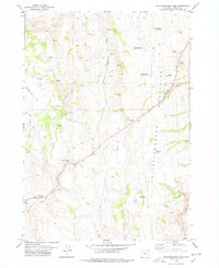
1978 Map of Stinkingwater Pass
USGS Topo · Published 1978About this map
Stinkingwater Pass serves as a critical geographic marker within the Stinkingwater Mountains in Harney County, illustrating a landscape defined by seasonal water management and livestock movement. The topography is dotted with human-made water sources necessary for ranching in the high desert, such as Lazy Man Reservoir, Fins Reservoir, and Steer Ridge Reservoir. A network of unpaved transit is evident, including the Mc Muller route and various sections of Jeep Trail, which connect isolated points of interest like the Percy West Cabin. The mapping of extensive Fence lines and specific watering holes like Indian Grade Spring and Hiway Spring No 1 underscores the area's primary use as grazing land during the late 1970s. Dramatic terrain features including Gravel Ridges and Sagebrush Flat frame the drainage patterns of Pine Creek and Little Pine Creek.
Find a feature on this map
31 named features on this map. Tap any name to fly to it.
Don’t see what you’re looking for? This feature index may not catch every label — zoom into the map to look around manually.
Map Details
Editions of this 1978 Stinkingwater Pass Map
This is the sole edition of this map. No revisions or reprints were ever made.
Other maps of this area

1955 · Burns
USGS Topo · 1:250,000

1958 · Burns
USGS Topo · 1:250,000

1959 · Burns
USGS Topo · 1:250,000

1968 · Drewsey
USGS Topo · 1:62,500

1968 · Van
USGS Topo · 1:62,500

1973 · Buchanan
USGS Topo · 1:24,000

1973 · Mahon Creek
USGS Topo · 1:24,000

1973 · Carson Point
USGS Topo · 1:24,000
1977 · Bartlett Mtn
USGS Topo · 1:24,000

1978 · Stinkingwater Mountains
USGS Topo · 1:100,000