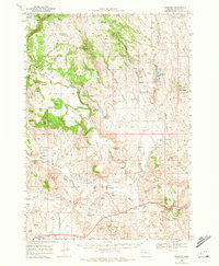
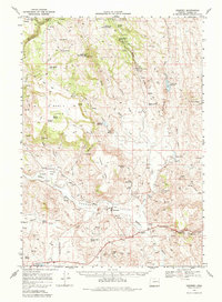
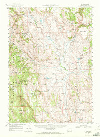
1968 Map of Drewsey
USGS Topo · Published 1972About this map
Drewsey Valley serves as the focal point of this late 1960s survey, where the Malheur River winds through high-desert terrain toward the settlement of Drewsey. The landscape is defined by its water management and grazing history, evidenced by the intricate system of irrigation including Miller Ditch and Drewsey Ditch, alongside numerous stock-water sources like Riley Reservoir and Stallard Reservoir. To the north, the timbered slopes of Malheur National Forest contrast with the open expanses of Kimball Flat and Merlie Table.
Find a feature on this map
50 named features on this map. Tap any name to fly to it.
Don’t see what you’re looking for? This feature index may not catch every label — zoom into the map to look around manually.
Map Details
Editions of this 1968 Drewsey Map
2 editions found
Other maps of this area

1908 · Ironside Mountain
USGS Topo · 1:125,000

1955 · Burns
USGS Topo · 1:250,000

1955 · Canyon City
USGS Topo · 1:250,000

1958 · Burns
USGS Topo · 1:250,000

1959 · Burns
USGS Topo · 1:250,000

1959 · Canyon City
USGS Topo · 1:250,000
1961 · Logan Valley
USGS Topo · 1:62,500
1966 · Beulah
USGS Topo · 1:62,500
1968 · Van
USGS Topo · 1:62,500
1970 · Flag Prairie
USGS Topo · 1:62,500