
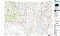
1978 Map of Stinkingwater Mountains
USGS Topo · Published 1997About this map
The Stinkingwater Mountains dominate this 1978 landscape, a high-desert terrain of tables and buttes defined by the course of the Malheur River and Silvies River. Local history is anchored at the Fort Harney (Site) and the small cattle and rail hubs like Drewsey and Juntura. The Oregon and Northwestern Railroad cuts through the western edge, reflecting the region's timber and transit heritage. Large water features including the Warm Springs Reservoir and Beulah Reservoir stand out against the high-elevation flats of Moffit Table and Merlie Table. This survey captures the rural infrastructure of eastern Oregon before modern shifts, documenting the primitive roads and water rights that shaped the Malheur National Forest and surrounding Harney County ranchlands.
Find a feature on this map
57 named features on this map. Tap any name to fly to it.
Don’t see what you’re looking for? This feature index may not catch every label — zoom into the map to look around manually.
Map Details
Editions of this 1978 Stinkingwater Mountains Map
2 editions found
Other maps of this area

1908 · Ironside Mountain
USGS Topo · 1:125,000

1955 · Baker
USGS Topo · 1:250,000

1955 · Burns
USGS Topo · 1:250,000

1955 · Canyon City
USGS Topo · 1:250,000

1955 · Boise
USGS Topo · 1:250,000

1958 · Burns
USGS Topo · 1:250,000

1958 · Boise
USGS Topo · 1:250,000

1959 · Baker
USGS Topo · 1:250,000

1959 · Burns
USGS Topo · 1:250,000

1959 · Canyon City
USGS Topo · 1:250,000