Old Maps of Hood River, Oregon for Hiking & Exploration
Hike through history with 23 historic maps of Hood River. Explore old trails, ghost towns, and forgotten backroads — perfect for outdoor adventurers and local explorers.
- Rediscover forgotten places: Map out old mining camps, roads, and footpaths that no longer exist on modern maps.
- Layer with modern tools: Combine with LiDAR or satellite views to plan hikes through historical terrain.
- Made for exploration: Popular among hikers, overlanders, and local history lovers.
Use these maps to find adventure and explore the hidden past of Hood River.
Hood River, OR maps
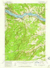
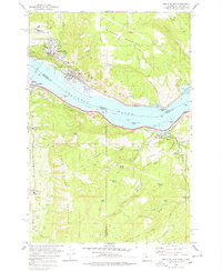
(23)- 1926 Map of Hood River, 1955 Print
 1926 Hood River1955 Print · USGSThe Columbia River Gorge in the mid-twenties shows a landscape defined by competing railroads and early trans-river engineering. Trace the rail lines between Stevenson and Hood River, or locate historic sites like Hemlock Sch and the Bridge of the Gods.
 - 1929 Map of Hood River
 1929 Hood River1929 Print · USGSThe Columbia River Gorge and Hood River Valley are captured here in the late twenties during a period of significant infrastructure growth. Researchers can trace the early rail networks, find remote forest outposts like Race Track Ranger Sta, and locate vanished landmarks such as the Government Sprs Hotel.3 unique versions available
 - 1934 Map of The Dalles
 1934 The Dalles1934 Print · USGSThe Columbia River Gorge in the early thirties reveals a complex network of rapids and river engineering before the completion of major modern dams. Local historians can trace early school districts like Threemile Sch and family landmarks such as Clancy Ranch or Petersburg.4 unique versions available
 - 1953 Map of The Dalles, 1965 Print
 1953 The Dalles1965 Print · USGSThe Columbia River Gorge at mid-century shows a region being transformed by massive hydroelectric dams and a growing highway network. Researchers can trace the development of The Dalles Dam, locate the Maryhill Museum, and find old rail stops in Rufus, Wishram, and Arlington.3 unique versions available
 - 1956 Map of The Dalles
 1956 The Dalles1956 Print · USGSThe Columbia River Gorge and the high Cascades are captured in the mid-1950s, showing a vital corridor of rail and road. Researchers can trace the original path of The Old Oregon Trail or locate historical landmarks like the Maryhill Museum and Mount Hood.
 - 1957 Map of The Dalles
 1957 The Dalles1957 Print · USGSThe Columbia River Gorge and the high plateaus of the mid-1950s come alive on this detailed survey of northern Oregon and southern Washington. Researchers can trace the path of the Oregon Trail and The Old Barlow Road alongside river towns like The Dalles and Wishram.
 - 1957 Map of White Salmon, 1959 Print
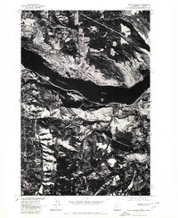
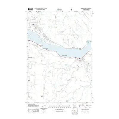
 1957 White Salmon1959 Print · USGSThe Columbia River Gorge in the late fifties shows a bustling corridor of rail and river transport. Researchers can locate family landmarks like Ketchum Ranch, old meeting halls such as Mill Creek Grange, and the riverfront communities of Bingen and Mosier.2 unique versions available
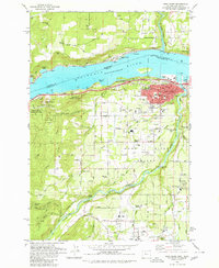
 - 1957 Map of Hood River, 1959 Print
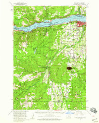 1957 Hood River1959 Print · USGSThe Columbia River Gorge in the late fifties is captured here as a thriving corridor of rail, timber, and orchard life. Genealogists and historians can trace local landmarks like Pine Grove Cem, the community at Odell, and early forest service sites such as Kingsley Guard Sta.3 unique versions available
 - 1975 Map of Hood River NE, 1979 Print
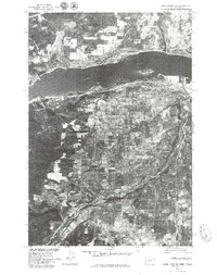 1975 Hood River NE1979 Print · USGSThe mid-seventies landscape of the Columbia River Gorge is captured in this detailed aerial survey. Researchers can trace the development of Hood River and Odell along with the winding course of the Hood River and the industrial riverfront.2 unique versions available
 - 1975 Map of White Salmon, 1980 Print
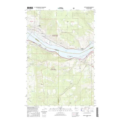
 1975 White Salmon1980 Print · USGSThe mid-1970s landscape of the Columbia River Gorge is captured here through detailed aerial photography. Genealogists and local historians can trace the street grids and rural boundaries of White Salmon, Bingen, and Mosier as they appeared decades ago.
 - 1978 Map of White Salmon
 1978 White Salmon1978 Print · USGSThe Columbia River Gorge in the late seventies reveals a bustling transportation corridor shared by Washington and Oregon. Researchers can trace the rail lines of the Northern Burlington, locate family plots at the IOOF Cem, or explore the old layout of White Salmon and Mosier.
 - 1979 Map of Hood River, 1980 Print
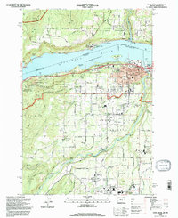
 1979 Hood River1980 Print · USGSThe Columbia River corridor thrives in the late seventies as a hub of transport and agriculture. Trace local family roots and early infrastructure at Idelwilde Cem, Frankton Sch, and the Powerdale Dam.
 - 1982 Map of Hood River, 1983 Print
 1982 Hood River1983 Print · USGSThe Columbia River Gorge in the early eighties shows a landscape shaped by massive hydroelectric projects and deep-rooted timber communities. Researchers can trace the rail-and-river network through Cascade Locks and The Dalles Dam, or explore the terrain of Gifford Pinchot National Forest.
 - 1994 Map of Hood River, 1996 Print
 1994 Hood River1996 Print · USGSThe Columbia River Gorge area in the mid-1990s reflects a landscape shaped by orchards, timber, and the river economy. Genealogists and historians can trace family locations through Idelwild Cem, Frankton Sch, and the settlements of Underwood and Rockford.
 - 1994 Map of White Salmon, 1996 Print
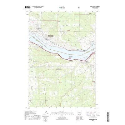
 1994 White Salmon1996 Print · USGSThe Columbia River Gorge comes to life in the mid-1990s as it winds between the growing communities of White Salmon, Washington, and Hood River, Oregon. Researchers can trace local landmarks like Skyline Hospital, Pine Grove School, and the historic Mosier Cem along the southern river bluffs.
 - 2011 Map of White Salmon, 2011 Print
 2011 White Salmon2011 Print · USGSCovers Hood River, including White Salmon, Bingen, and other nearby areas
 - 2014 Map of White Salmon, 2014 Print
 2014 White Salmon2014 Print · USGSCovers Hood River, including White Salmon, Bingen, and other nearby areas
 - 2017 Map of White Salmon, 2017 Print
 2017 White Salmon2017 Print · USGSCovers Hood River, including White Salmon, Bingen, and other nearby areas
 - 2017 Map of Hood River, 2017 Print
 2017 Hood River2017 Print · USGSCovers Hood River, including White Salmon, Odell, and other nearby areas
 - 2020 Map of White Salmon, 2020 Print
 2020 White Salmon2020 Print · USGSCovers Hood River, including White Salmon, Bingen, and other nearby areas
 - 2020 Map of Hood River, 2020 Print
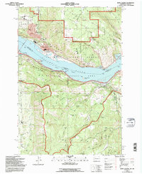
 2020 Hood River2020 Print · USGSCovers Hood River, including White Salmon, Odell, and other nearby areas
 - 2023 Map of White Salmon, 2023 Print
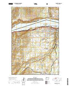
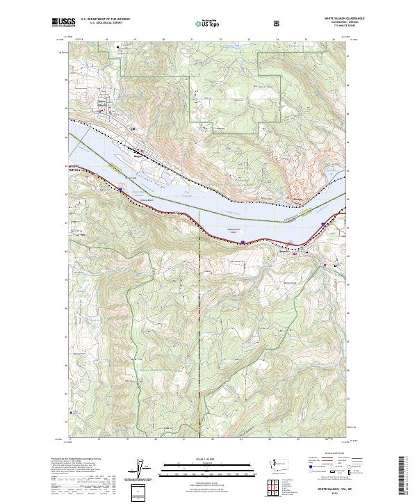 2023 White Salmon2023 Print · USGSThe Columbia River Gorge comes into sharp focus in this 2023 study of the Washington-Oregon border. Genealogists and local historians can trace legacy sites like Mosier Pioneer Cem and Jackson Family Cem alongside landmarks like Eighteenmile Island and Burdoin Mtn.
 - 2024 Map of Hood River, 2024 Print
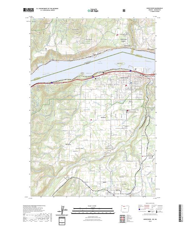 2024 Hood River2024 Print · USGSThe Columbia River corridor thrives here during the 2020s, showing the intersection of Washington and Oregon across the Columbia Gorge. Trace family history at Frankton Cem or explore the valley settlements of Rockford and Odell.
End of results
Showing maps 1-23 of 23
Top cities near Hood River
Top neighborhoods of Hood River
- Stranahan's Addition historical maps
- South Addition historical maps
- Middle Terrace Neighborhood historical maps
- West Cascade Avenue District historical maps
Frequently asked questions
- What are the different types of historical maps available for Hood River?
- What is the oldest map of Hood River?
- Where can I purchase historical maps of Hood River for my home or office?
- Where can I download high-res historical maps of Hood River?
- Are there historical topographic maps available for Hood River?
- Is there historical aerial imagery available for Hood River?
- Where are historical maps of Hood River sourced from?