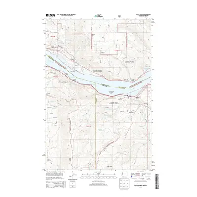
2014 Map of White Salmon
USGS Topo · Published 2014About this map
The Columbia River carves a deep path between Washington and Oregon on this modern survey, highlighting the twin riverside towns of White Salmon and Bingen. The landscape is dominated by the steep slopes of Burdoin Mtn and Hood River Mtn, while the Oregon side reveals the agricultural character of Moore Orchards. Notable transport features include the Mosier Twin Tunnels 653 and the navigation aid at Wasco Light, marking the importance of the gorge as a major transit corridor.
Find a feature on this map
92 named features on this map. Tap any name to fly to it.
Don’t see what you’re looking for? This feature index may not catch every label — zoom into the map to look around manually.
Map Details
Editions of this 2014 White Salmon Map
This is the sole edition of this map. No revisions or reprints were ever made.
Other maps of this area

1926 · Hood River
USGS Topo · 1:125,000

1929 · Hood River
USGS Topo · 1:125,000

1934 · The Dalles
USGS Topo · 1:125,000

1953 · The Dalles
USGS Topo · 1:250,000

1956 · The Dalles
USGS Topo · 1:250,000

1957 · The Dalles
USGS Topo · 1:250,000

1957 · Willard
USGS Topo · 1:62,500

1957 · White Salmon
USGS Topo · 1:62,500

1957 · Husum
USGS Topo · 1:62,500

1957 · Hood River
USGS Topo · 1:62,500