
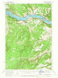
1957 Map of White Salmon
USGS Topo · Published 1959About this map
The Columbia River forms the central axis of this mid-century survey, dividing Washington and Oregon at the Bonneville Normal Pool Level. On the northern bank, the settlements of White Salmon and Bingen sit below the heights of Burdoin Mountain, while to the east, Lyle marks the confluence of the Klickitat River. The southern shore features the town of Mosier and the winding Union Pacific Highway, which follows the river's edge through the Hood River Valley.
Find a feature on this map
68 named features on this map. Tap any name to fly to it.
Don’t see what you’re looking for? This feature index may not catch every label — zoom into the map to look around manually.
Map Details
Editions of this 1957 White Salmon Map
2 editions found
Other maps of this area

1924 · Mount Hood
USGS Topo · 1:125,000

1926 · Hood River
USGS Topo · 1:125,000

1927 · Mount Hood
USGS Topo · 1:125,000

1929 · Hood River
USGS Topo · 1:125,000

1930 · Dufur
USGS Topo · 1:125,000

1934 · Dufur
USGS Topo · 1:125,000

1934 · The Dalles
USGS Topo · 1:125,000

1953 · The Dalles
USGS Topo · 1:250,000

1956 · The Dalles
USGS Topo · 1:250,000

1957 · The Dalles
USGS Topo · 1:250,000