
1927 Map of Mount Hood
USGS Topo · Published 1927About this map
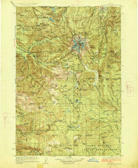
Mt Hood Highway and the historic Barlow Road provide the primary transit corridors through this mid-1920s wilderness landscape, where early forest management and tourism infrastructure are clearly defined. Early traveler waypoints like Government Camp, Rhododendron, and the iconic Cloud Cap Inn highlight the transition from pioneer trails to recreational use within the national forest. The map documents a network of high-altitude infrastructure, including the Zigzag Ranger Station, Robin Hood Ranger Sta, and the Skyline Trail, alongside early fire-watch points like the Plaza Ranger Sta. To the north, the protected waters of Bull Run Lake and Lost Lake are set against the drainage of the Sandy River, while the southern portion transitions into the Warm Springs Indian Reservation. This survey captures the region just as the automotive era began to solidify the names of modern mountain communities.
Find a feature on this map
190 named features on this map. Tap any name to fly to it.
Don’t see what you’re looking for? This feature index may not catch every label — zoom into the map to look around manually.
Map Details
Editions of this 1927 Mount Hood Map
4 editions found
Other maps of this area

1916 · Estacada
USGS Topo · 1:125,000

1924 · Mount Hood
USGS Topo · 1:125,000

1926 · Hood River
USGS Topo · 1:125,000

1927 · Mt. Jefferson
USGS Topo · 1:125,000

1928 · Madras
USGS Topo · 1:125,000

1929 · Mill City
USGS Topo · 1:125,000

1929 · Hood River
USGS Topo · 1:125,000

1930 · Mt. Jefferson
USGS Topo · 1:125,000

1930 · Dufur
USGS Topo · 1:125,000

1931 · Madras
USGS Topo · 1:125,000