Loading...
Loading map...1927 Map of Mount Hood
USGS Topo · Published 1927About this map
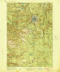
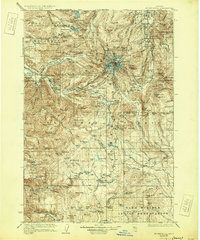
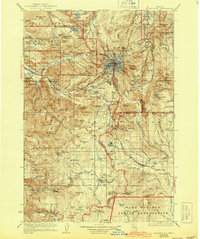
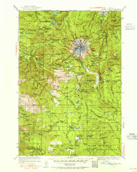
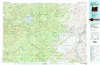
Mt Hood stands at the center of this 1924 survey, serving as the source for the radiating drainages of the Sandy River, Zigzag River, and Salmon River. The mountain is detailed with its named glaciers and high ridges, including Cooper Spur and Illumination Rock. Along the southwestern approaches, early recreation and logging infrastructure is visible through the Zigzag Ranger Station and settlements like Rhododendron, Welches, and Tawneys.
Find a feature on this map
81 named features on this map. Tap any name to fly to it.
Don’t see what you’re looking for? This feature index may not catch every label — zoom into the map to look around manually.
Map Details
Date Portrayed1927
Date Published1927
PublisherU.S. Geological Survey
Map TypeTopographic
Scale1:125,000
Physical Dimensions16.3 x 19.7 inches
Editions of this 1927 Mount Hood Map
4 editions found

Historical Maps of Wemme Through Time
3 maps found
Featured Locations
Source Details
SourceU.S. Geological Survey
CopyrightPublic Domain