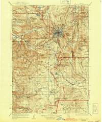
1924 Map of Mount Hood
USGS Topo · Published 1955About this map
Mt Hood stands as the central landmark of this mid-1920s survey, surrounded by the deep drainages of the Sandy River and White River. Early mountaineering and recreational infrastructure are evident in the presence of Timberline Cabin, Camp Blossom, and the Homestead Inn. The settlement pattern follows the established mountain corridors, with clusters of activity at Rhododendron, Government Camp, and Welches. The map documents the high-country travel network of the era, including the Mt Hood Loop Highway and the Skyline Trail as they traverse the Mount Hood National Forest. Notable water sources for the region, such as Bull Run Lake and Lost Lake, are depicted alongside the intricate ridges of Zigzag Mountain and Yocum Ridge. To the south, the boundary with the Warm Springs Indian Reservation indicates the intersection of different land management priorities during this period of growing federal oversight.
Find a feature on this map
152 named features on this map. Tap any name to fly to it.
Don’t see what you’re looking for? This feature index may not catch every label — zoom into the map to look around manually.
Map Details
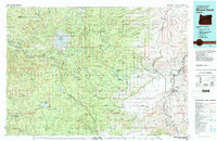
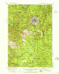
Editions of this 1924 Mount Hood Map
2 editions found
Historical Maps of Wemme Through Time
3 maps found