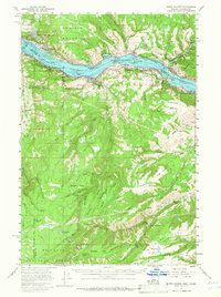
1957 Map of White Salmon
USGS Topo · Published 1966About this map
White Salmon and Bingen anchor the Washington side of the Columbia River in this mid-1950s survey, a period when the river served as a vital industrial artery between the Spokane Portland and Seattle and Union Pacific railroads. The landscape is defined by its dramatic elevation changes, from the river level at Bonneville Normal Pool Level 72 Feet to the heights of Burdoin Mountain and Sevenmile Hill. The map documents the rural social infrastructure of the time, noting gathering places like the Lyle Grange and Mill Creek Grange, alongside educational landmarks such as Pine Grove Sch. Settlement patterns follow the river and its tributaries, with the town of Mosier and Lyle situated near key river crossings and canyons like Blackburn Canyon. The area south of the river shows a more dispersed agricultural footprint, including Ketchum Ranch and the flatlands of Government Flat and Oak Flat.
Find a feature on this map
72 named features on this map. Tap any name to fly to it.
Don’t see what you’re looking for? This feature index may not catch every label — zoom into the map to look around manually.
Map Details
Editions of this 1957 White Salmon Map
2 editions found

Other maps of this area

1924 · Mount Hood
USGS Topo · 1:125,000

1926 · Hood River
USGS Topo · 1:125,000

1927 · Mount Hood
USGS Topo · 1:125,000

1929 · Hood River
USGS Topo · 1:125,000

1930 · Dufur
USGS Topo · 1:125,000

1934 · Dufur
USGS Topo · 1:125,000

1934 · The Dalles
USGS Topo · 1:125,000

1953 · The Dalles
USGS Topo · 1:250,000

1956 · The Dalles
USGS Topo · 1:250,000

1957 · The Dalles
USGS Topo · 1:250,000