Old Maps of Ashwood, Oregon for Metal Detecting
Plan your next treasure hunt with 10 historic maps of Ashwood. Find old homesites, ghost towns, trails, and gathering spots that may be lost to time — perfect for identifying promising metal detecting locations.
- Locate forgotten sites: Uncover places like long-lost settlements, abandoned rail lines, or gathering spots.
- Plan better hunts: Use map overlays combined with LiDAR or satellite views to narrow in on historically rich areas.
- Made for detectorists: Thousands of hobbyists use these maps to discover relics, coins, and hidden history.
Use these historic maps to boost your research and find new opportunities beneath the surface of Ashwood.
Ashwood, OR maps
(10)- 1955 Map of Bend, 1964 Print
 1955 Bend1964 Print · USGSCentral Oregon was undergoing significant growth in the mid-1960s as irrigation and infrastructure transformed the high desert. Researchers can trace the path of the Oregon Trunk Line, locate old stops like Gateway, and find landmarks like Lava Butte or the Grange.3 unique versions available
 - 1957 Map of Bend
 1957 Bend1957 Print · USGSCentral Oregon in the mid-fifties is a landscape of transition between the high Cascades and the arid volcanic plateau. Local historians can trace the rail corridors of the Oregon Trunk and locate early settlements like Ashwood, Odin Falls, and Camp Sherman.
 - 1958 Map of Bend
 1958 Bend1958 Print · USGSCentral Oregon in the late fifties was a land of high desert ranching and growing mountain towns. Researchers can trace the rail lines of the Oregon Trunk Railroad, find established settlements like Madras and Sisters, or locate landmarks such as Smith Rock and Lava Butte.
 - 1968 Map of Ashwood, 1972 Print
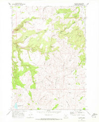 1968 Ashwood1972 Print · USGSAshwood was a quiet hub for ranching and mineral exploration in Jefferson County during the late sixties. Genealogists and historians can trace family locations near Woods Cem, the waters of Little Willow Creek Reservoir, and landmarks like Hat Rock.
 - 1981 Map of Stephenson Mountain, 1997 Print
 1981 Stephenson Mountain1997 Print · USGSThe high-desert ranching and mining heart of North Central Oregon is captured here in the early eighties. Genealogists and historians can trace old settlements and mineral prospects from Shaniko to the Oregon King Mine and the John Day River canyon.
 - 2011 Map of Ashwood, 2011 Print
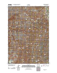 2011 Ashwood2011 Print · USGSCovers Ashwood, including Jefferson County, United States, and other nearby areas
 - 2014 Map of Ashwood, 2014 Print
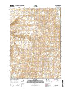 2014 Ashwood2014 Print · USGSCovers Ashwood, including Jefferson County, United States, and other nearby areas
 - 2017 Map of Ashwood, 2017 Print
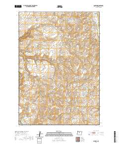
 2017 Ashwood2017 Print · USGSCovers Ashwood, including Jefferson County, United States, and other nearby areas
 - 2020 Map of Ashwood, 2020 Print
 2020 Ashwood2020 Print · USGSCovers Ashwood, including Jefferson County, United States, and other nearby areas
 - 2024 Map of Ashwood, 2024 Print
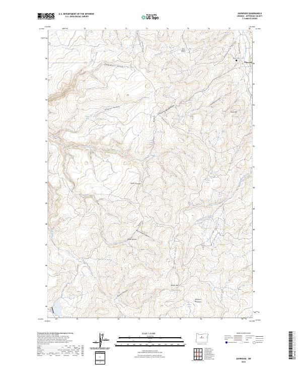 2024 Ashwood2024 Print · USGSThe high-desert ranching country of Jefferson County comes into focus here, centered on the community of Ashwood. Researchers can trace local lineage at Woods Cem and locate landforms like Blizzard Ridge, Indian Arrows, and the drainages of Big Whetstone Creek.
End of results
Showing maps 1-10 of 10
Top cities near Ashwood
Frequently asked questions
- What are the different types of historical maps available for Ashwood?
- What is the oldest map of Ashwood?
- Where can I purchase historical maps of Ashwood for my home or office?
- Where can I download high-res historical maps of Ashwood?
- Are there historical topographic maps available for Ashwood?
- Is there historical aerial imagery available for Ashwood?
- Where are historical maps of Ashwood sourced from?