Old Maps of Warm Springs, Oregon for Academic Research
Study the evolution of Warm Springs with 12 high-resolution historic maps. Whether you're teaching, researching, or modeling changes in land use, these maps provide essential visual documentation of urban, environmental, and geographic change.
- Analyze long-term change: Track patterns in development, transportation, and natural features.
- Ideal for environmental or urban studies: Support academic projects with primary historical map data.
- Use in the classroom or lab: Educators and researchers rely on these maps to bring historical context to life.
These maps are a powerful tool for teaching, research, and visualizing how Warm Springs has changed over the decades.
Warm Springs, OR maps
(12)- 1928 Map of Madras, 1956 Print
 1928 Madras1956 Print · USGSJefferson County was a landscape of high plateaus and deep river canyons in the late twenties, where new highways met tribal lands. Genealogists can trace family footprints at Hebe Mill, Simnasho, and rural schoolhouses like Mountain View Sch.
 - 1931 Map of Madras
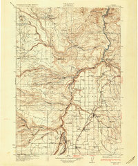 1931 Madras1931 Print · USGSCentral Oregon ranching and rail life come into focus in the late twenties, centering on the Warm Springs Agency. Trace the river-level rail stops at Mecca and Kaskela or locate early rural schoolhouses like New Era Sch and Lyle Gap Sch.2 unique versions available
 - 1955 Map of Bend, 1964 Print
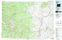
 1955 Bend1964 Print · USGSCentral Oregon was undergoing significant growth in the mid-1960s as irrigation and infrastructure transformed the high desert. Researchers can trace the path of the Oregon Trunk Line, locate old stops like Gateway, and find landmarks like Lava Butte or the Grange.3 unique versions available
 - 1957 Map of Bend
 1957 Bend1957 Print · USGSCentral Oregon in the mid-fifties is a landscape of transition between the high Cascades and the arid volcanic plateau. Local historians can trace the rail corridors of the Oregon Trunk and locate early settlements like Ashwood, Odin Falls, and Camp Sherman.
 - 1958 Map of Bend
 1958 Bend1958 Print · USGSCentral Oregon in the late fifties was a land of high desert ranching and growing mountain towns. Researchers can trace the rail lines of the Oregon Trunk Railroad, find established settlements like Madras and Sisters, or locate landmarks such as Smith Rock and Lava Butte.
 - 1963 Map of Warm Springs, 1964 Print
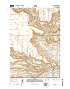
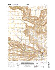
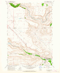 1963 Warm Springs1964 Print · USGSThe Warm Springs Reservation in the early sixties shows a landscape defined by plateau flats and deep creek canyons. Researchers can locate the Bruno Cem, trace the route of Tenino Road, and identify the mid-century layout of the Rodeo Grounds and Warm Springs settlement.2 unique versions available
 - 1983 Map of Madras
 1983 Madras1983 Print · USGSJefferson County and the Warm Springs Indian Reservation are shown in detail during the early 1980s, from the Cascade peaks to the high desert. Researchers can trace the legacy of tribal lands at Simnasho, find the Abbot Cemetery, or follow the rail lines through Madras Sta.
 - 2011 Map of Warm Springs, 2011 Print
 2011 Warm Springs2011 Print · USGSCovers Warm Springs, including Wasco County, Jefferson County, and other nearby areas
 - 2014 Map of Warm Springs, 2014 Print
 2014 Warm Springs2014 Print · USGSCovers Warm Springs, including Wasco County, Jefferson County, and other nearby areas
 - 2017 Map of Warm Springs, 2017 Print
 2017 Warm Springs2017 Print · USGSCovers Warm Springs, including Wasco County, Jefferson County, and other nearby areas
 - 2020 Map of Warm Springs, 2020 Print
 2020 Warm Springs2020 Print · USGSCovers Warm Springs, including Wasco County, Jefferson County, and other nearby areas
 - 2023 Map of Warm Springs, 2023 Print
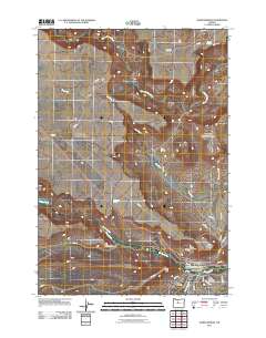
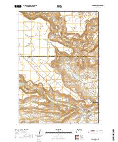
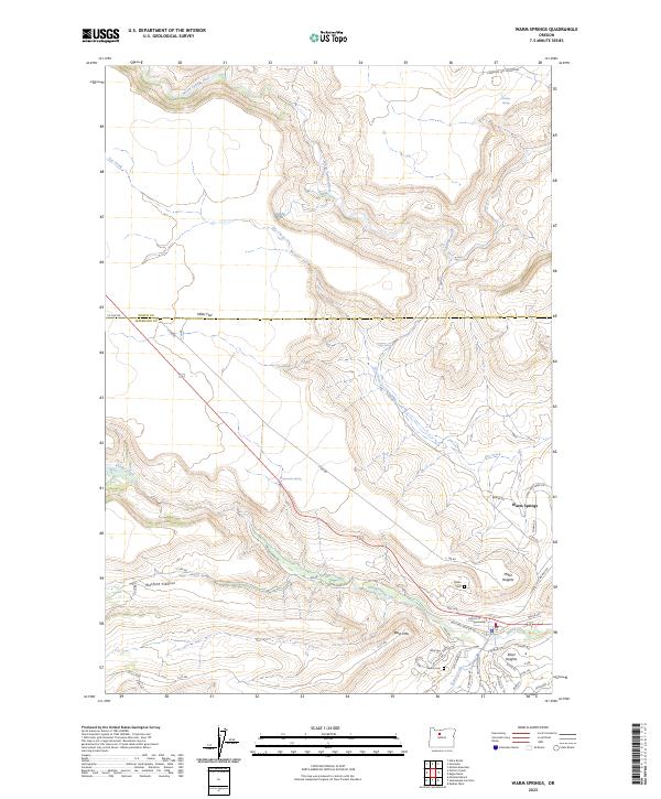 2023 Warm Springs2023 Print · USGSWarm Springs and the surrounding plateaus are mapped in detail here during the early 2020s. Genealogists and researchers can locate Bruno Cem, trace the developed streets of Elliot Heights, and follow the riparian corridor of Shitike Creek.
End of results
Showing maps 1-12 of 12
Top cities near Warm Springs
Frequently asked questions
- What are the different types of historical maps available for Warm Springs?
- What is the oldest map of Warm Springs?
- Where can I purchase historical maps of Warm Springs for my home or office?
- Where can I download high-res historical maps of Warm Springs?
- Are there historical topographic maps available for Warm Springs?
- Is there historical aerial imagery available for Warm Springs?
- Where are historical maps of Warm Springs sourced from?