Old Maps of Blaisdell, Oregon
Explore 11 old maps of Blaisdell, spanning from 1955 to today. These high-resolution historic maps reveal how streets, neighborhoods, landmarks, and natural features evolved over time — perfect for genealogy, metal detecting, research, and local history exploration.
What you can do with these maps:
- See how Blaisdell changed over time: Compare historical maps to modern-day views to trace roads, homesites, rail lines & more.
- View detailed metadata: Each map includes creators, publishers, year, scale, and archive source.
- Overlay maps with satellite & LiDAR: Visualize the past alongside modern tools to explore terrain & human change.
- Trusted historical sources: Maps sourced from the USGS, Library of Congress, and other archives.
- Access maps your way: View online, download high-res files, or order prints for personal or research use.
Start exploring old maps of Blaisdell to uncover forgotten places, hidden landmarks, and the deep history beneath your feet.
Blaisdell, OR maps
(11)- 1955 Map of Klamath Falls, 1963 Print
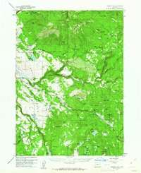
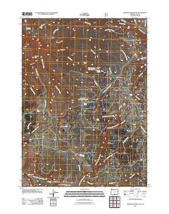
 1955 Klamath Falls1963 Print · USGSSouthern Oregon's high desert and timber country are captured here during the mid-fifties, showing the rail-dependent economies of the basin. Genealogists and researchers can locate old outposts like the Keno Guard Station, the Bly Ranger Station, and the campus of the Oregon Technical Institute.4 unique versions available
 - 1958 Map of Klamath Falls
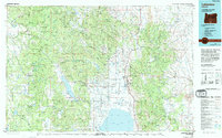
 1958 Klamath Falls1958 Print · USGSSouthern Oregon and the California borderlands are captured here in the mid-1950s during a peak era for the region's timber and rail industries. Trace the historic Klamath Indian Reservation boundaries and the rail lines of the Great Northern RR and the Oregon California and Eastern RR that connected remote towns like Bly and Beatty.3 unique versions available
 - 1960 Map of Fishhole Mtn, 1962 Print
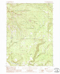
 1960 Fishhole Mtn1962 Print · USGSThe high timber and ranching country of southern Oregon is documented here during the early sixties, showing the transition from rail-based logging to forest management. Genealogists and researchers can find remote outposts like Swede Cabin, the Mitchell Monument, and ancient Indian Petroglyphs.2 unique versions available
 - 1975 Map of Lakeview, 1994 Print
 1975 Lakeview1994 Print · USGSLakeview and the surrounding high desert terrain are captured in the mid-seventies just as the region’s timber and mining industries remained active. Researchers can trace the layout of Booth-Kelly State Park or locate the White King Mine and the Thomas Creek Work Center.
 - 1988 Map of Gearhart Mountain
 1988 Gearhart Mountain1988 Print · USGSLake County high country in the late eighties is defined by the high peaks of the Gearhart Mountain Wilderness. Outdoor enthusiasts and historians can trace the Gearhart Mountain Trail past landmarks like The Dome and the Mitchell Monument.
 - 2004 Map of Gearhart Mountain, 2007 Print
 2004 Gearhart Mountain2007 Print · USGSFremont National Forest and the high-country wilderness of Lake County are captured here in the early 2000s. Researchers can locate remote landmarks like the Mitchell Monument, the Coykendall Cabin, and Finley Corrals.
 - 2011 Map of Gearhart Mountain, 2011 Print
 2011 Gearhart Mountain2011 Print · USGSCovers Blaisdell, including Lake County, United States, and other nearby areas
 - 2014 Map of Gearhart Mountain, 2014 Print
 2014 Gearhart Mountain2014 Print · USGSCovers Blaisdell, including Lake County, United States, and other nearby areas
 - 2017 Map of Gearhart Mountain, 2017 Print
 2017 Gearhart Mountain2017 Print · USGSCovers Blaisdell, including Lake County, United States, and other nearby areas
 - 2020 Map of Gearhart Mountain, 2020 Print
 2020 Gearhart Mountain2020 Print · USGSCovers Blaisdell, including Lake County, United States, and other nearby areas
 - 2023 Map of Gearhart Mountain, 2023 Print
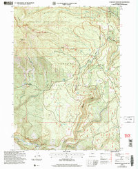
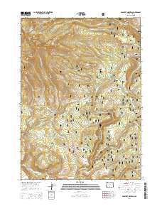
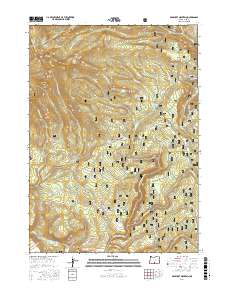
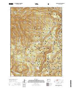
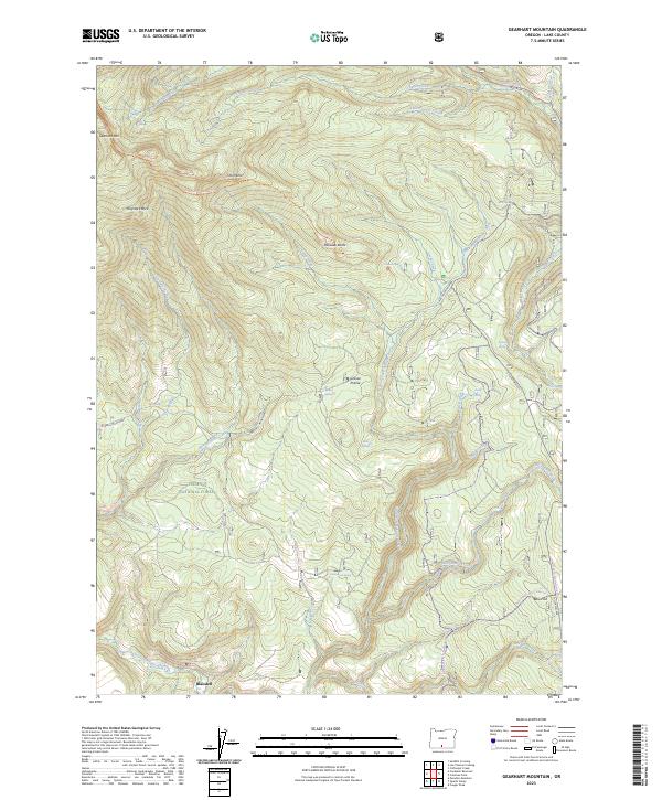 2023 Gearhart Mountain2023 Print · USGSLake County high country is documented in the 2020s, showing the high-elevation terrain of the Fremont National Forest. Researchers can trace old routes like the Old Trunk, locate the Mitchell Monument, and find the small settlement of Blaisdell.
End of results
Showing maps 1-11 of 11
Frequently asked questions
- What are the different types of historical maps available for Blaisdell?
- What is the oldest map of Blaisdell?
- Where can I purchase historical maps of Blaisdell for my home or office?
- Where can I download high-res historical maps of Blaisdell?
- Are there historical topographic maps available for Blaisdell?
- Is there historical aerial imagery available for Blaisdell?
- Where are historical maps of Blaisdell sourced from?