Old Maps of Horton, Oregon for Academic Research
Study the evolution of Horton with 16 high-resolution historic maps. Whether you're teaching, researching, or modeling changes in land use, these maps provide essential visual documentation of urban, environmental, and geographic change.
- Analyze long-term change: Track patterns in development, transportation, and natural features.
- Ideal for environmental or urban studies: Support academic projects with primary historical map data.
- Use in the classroom or lab: Educators and researchers rely on these maps to bring historical context to life.
These maps are a powerful tool for teaching, research, and visualizing how Horton has changed over the decades.
Horton, OR maps
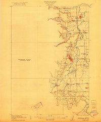
(16)- 1909 Map of Elmira
 1909 Elmira1909 Print · USGSLane County at the turn of the century shows a landscape of river-bottom farms and emerging rail towns. Genealogists and historians can locate early landmarks like Perkins Mill, the Redonk School, and the original footprints of Elmira and Alvadore.
 - 1922 Map of Elmira
 1922 Elmira1922 Print · USGSLane County's timber and rail landscape is caught in detail in the early 1920s, showcasing the development of rural communities and milling operations. Genealogists can locate family homesteads near numerous local institutions like Redonk School, Perkins Mill, and the many stations along the Oregon Electric line.3 unique versions available
 - 1942 Map of Elmira
 1942 Elmira1942 Print · USGSThe rural valleys and timbered foothills of western Lane County are captured in detail just as the second World War began. Genealogists and historians can trace family locations through numerous named schools like Laurel Home Sch and settlements along the Southern Pacific tracks.
 - 1953 Map of Salem
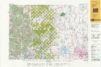
 1953 Salem1953 Print · USGSMid-century Oregon comes to life through this detailed survey of the Willamette Valley and the adjacent Pacific coastline. Researchers can trace the rail lines of the Southern Pacific RR, visit rural hubs like Fairview School, or locate coastal landmarks like the Yaquina Head Lighthouse.
 - 1954 Map of Salem
 1954 Salem1954 Print · USGSMid-century Western Oregon is centered on the productive Willamette River valley as its cities and infrastructure expand toward the mountains. Genealogists and historians can trace the rail lines of the Southern Pacific RR and Oregon Electric Ry through towns like Dallas, Independence, and Brownsville.
 - 1957 Map of Elmira, 1959 Print
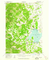 1957 Elmira1959 Print · USGSThe Lane County countryside near Eugene comes into focus in the late fifties as the reservoir and rail lines shaped local life. Researchers can trace family sites like the Danish Cemetery, locate the old Covered Bridge, and explore rail stops at Noti and Veneta.3 unique versions available
 - 1960 Map of Salem, 1968 Print
 1960 Salem1968 Print · USGSThe Willamette Valley and the surrounding mountain ranges are shown here in the 1960s during a period of significant reservoir construction. Genealogists and historians can trace rail lines like the Oregon Electric and find communities from Lincoln City on the coast to Sweet Home and Mill City in the foothills.2 unique versions available
 - 1962 Map of Salem
 1962 Salem1962 Print · USGSThe Willamette Valley and the surrounding Oregon ranges are captured here in the early sixties, showing the vital growth of the state's primary agricultural and academic corridor. Researchers can trace the mid-century footprints of Oregon State University and the University of Oregon, alongside rural landmarks like Camp Adair and Black Butte Mine.
 - 1963 Map of Salem
 1963 Salem1963 Print · USGSMid-century Oregon comes into focus as the Willamette Valley’s timber and agricultural industries meet the growing campuses of Oregon State University and the University of Oregon. Researchers can trace old rail lines like the Oregon Electric Railway and locate family plots at Siletz Cem or Dallas Cem.
 - 1980 Map of Eugene
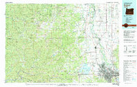 1980 Eugene1980 Print · USGSThe southern Willamette Valley and Coast Range are captured in the early eighties as the urban centers of Eugene and Springfield expanded. Researchers can trace the legacy of family estates and regional infrastructure through landmarks like Mahlon Sweet Airport, Fern Ridge Lake, and Junction City.
 - 1984 Map of Horton
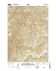
 1984 Horton1984 Print · USGSLane County in the mid-eighties shows a landscape of timber ridges and winding river valleys. Genealogists and hikers can locate Horton, the Goldson Cem, and landmarks like Crenshaw Hill or Burp Hollow.
 - 1992 Map of Eugene
 1992 Eugene1992 Print · USGSThe Willamette Valley and Coast Range are captured in the early nineties, showing the growth of Eugene and Springfield. Researchers can trace timber history in the Siuslaw National Forest or locate valley settlements like Junction City and Harrisburg.
 - 2011 Map of Horton, 2011 Print
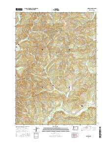
 2011 Horton2011 Print · USGSCovers Horton, including Low Pass, Lane County, and other nearby areas
 - 2014 Map of Horton, 2014 Print
 2014 Horton2014 Print · USGSCovers Horton, including Low Pass, Lane County, and other nearby areas
 - 2017 Map of Horton, 2017 Print
 2017 Horton2017 Print · USGSCovers Horton, including Low Pass, Lane County, and other nearby areas
 - 2024 Map of Horton, 2024 Print
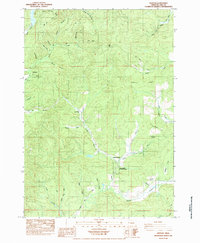
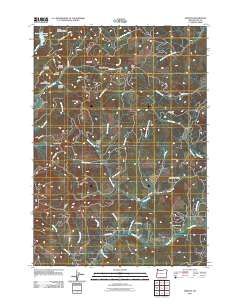
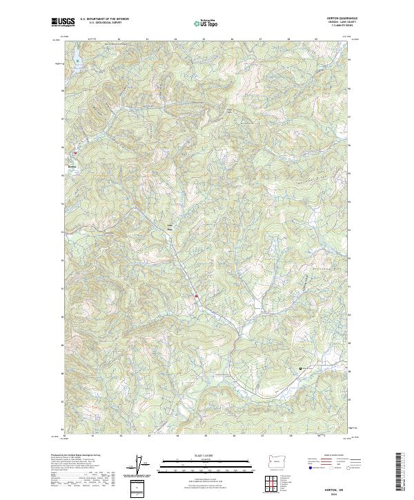 2024 Horton2024 Print · USGSThe timbered ridges and river headwaters of the Oregon Coast Range are charted here in the mid-2020s. Genealogists and local historians can trace family-named landmarks like John Horton Canyon and Doris Stevens Ridge or locate the Goldson Cem.
End of results
Showing maps 1-16 of 16
Top cities near Horton
Frequently asked questions
- What are the different types of historical maps available for Horton?
- What is the oldest map of Horton?
- Where can I purchase historical maps of Horton for my home or office?
- Where can I download high-res historical maps of Horton?
- Are there historical topographic maps available for Horton?
- Is there historical aerial imagery available for Horton?
- Where are historical maps of Horton sourced from?