1980s Maps of Rainbow, Oregon
Explore 2 historic maps of Rainbow from the 1980s. These maps offer a rare glimpse into what life looked like during the 1980s — showing old roads, neighborhoods, homes, and landmarks that have changed or disappeared over time.
Whether you're researching your family's past, planning a metal detecting trip, or studying how Rainbow's landscape evolved across the 1980s, these high-resolution maps are a powerful tool for exploring the history of this region.
- Focus on a specific era: All maps on this page are from the 1980s, giving you a focused view of this time period.
- See what’s changed: Compare century-old streets, trails, and buildings to today's modern landscape using overlays and satellite layers.
- Research with precision: Use these maps for genealogy, historical research, land use analysis, or educational projects.
- View, download, or print: Maps are fully viewable online in high resolution, and can be downloaded or printed for your own records.
Start exploring Rainbow's history through authentic maps from the 1980s. This is your window into the past.
Rainbow, OR maps
(2)- 1983 Map of Mc Kenzie River, 1984 Print
 1983 Mc Kenzie River1984 Print · USGSLinn and Lane Counties are shown in the early 1980s as a hub of hydroelectric power and timber production. Researchers can trace the development of river-valley towns like Sweet Home and Marcola or locate recreation sites at Foster Lake and Cougar Reservoir.
 - 1989 Map of Mc Kenzie Bridge
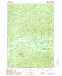 1989 Mc Kenzie Bridge1989 Print · USGSThe McKenzie River valley in the late eighties serves as a gateway to the high Cascades, showcasing a landscape of timber and tourism. Researchers can trace historic river crossings at the Mc Kenzie Covered Bridge and find local landmarks like Castle Rock and Rainbow.
End of results
Showing maps 1-2 of 2
Frequently asked questions
- What are the different types of historical maps available for Rainbow?
- What is the oldest map of Rainbow?
- Where can I purchase historical maps of Rainbow for my home or office?
- Where can I download high-res historical maps of Rainbow?
- Are there historical topographic maps available for Rainbow?
- Is there historical aerial imagery available for Rainbow?
- Where are historical maps of Rainbow sourced from?