Old Maps of Royal, Oregon for Genealogy
Trace your family roots with 11 historic maps of Royal. These high-res maps reveal old neighborhoods, homesites, landmarks, and streets — helping you uncover where your ancestors lived and how the area evolved over time.
- Explore historic neighborhoods: Identify where your relatives may have lived in the 1800s or 1900s.
- Compare maps over time: Trace the changes in streets, buildings, and landmarks for multi-generational research.
- Perfect for genealogy & ancestry research: Used by family historians and researchers to map out lineage and migration.
These maps are an incredible resource for exploring your personal connection to Royal's past.
Royal, OR maps
(11)- 1921 Map of Cottage Grove
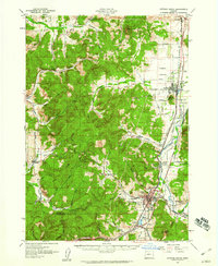
 1921 Cottage Grove1921 Print · USGSSouthern Lane County comes alive in this post-World War I survey, showing the valley floor before modern development. Genealogists can locate family homesteads near old schoolhouses like Green Door School or trace the early rail stops at Saginaw and Latham.3 unique versions available
 - 1957 Map of Cottage Grove, 1960 Print
 1957 Cottage Grove1960 Print · USGSCottage Grove and the southern Willamette Valley are captured here in the late fifties as timber and rail still drove the local economy. Genealogists and historians can locate numerous rural schoolhouses like Silk Creek School and trace the Southern Pacific line through Saginaw and Latham.2 unique versions available
 - 1958 Map of Roseburg, 1960 Print
 1958 Roseburg1960 Print · USGSThe timber valleys and high volcanic peaks of Southern Oregon are captured here in the late fifties. Researchers can trace the Southern Pacific rail line through historic settlements like Cottage Grove, Yoncalla, and Oakridge near the Cascade Range crest.4 unique versions available
 - 1959 Map of Roseburg
 1959 Roseburg1959 Print · USGSThe Umpqua and Willamette valleys meet the high Cascades in this late-fifties study of Southern Oregon's timber and rail corridors. Genealogists and researchers can trace the Southern Pacific RR through historic towns like Roseburg, Yoncalla, and Cottage Grove.
 - 1979 Map of Cottage Grove
 1979 Cottage Grove1979 Print · USGSThe Oregon timber and rail corridors of the late seventies are documented here, centered on the Coast Fork Willamette River and the growing hub of Cottage Grove. Researchers can trace the path of the Southern Pacific railroad as it connects small stations like Divide, Saginaw, and Yoncalla.2 unique versions available
 - 1984 Map of Lorane
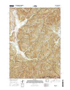
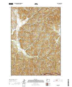
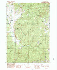 1984 Lorane1984 Print · USGSSouthern Lane County in the mid-1980s reveals a landscape of timbered ridges and river headwaters at the edge of the Coast Range. Researchers can trace the Southern Pacific rail line and locate old community hubs like Lorane, Mill Camp, and Royal.
 - 2011 Map of Lorane, 2011 Print
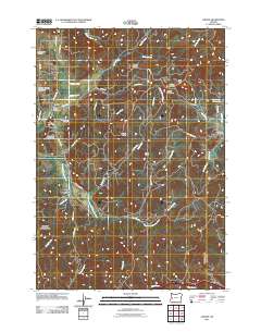 2011 Lorane2011 Print · USGSCovers Royal, including Mill Camp, Lorane, and other nearby areas
 - 2014 Map of Lorane, 2014 Print
 2014 Lorane2014 Print · USGSCovers Royal, including Mill Camp, Lorane, and other nearby areas
 - 2017 Map of Lorane, 2017 Print
 2017 Lorane2017 Print · USGSCovers Royal, including Mill Camp, Lorane, and other nearby areas
 - 2020 Map of Lorane, 2020 Print
 2020 Lorane2020 Print · USGSCovers Royal, including Mill Camp, Lorane, and other nearby areas
 - 2023 Map of Lorane, 2023 Print
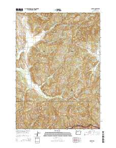
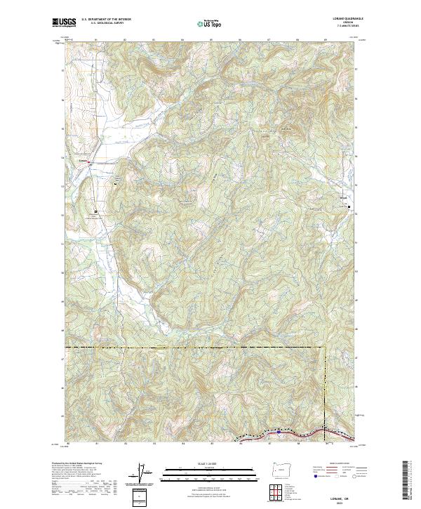 2023 Lorane2023 Print · USGSNear the Lane and Douglas County line in western Oregon, this survey shows the rural communities and timbered ridges at the start of the 2020s. Genealogists and local historians can locate the Crow Family Cem, the Independent Order of Good Templars Cem, and the settlement of Royal.
End of results
Showing maps 1-11 of 11
Top cities near Royal
- Eugene historical maps
- Springfield historical maps
- Cottage Grove historical maps
- Creswell historical maps
- Veneta historical maps
- Yoncalla historical maps
See more
Frequently asked questions
- What are the different types of historical maps available for Royal?
- What is the oldest map of Royal?
- Where can I purchase historical maps of Royal for my home or office?
- Where can I download high-res historical maps of Royal?
- Are there historical topographic maps available for Royal?
- Is there historical aerial imagery available for Royal?
- Where are historical maps of Royal sourced from?