Old Maps of Veatch, Oregon for Hiking & Exploration
Hike through history with 9 historic maps of Veatch. Explore old trails, ghost towns, and forgotten backroads — perfect for outdoor adventurers and local explorers.
- Rediscover forgotten places: Map out old mining camps, roads, and footpaths that no longer exist on modern maps.
- Layer with modern tools: Combine with LiDAR or satellite views to plan hikes through historical terrain.
- Made for exploration: Popular among hikers, overlanders, and local history lovers.
Use these maps to find adventure and explore the hidden past of Veatch.
Veatch, OR maps
(9)- 1921 Map of Cottage Grove
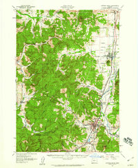
 1921 Cottage Grove1921 Print · USGSSouthern Lane County comes alive in this post-World War I survey, showing the valley floor before modern development. Genealogists can locate family homesteads near old schoolhouses like Green Door School or trace the early rail stops at Saginaw and Latham.3 unique versions available
 - 1957 Map of Cottage Grove, 1960 Print
 1957 Cottage Grove1960 Print · USGSCottage Grove and the southern Willamette Valley are captured here in the late fifties as timber and rail still drove the local economy. Genealogists and historians can locate numerous rural schoolhouses like Silk Creek School and trace the Southern Pacific line through Saginaw and Latham.2 unique versions available
 - 1958 Map of Roseburg, 1960 Print
 1958 Roseburg1960 Print · USGSThe timber valleys and high volcanic peaks of Southern Oregon are captured here in the late fifties. Researchers can trace the Southern Pacific rail line through historic settlements like Cottage Grove, Yoncalla, and Oakridge near the Cascade Range crest.4 unique versions available
 - 1959 Map of Roseburg
 1959 Roseburg1959 Print · USGSThe Umpqua and Willamette valleys meet the high Cascades in this late-fifties study of Southern Oregon's timber and rail corridors. Genealogists and researchers can trace the Southern Pacific RR through historic towns like Roseburg, Yoncalla, and Cottage Grove.
 - 1979 Map of Cottage Grove
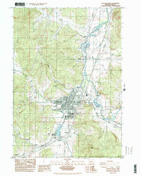
 1979 Cottage Grove1979 Print · USGSThe Oregon timber and rail corridors of the late seventies are documented here, centered on the Coast Fork Willamette River and the growing hub of Cottage Grove. Researchers can trace the path of the Southern Pacific railroad as it connects small stations like Divide, Saginaw, and Yoncalla.2 unique versions available
 - 1984 Map of Cottage Grove
 1984 Cottage Grove1984 Print · USGSCottage Grove and the southern Willamette Valley are captured in the mid-1980s as the regional timber and rail economy remained central to the landscape. Researchers can trace family sites at Shields Cem, locate neighborhood schools like Bohemia Sch, and follow the Southern Pacific line through Saginaw.
 - 2011 Map of Cottage Grove, 2011 Print
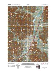 2011 Cottage Grove2011 Print · USGSCovers Veatch, including Cottage Grove, Latham, and other nearby areas
 - 2014 Map of Cottage Grove, 2014 Print
 2014 Cottage Grove2014 Print · USGSCovers Veatch, including Cottage Grove, Latham, and other nearby areas
 - 2023 Map of Cottage Grove, 2023 Print
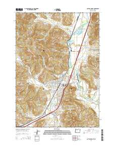
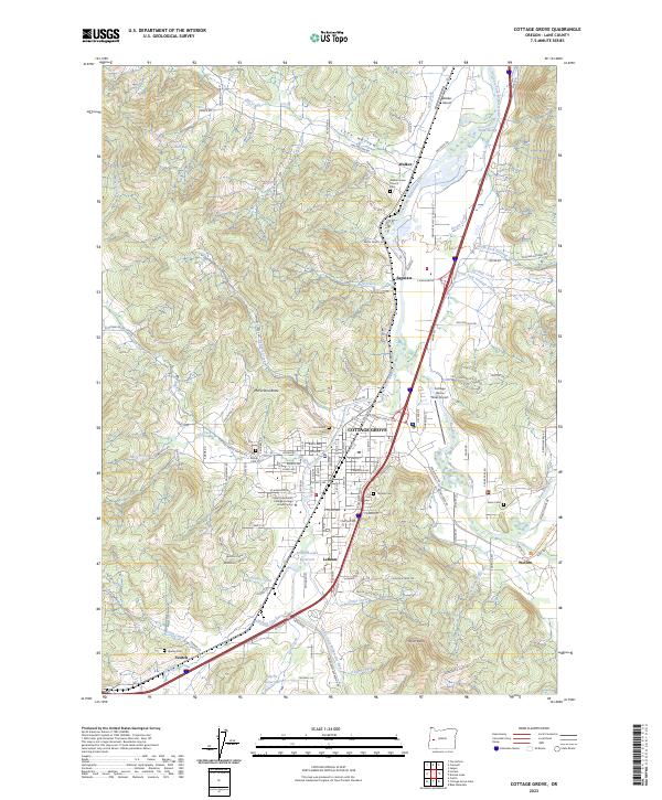 2023 Cottage Grove2023 Print · USGSCottage Grove and the southern Willamette Valley come into focus in this contemporary survey of Lane County. Genealogists can trace family footprints through numerous rural burial grounds like Walker Union Cemetery and landmarks such as McFarland Butte.
End of results
Showing maps 1-9 of 9
Top cities near Veatch
Frequently asked questions
- What are the different types of historical maps available for Veatch?
- What is the oldest map of Veatch?
- Where can I purchase historical maps of Veatch for my home or office?
- Where can I download high-res historical maps of Veatch?
- Are there historical topographic maps available for Veatch?
- Is there historical aerial imagery available for Veatch?
- Where are historical maps of Veatch sourced from?