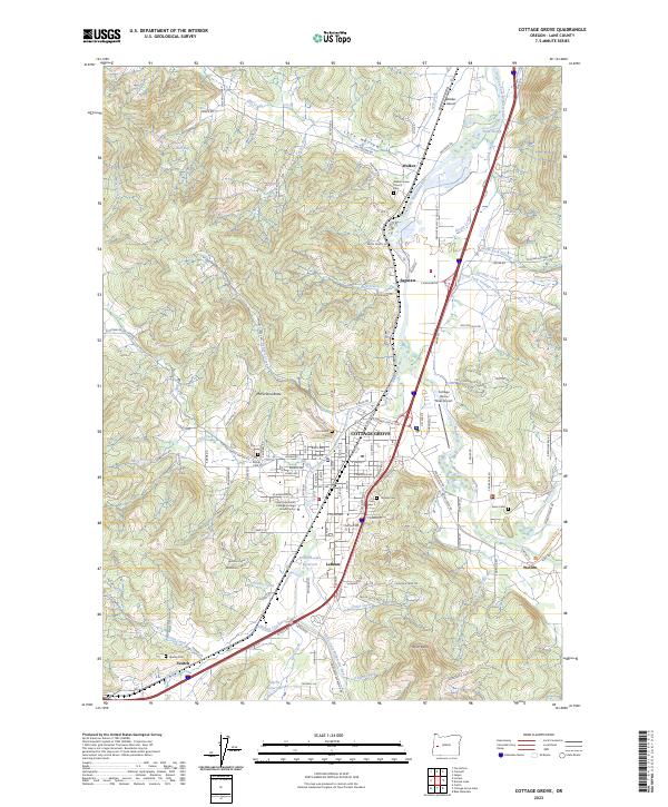
2023 Map of Cottage Grove
USGS Topo · Published 2023About this map
The Coast Fork Willamette River defines the central corridor of this Lane County landscape, where the valley floor transitions into the rising timbered slopes of the Cascade foothills. The city of Cottage Grove serves as the primary hub, surrounded by smaller historical clusters like Saginaw, Latham, and Walker. This area is characterized by a high density of lineage-rich landmarks, including numerous burial grounds such as Walker Union Cem, Fir Grove Cem, and Hawley Cem, which anchor the early rural settlements to the land.
Find a feature on this map
151 named features on this map. Tap any name to fly to it.
Don’t see what you’re looking for? This feature index may not catch every label — zoom into the map to look around manually.
Map Details
Editions of this 2023 Cottage Grove Map
This is the sole edition of this map. No revisions or reprints were ever made.
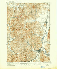
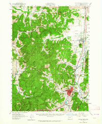
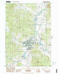
Historical Maps of Veatch Through Time
5 maps found