Old Maps of Seal Rock, Oregon for Academic Research
Study the evolution of Seal Rock with 16 high-resolution historic maps. Whether you're teaching, researching, or modeling changes in land use, these maps provide essential visual documentation of urban, environmental, and geographic change.
- Analyze long-term change: Track patterns in development, transportation, and natural features.
- Ideal for environmental or urban studies: Support academic projects with primary historical map data.
- Use in the classroom or lab: Educators and researchers rely on these maps to bring historical context to life.
These maps are a powerful tool for teaching, research, and visualizing how Seal Rock has changed over the decades.
Seal Rock, OR maps
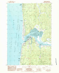
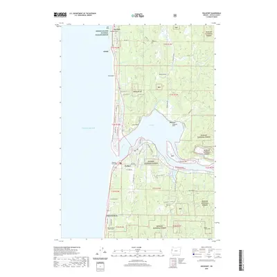
(16)- 1922 Map of Waldport
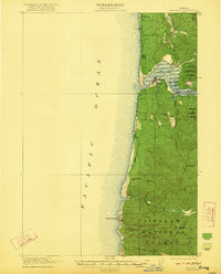 1922 Waldport1922 Print · USGSCoastal Oregon at the end of the Great War era reveals a landscape of isolated bays and forest outposts. Genealogists and local historians can trace early settlements like Waldport and Sanlots, or locate the site of the rural Alder Grove School.2 unique versions available
 - 1942 Map of Waldport
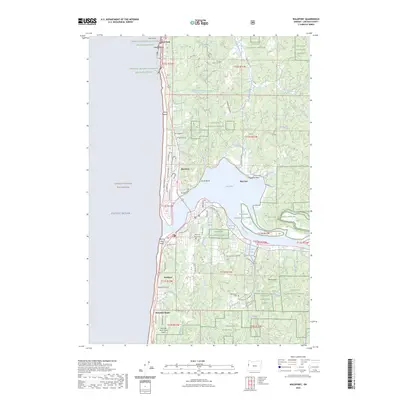
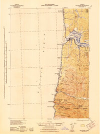 1942 Waldport1942 Print · USGSThe Oregon coast at the onset of World War II reveals a landscape of isolated seaside settlements and managed forests. Trace the early layout of Waldport and Yachats alongside landmarks like the CCC Camp and Smithy Ranch.2 unique versions available
 - 1953 Map of Salem
 1953 Salem1953 Print · USGSMid-century Oregon comes to life through this detailed survey of the Willamette Valley and the adjacent Pacific coastline. Researchers can trace the rail lines of the Southern Pacific RR, visit rural hubs like Fairview School, or locate coastal landmarks like the Yaquina Head Lighthouse.
 - 1954 Map of Salem
 1954 Salem1954 Print · USGSMid-century Western Oregon is centered on the productive Willamette River valley as its cities and infrastructure expand toward the mountains. Genealogists and historians can trace the rail lines of the Southern Pacific RR and Oregon Electric Ry through towns like Dallas, Independence, and Brownsville.
 - 1956 Map of Waldport, 1958 Print
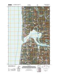
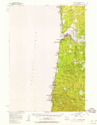 1956 Waldport1958 Print · USGSThe Oregon coast at the mid-century shows a landscape of fishing villages and timber land before modern development. Genealogists can trace family sites at Fern Ridge Cemetery and Home Cem or explore the waterfronts of Waldport and Yachats.2 unique versions available
 - 1960 Map of Salem, 1968 Print
 1960 Salem1968 Print · USGSThe Willamette Valley and the surrounding mountain ranges are shown here in the 1960s during a period of significant reservoir construction. Genealogists and historians can trace rail lines like the Oregon Electric and find communities from Lincoln City on the coast to Sweet Home and Mill City in the foothills.2 unique versions available
 - 1962 Map of Salem
 1962 Salem1962 Print · USGSThe Willamette Valley and the surrounding Oregon ranges are captured here in the early sixties, showing the vital growth of the state's primary agricultural and academic corridor. Researchers can trace the mid-century footprints of Oregon State University and the University of Oregon, alongside rural landmarks like Camp Adair and Black Butte Mine.
 - 1963 Map of Salem
 1963 Salem1963 Print · USGSMid-century Oregon comes into focus as the Willamette Valley’s timber and agricultural industries meet the growing campuses of Oregon State University and the University of Oregon. Researchers can trace old rail lines like the Oregon Electric Railway and locate family plots at Siletz Cem or Dallas Cem.
 - 1980 Map of Waldport
 1980 Waldport1980 Print · USGSCoastal Oregon at the start of the 1980s reveals a landscape of rugged headlands and timbered ridges between Waldport and the Siuslaw River. Researchers can trace old beach communities and landmarks like the US Coast Guard Res Lighthouse at Heceta Head and Cape Perpetua.2 unique versions available
 - 1984 Map of Waldport
 1984 Waldport1984 Print · USGSThe Oregon coast at Waldport comes alive in this mid-eighties survey, showing the delicate balance between the Siuslaw National Forest and the Pacific. Researchers can trace the layout of Wakonda Beach or locate early sites like the Memorial Home Cem and Eckman Quarry.2 unique versions available
 - 2011 Map of Waldport, 2011 Print
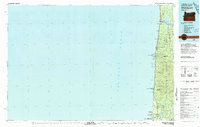
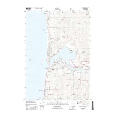
 2011 Waldport2011 Print · USGSCovers Seal Rock, including Waldport, Wakonda Beach, and other nearby areas
 - 2014 Map of Waldport, 2014 Print
 2014 Waldport2014 Print · USGSCovers Seal Rock, including Waldport, Wakonda Beach, and other nearby areas
 - 2017 Map of Waldport, 2017 Print
 2017 Waldport2017 Print · USGSCovers Seal Rock, including Waldport, Wakonda Beach, and other nearby areas
 - 2020 Map of Waldport, 2020 Print
 2020 Waldport2020 Print · USGSCovers Seal Rock, including Waldport, Wakonda Beach, and other nearby areas
 - 2023 Map of Waldport, 2023 Print
 2023 Waldport2023 Print · USGSCovers Seal Rock, including Waldport, Wakonda Beach, and other nearby areas
 - 2024 Map of Waldport, 2024 Print
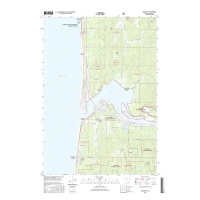
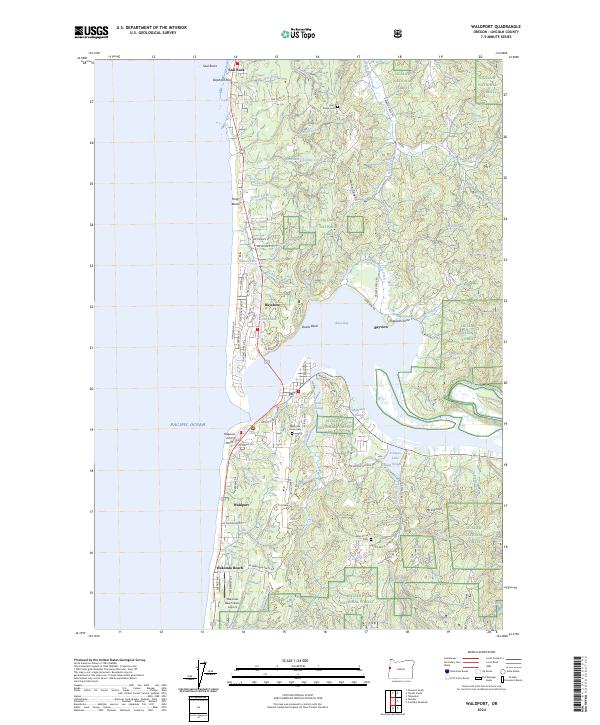 2024 Waldport2024 Print · USGSThe Lincoln County coastline comes into focus in this study of the communities surrounding Alsea Bay. Trace the development of Waldport and Seal Rock, and locate local burial grounds like Fern Ridge Cem and Alder Grove Cem.
End of results
Showing maps 1-16 of 16
Top cities near Seal Rock
- Newport historical maps
- Toledo historical maps
- Waldport historical maps
- Siletz historical maps
- Yachats historical maps
Frequently asked questions
- What are the different types of historical maps available for Seal Rock?
- What is the oldest map of Seal Rock?
- Where can I purchase historical maps of Seal Rock for my home or office?
- Where can I download high-res historical maps of Seal Rock?
- Are there historical topographic maps available for Seal Rock?
- Is there historical aerial imagery available for Seal Rock?
- Where are historical maps of Seal Rock sourced from?