Old Maps of Beulah, Oregon for Genealogy
Trace your family roots with 11 historic maps of Beulah. These high-res maps reveal old neighborhoods, homesites, landmarks, and streets — helping you uncover where your ancestors lived and how the area evolved over time.
- Explore historic neighborhoods: Identify where your relatives may have lived in the 1800s or 1900s.
- Compare maps over time: Trace the changes in streets, buildings, and landmarks for multi-generational research.
- Perfect for genealogy & ancestry research: Used by family historians and researchers to map out lineage and migration.
These maps are an incredible resource for exploring your personal connection to Beulah's past.
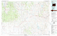
Beulah, OR maps
(11)- 1955 Map of Burns, 1964 Print
 1955 Burns1964 Print · USGSHarney County's high desert ranching and timber heartland is captured here in the mid-fifties, centered on the hub of Burns and Hines. Genealogists and researchers can locate remote landmarks like the Suntex School, New Princeton P. O., and the Lumber Mill.3 unique versions available
 - 1958 Map of Burns
 1958 Burns1958 Print · USGSHarney County ranching and timber lands are captured here in the late fifties. Genealogists and local historians can trace family holdings and rural institutions, from the Kimball Flat School to remote outposts like Crow Camp Ranch and the Sutton Ranch.
 - 1959 Map of Burns
 1959 Burns1959 Print · USGSHarney County in the late fifties remains a landscape of high-desert ranching and timber production, centered on the hubs of Burns and Hines. Researchers can locate remote rural institutions like the Suntex School or trace family landholdings such as the Stallard Ranch and O'Keefe Homestead.
 - 1966 Map of Beulah, 1971 Print
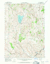 1966 Beulah1971 Print · USGSThe high desert of Malheur County comes alive in this mid-century survey, centered on the Beulah Reservoir and the North Fork Malheur River. Researchers can trace early infrastructure and local genealogy through landmarks like Agency Valley Cem, the Agency Valley Dam, and the Old Indian Treaty Boundary.2 unique versions available
 - 1978 Map of Stinkingwater Mountains, 1997 Print
 1978 Stinkingwater Mountains1997 Print · USGSHarney County in the late seventies is a land of high tables and deep basins, where the Stinkingwater Mountains rise over the Malheur River. Researchers can trace the Oregon and Northwestern Railroad and locate historic points like Fort Harney (Site) and Drewsey.2 unique versions available
 - 1990 Map of Beulah, 1991 Print
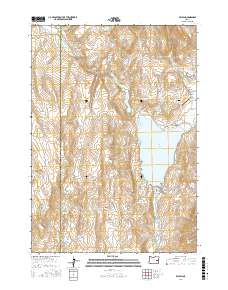
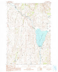 1990 Beulah1991 Print · USGSIn the arid landscape of eastern Oregon during the early nineties, the waters of the North Fork Malheur River define local life. Genealogists and historians can trace the community of Beulah, locate the Agency Valley Cemetery, and find remote landmarks like Altnow.
 - 2011 Map of Beulah, 2011 Print
 2011 Beulah2011 Print · USGSCovers Beulah, including Malheur County, Harney County, and other nearby areas
 - 2014 Map of Beulah, 2014 Print
 2014 Beulah2014 Print · USGSCovers Beulah, including Malheur County, Harney County, and other nearby areas
 - 2017 Map of Beulah, 2017 Print
 2017 Beulah2017 Print · USGSCovers Beulah, including Malheur County, Harney County, and other nearby areas
 - 2020 Map of Beulah, 2020 Print
 2020 Beulah2020 Print · USGSCovers Beulah, including Malheur County, Harney County, and other nearby areas
 - 2024 Map of Beulah, 2024 Print
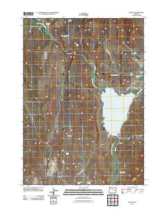
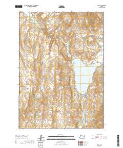
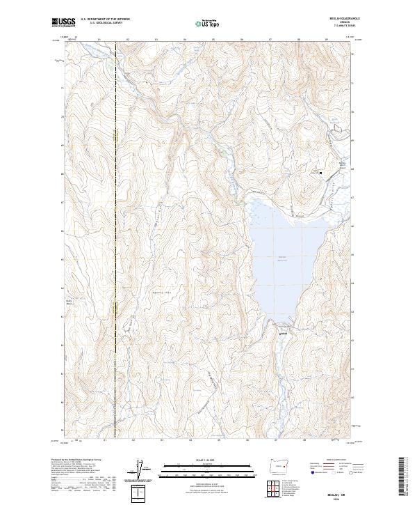 2024 Beulah2024 Print · USGSThe border of Malheur and Harney counties is captured here in the 2020s, centered on the vital waters of Beulah Reservoir. Genealogists and local historians can trace legacy ranch sites near Agency Valley Cem or follow the path of Castle Rock Creek through the high desert.
End of results
Showing maps 1-11 of 11
Frequently asked questions
- What are the different types of historical maps available for Beulah?
- What is the oldest map of Beulah?
- Where can I purchase historical maps of Beulah for my home or office?
- Where can I download high-res historical maps of Beulah?
- Are there historical topographic maps available for Beulah?
- Is there historical aerial imagery available for Beulah?
- Where are historical maps of Beulah sourced from?