Old Maps of Brogan, Oregon for Metal Detecting
Plan your next treasure hunt with 10 historic maps of Brogan. Find old homesites, ghost towns, trails, and gathering spots that may be lost to time — perfect for identifying promising metal detecting locations.
- Locate forgotten sites: Uncover places like long-lost settlements, abandoned rail lines, or gathering spots.
- Plan better hunts: Use map overlays combined with LiDAR or satellite views to narrow in on historically rich areas.
- Made for detectorists: Thousands of hobbyists use these maps to discover relics, coins, and hidden history.
Use these historic maps to boost your research and find new opportunities beneath the surface of Brogan.
Brogan, OR maps
(10)- 1955 Map of Baker, 1964 Print
 1955 Baker1964 Print · USGSThe Oregon-Idaho borderlands are captured here in the mid-fifties as the Snake River underwent massive changes from dam construction. Trace the Oregon Trail Memorial Monument near Baker, find early mines like Virtue Mine, and follow the Union Pacific Railroad through Huntington.4 unique versions available
 - 1959 Map of Baker
 1959 Baker1959 Print · USGSThe Oregon and Idaho borderlands come alive in the late fifties, showing the rugged corridor along the Snake River and the high peaks of the Wallowa Mountains. Researchers can trace the legacy of the Union Pacific railroad or locate historic mining sites like the Flagstaff Mine and Virtue Mine.2 unique versions available
 - 1964 Map of Brogan, 1966 Print
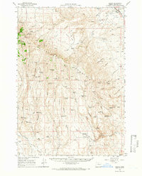 1964 Brogan1966 Print · USGSEastern Oregon ranching life in the 1960s is preserved here through the remote outposts and water sources of Malheur County. Genealogists and historians can locate family landmarks like Juniper Mtn Ranch, the Brogan Cem, and Richie Flat.
 - 1980 Map of Brogan, 1997 Print
 1980 Brogan1997 Print · USGSThe Oregon-Idaho borderlands come alive in this late-century survey of the high desert and river valleys. Researchers can trace the legacy of ranching and transport through sites like Malheur City, the Union Pacific rail lines, and the Snake River crossings.
 - 1990 Map of Brogan
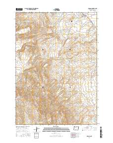
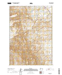
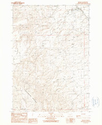 1990 Brogan1990 Print · USGSBrogan and the surrounding high-desert slopes of Malheur County are documented here in the late twentieth century. Genealogists and local historians can locate the Brogan Cem, the PO, and remote sites like Boston Horse Camp near Cottonwood Mountain.
 - 2011 Map of Brogan, 2011 Print
 2011 Brogan2011 Print · USGSCovers Brogan, including Malheur County, United States, and other nearby areas
 - 2014 Map of Brogan, 2014 Print
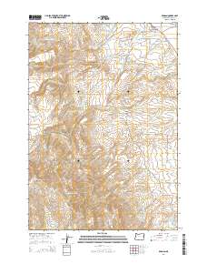 2014 Brogan2014 Print · USGSCovers Brogan, including Malheur County, United States, and other nearby areas
 - 2017 Map of Brogan, 2017 Print
 2017 Brogan2017 Print · USGSCovers Brogan, including Malheur County, United States, and other nearby areas
 - 2020 Map of Brogan, 2020 Print
 2020 Brogan2020 Print · USGSCovers Brogan, including Malheur County, United States, and other nearby areas
 - 2023 Map of Brogan, 2023 Print
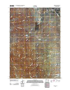
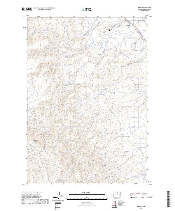 2023 Brogan2023 Print · USGSEastern Oregon's high-desert ranching and irrigation systems are documented here near the Idaho border. Researchers can trace family history at the Brogan Cem or study the critical water network of the High Line Ditch and Pritchard Reservoir.
End of results
Showing maps 1-10 of 10
Frequently asked questions
- What are the different types of historical maps available for Brogan?
- What is the oldest map of Brogan?
- Where can I purchase historical maps of Brogan for my home or office?
- Where can I download high-res historical maps of Brogan?
- Are there historical topographic maps available for Brogan?
- Is there historical aerial imagery available for Brogan?
- Where are historical maps of Brogan sourced from?