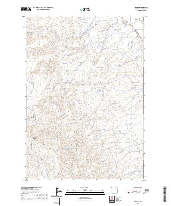
2023 Map of Brogan
USGS Topo · Published 2023About this map
The community of Brogan serves as the focal point of this northern Malheur County landscape, situated at the head of the Willow Creek Valley. This high-desert region is defined by a sophisticated network of irrigation infrastructure essential for local agriculture, featuring the Low Line Ditch and High Line Ditch that draw from Willow Creek. The terrain transitions from the valley floor up toward the prominent Cottonwood Mountain and Thorn Flat, a landscape scarred by numerous drainages such as Snake Creek and South Fork Black Creek. Genealogists and local historians can locate the Brogan Cem north of the main settlement. The abundance of named water sources, including Shell Rock Spring, Teel Spring, and various reservoirs like Pritchard Reservoir, reveals a long-standing reliance on carefully managed water rights to sustain life and ranching in this arid corner of Eastern Oregon.
Find a feature on this map
42 named features on this map. Tap any name to fly to it.
Don’t see what you’re looking for? This feature index may not catch every label — zoom into the map to look around manually.
Map Details
Editions of this 2023 Brogan Map
This is the sole edition of this map. No revisions or reprints were ever made.
Other maps of this area

1950 · Jamieson
USGS Topo · 1:62,500

1951 · Huntington
USGS Topo · 1:62,500

1955 · Baker
USGS Topo · 1:250,000

1959 · Baker
USGS Topo · 1:250,000

1964 · Bridgeport
USGS Topo · 1:62,500

1964 · Brogan
USGS Topo · 1:62,500

1980 · Brogan
USGS Topo · 1:100,000
1988 · Birch Creek Meadow
USGS Topo · 1:24,000
1988 · Jamieson
USGS Topo · 1:24,000
1988 · Hope Butte
USGS Topo · 1:24,000