Old Maps of Central City, Gresham for Hiking & Exploration
Hike through history with 34 historic maps of Central City. Explore old trails, ghost towns, and forgotten backroads — perfect for outdoor adventurers and local explorers.
- Rediscover forgotten places: Map out old mining camps, roads, and footpaths that no longer exist on modern maps.
- Layer with modern tools: Combine with LiDAR or satellite views to plan hikes through historical terrain.
- Made for exploration: Popular among hikers, overlanders, and local history lovers.
Use these maps to find adventure and explore the hidden past of Central City.
Central City, Gresham maps
(34)- 1911 Map of Boring
 1911 Boring1911 Print · USGSClackamas County was a patchwork of small farming communities and emerging rail hubs in the decade before the First World War. Researchers can trace the early footprints of settlements like Boring and Gresham, alongside family landmarks such as Peterson Crossroads and Sycamore School.
 - 1914 Map of Boring
 1914 Boring1914 Print · USGSThe Clackamas River valley was a hub of early twentieth-century logging and electric rail expansion between Gresham and Estacada. Genealogists and historians can trace defunct river crossings like McMurray Ferry and rural landmarks such as Fishers Mill and Stone School.3 unique versions available
 - 1916 Map of Estacada
 1916 Estacada1916 Print · USGSClackamas County is captured here during a period of rapid hydroelectric and rail development just before the First World War. Researchers can trace early family homesteads near Fishers Mill, the old Feldbimer Ferry crossing, and the rail line serving Boring and Estacada.5 unique versions available
 - 1918 Map of Troutdale
 1918 Troutdale1918 Print · USGSEast of Portland in the late nineteen-teens, the riverfront and rail lines were transforming the landscape of Multnomah County. Genealogists and historians can trace family roots at the Multnomah County Farm, Sundial Ranch, and small rural schools like Cedar School.2 unique versions available
 - 1934 Map of Troutdale
 1934 Troutdale1934 Print · USGSThe Columbia River shoreline and the wooded hills of Clark County come alive in this mid-1930s survey of the riverfront. Researchers can trace early rural life through Washougal and local landmarks like Fern Prairie Grange, Lackamas Lake, and the Silver Star Mine.
 - 1940 Map of Boring
 1940 Boring1940 Print · USGSClackamas and Multnomah Counties are captured in the late thirties, documenting a landscape shaped by the Clackamas River and electric rail lines. Trace the route of the Cazadero Line or locate family roots at Mt Zion Cem and Lusted School.
 - 1941 Map of Camas
 1941 Camas1941 Print · USGSThe Columbia River corridor is captured here just before the mid-century, showing the bustling industrial towns of Camas and Washougal alongside a rural network of country schools. Genealogists and historians can trace family roots through landmarks like the Silver Star Mine, Cemetery Hill, and dozens of local schoolhouses such as Harmony Sch.
 - 1942 Map of Camas
 1942 Camas1942 Print · USGSThe Columbia River corridor is captured here in the early 1940s, showing the industrial heart of Camas and the rural outskirts of Gresham. Genealogists and historians can trace early schools like Twelvemile Corner Sch and the location of the Silver Star Mine.2 unique versions available
 - 1948 Map of Vancouver, 1957 Print
 1948 Vancouver1957 Print · USGSPost-war growth transforms the river valleys of the Pacific Northwest as the timber and rail economy thrives. Trace family roots in Tillamook or Oregon City, and locate vanished landmarks like the spit at Bayocean or the Skamania Mine.
 - 1950 Map of Vancouver
 1950 Vancouver1950 Print · USGSCoastal Oregon and the lower Columbia River valley are captured in detail just after the war. Researchers can trace historic rail routes like the Southern Pacific or locate early settlements such as Vernonia, Gaston, and the Grand Ronde Indian Reservation.
 - 1950 Map of Vancouver, 1951 Print
 1950 Vancouver1951 Print · USGSThe Pacific Northwest urban corridor meets the rugged coast in the years following the war, showing the expansion of Portland and Vancouver. Genealogists and historians can trace the reach of the Southern Pacific RR and locate coastal communities like Tillamook, Seaside, and Tolovana Park.
 - 1954 Map of Damascus, 1956 Print
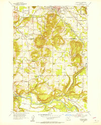 1954 Damascus1956 Print · USGSClackamas and Multnomah counties appear in the mid-1950s as a landscape of rural schools and river-valley settlements. Researchers can trace the Portland Traction Co line through Boring or locate family landmarks like the Baker Cabin and Union School.
 - 1954 Map of Camas, 1957 Print
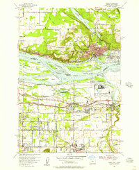 1954 Camas1957 Print · USGSThe Columbia River corridor hums with post-war activity in the mid-fifties as industrial sites and new expressways reshape the borderlands. Genealogists and local historians can locate early landmarks like Fern Prairie Cemetery and several abandoned schoolhouses including Grass Valley Sch (Aban'd).
 - 1954 Map of Camas, 1958 Print
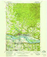 1954 Camas1958 Print · USGSThe Columbia River corridor in the mid-fifties shows the industrial growth of Camas and Washougal alongside the evolving suburbs of Gresham and Troutdale. Researchers can trace old school districts like Norway Sch and follow the S P & S RY through the river valley.3 unique versions available
 - 1958 Map of Vancouver, 1968 Print
 1958 Vancouver1968 Print · USGSThe Lower Columbia and Willamette valleys thrive in the late sixties as major rail and river hubs. Genealogists and historians can trace the development of Portland, identify the grounds of Camp Withycombe, and locate coastal landmarks from Tillamook Head to Garibaldi.3 unique versions available
 - 1961 Map of Damascus
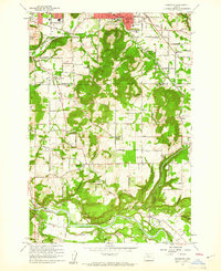 1961 Damascus1961 Print · USGSSoutheast of Portland in the early sixties, this area shows the suburban transition between Gresham and Boring. Genealogists and historians can locate the Sunnyside Church, trace the Portland Traction Co rail line, or find family-named landmarks like Walters Hill.4 unique versions available
 - 1961 Map of Camas, 1962 Print
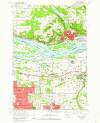 1961 Camas1962 Print · USGSThe Columbia River valley was entering a period of significant post-war growth in the early sixties, bridging the gap between Washington and Oregon. You can trace the development of Camas and Gresham, or locate specific landmarks like the Troutdale Airport and Knight Cem.3 unique versions available
 - 1961 Map of Sandy, 1962 Print
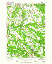 1961 Sandy1962 Print · USGSClackamas County was a landscape of river-driven industry and rural crossroads in the early sixties. Researchers can trace historic river crossings at the Feldheimer Ferry (Site), find the Fischers Mill site, and locate early schools like Damascus Union Sch.
 - 1964 Map of Vancouver
 1964 Vancouver1964 Print · USGSThe Pacific Northwest interior and coast are shown here in the 1960s, from the Portland metropolitan hub to the rugged Pacific shoreline. Researchers can trace the legacy of the Grand Ronde Indian Reservation, the early layout of McMinnville, and the maritime approaches near Tillamook Head.
 - 1975 Map of Camas, 1977 Print
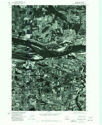 1975 Camas1977 Print · USGSMid-seventies development along the Columbia River waterfront is captured here just as suburban growth began to transform the landscape. Researchers can trace the mid-century footprints of Camas, Rockwood, and the northern edge of Gresham.
 - 1975 Map of Damascus, 1985 Print
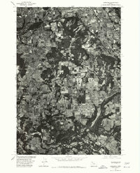 1975 Damascus1985 Print · USGSClackamas County is captured in the mid-1970s as a patchwork of timber and farmland during a period of steady rural growth. Researchers can trace the development of Damascus and Boring while examining the wooded slopes of Walters Hill.
 - 1979 Map of Vancouver, 1980 Print
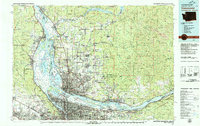 1979 Vancouver1980 Print · USGSThe Portland and Vancouver metropolitan area is captured here in the late seventies, showing the dense nexus of river, rail, and air transit. Genealogists and local historians can trace the footprints of Vancouver Barracks, Lincoln Memorial Park Cem, and the old rail lines of the Burlington Northern.2 unique versions available
 - 1982 Map of Oregon City, 1983 Print
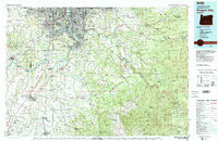 1982 Oregon City1983 Print · USGSGreater Portland and the Willamette Valley are shown in the early eighties as the region's urban and rural landscapes converged. Genealogists and historians can trace family-named sites across French Prairie, visit St Paul Ch, or locate the grounds of Dammasch State Hospital.
 - 1993 Map of Camas, 1996 Print
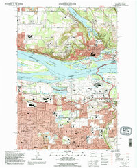 1993 Camas1996 Print · USGSThe Columbia River corridor in the 1990s reveals a bustling landscape of industry and suburban growth spanning the Washington and Oregon border. Genealogists and researchers can trace the development of Camas and Gresham, locating landmarks like Knight Cem, the Aluminum Plant, and Mount Hood Community College.
 - 2011 Map of Camas, 2011 Print
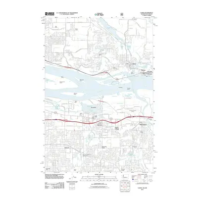 2011 Camas2011 Print · USGSThe Columbia River corridor near Camas and Troutdale is shown here during a period of significant regional transit and industrial development. Researchers can trace local heritage through landmarks like Knight Cemetery, the Parker Landing river site, and the Portland-Troutdale Airport.
Showing maps 1-25 of 34
Frequently asked questions
- What are the different types of historical maps available for Central City?
- What is the oldest map of Central City?
- Where can I purchase historical maps of Central City for my home or office?
- Where can I download high-res historical maps of Central City?
- Are there historical topographic maps available for Central City?
- Is there historical aerial imagery available for Central City?
- Where are historical maps of Central City sourced from?